
Trillium Estate - Mickleham SOLD OUT
This information is estimated by the OpenLot research team. Let us know here to provide up-to-date information about this development.
| Total new homes | N/A |
| Area size | N/A |
| Growth Region | Melbourne North Growth Corridor |
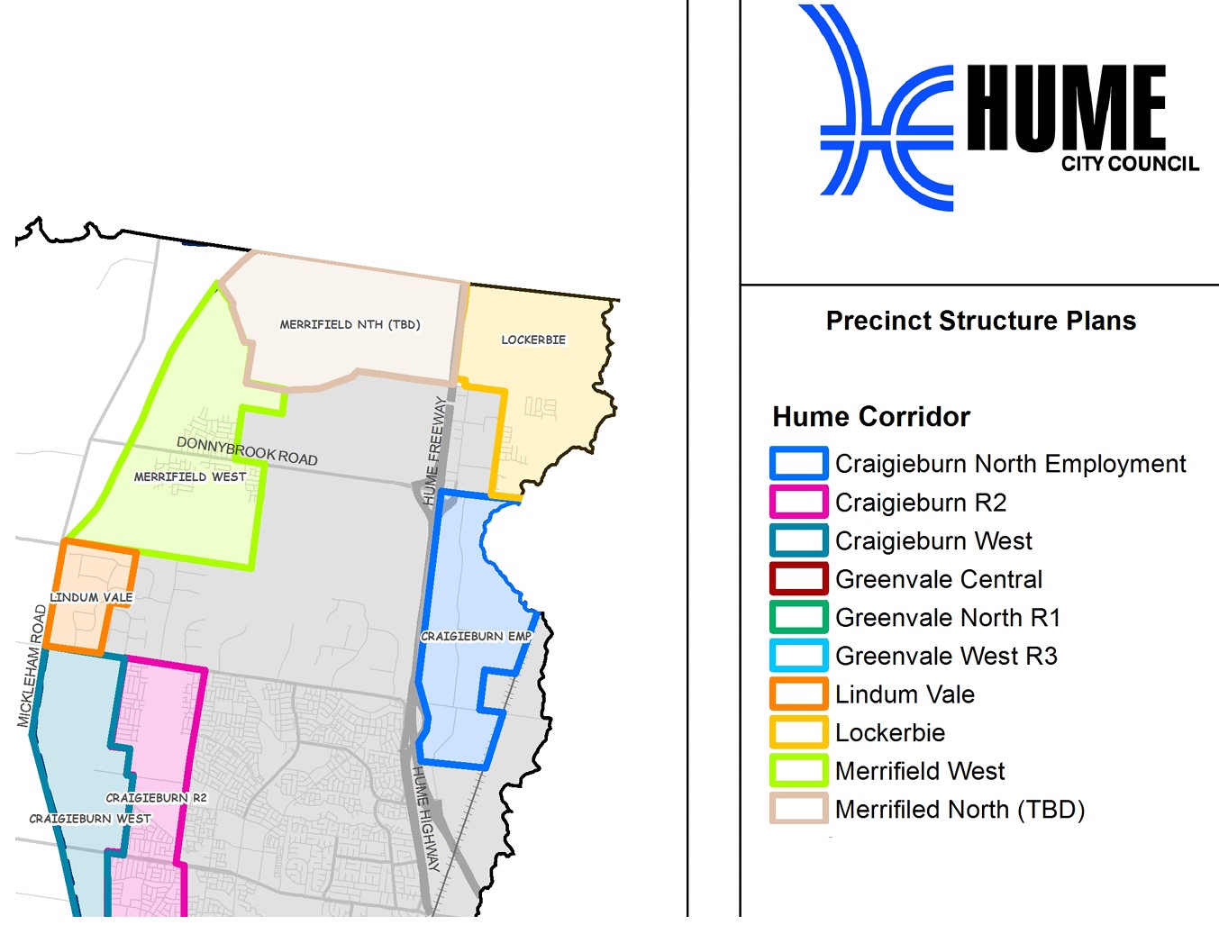
| City council | Hume City Council |
| Developer | Villawood Properties |
| Project marketer | Oliver Hume Real Estate Group |
| Distance to | Melbourne Airport - 12 km north Melbourne CBD - 28 km north |
Land for Sale, House and Land Packages:
Popular Estates near Trillium Estate - Mickleham


 4
4
 2
2
 2
2


Updates for Trillium Estate - Mickleham
Facebook updates:
Related news:
The Sahara Belle Q1 house by Henley Properties will be sold with all proceeds going towards the appeal.
GET ready to bid at this no-reserve auction of a luxury home and help raise money for The Royal Childrens Hospital.

Community vegetable patches and orchards are beginning to take root in newer outer suburban housing estates.

Private developer MAB Corporation has taken a strategic stake in a large parcel of land adjacent to its Merrifield estate on Melbourne's northern fringes in a $70 million plus deal.
A long-awaited public bus service to Melbournes rapidly expanding outer north is one step closer, with a prominent bus company given the green light to run it. Find out when the full route and timetable will be released.

Welcome to the Trillium Estate community portal - clubtrillium.com.au - provided for the exclusive use of the residents of the Trillium Estate, Mickleham
Missing articles? Send us a link here.
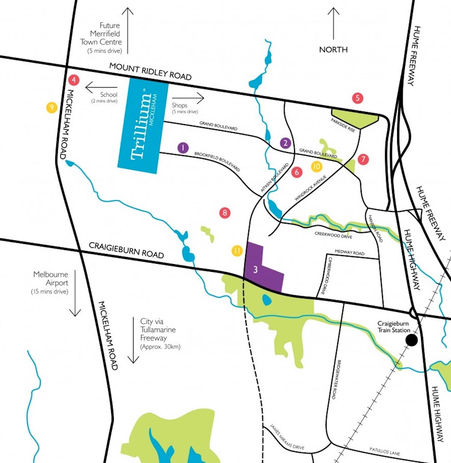
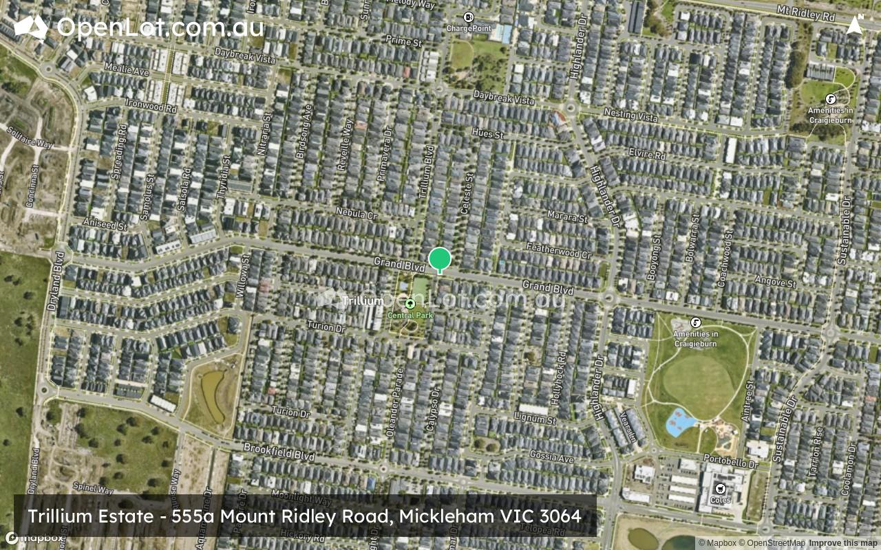
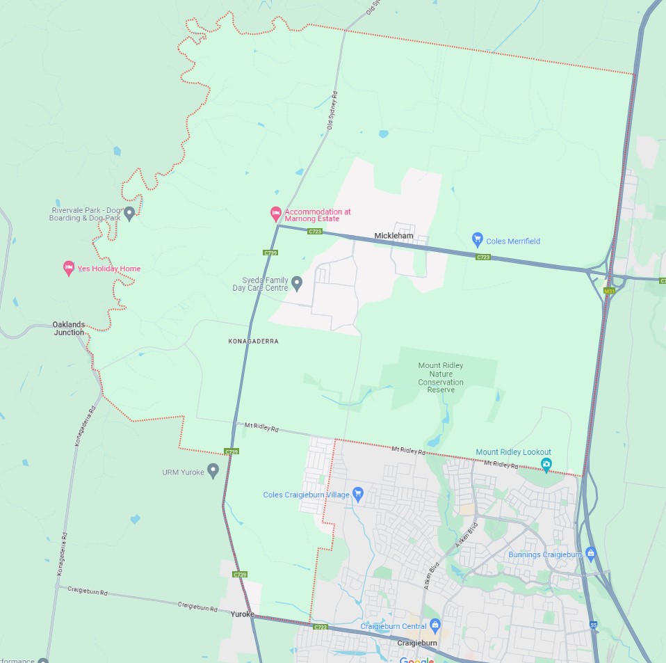
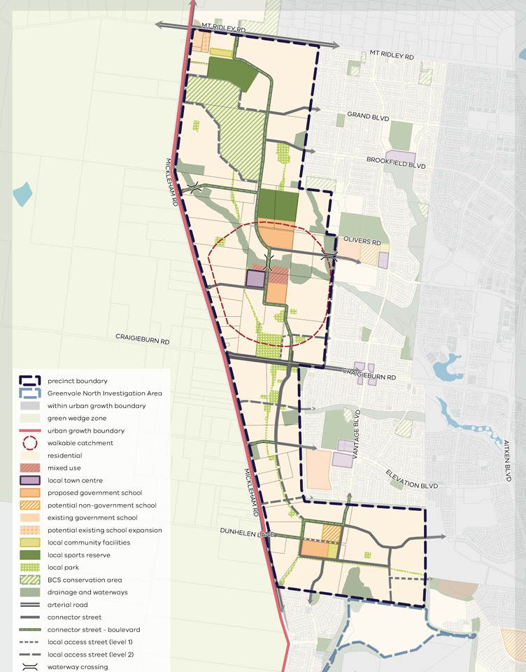
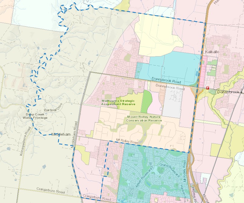
Location & Map for Trillium Estate - Mickleham
Visit Display Homes near Trillium Estate - Mickleham


Land Price Trend in Mickleham VIC 3064
- In Oct - Dec 24, the median price for vacant land in Mickleham VIC 3064 was $218,800. *
- From Oct - Dec 17 to Oct - Dec 24, the median price for vacant land in Mickleham VIC 3064 has decreased 14.7%. *
- From 2010 to 2024, the median price for vacant land in Mickleham VIC 3064 has increased 153.38%. *
Vacancy Rate in Mickleham VIC 3064
View full vacancy rate history in Mickleham VIC 3064 via SQM Research.
Schools near Trillium Estate - Mickleham
Here are 6 schools near Trillium Estate - Mickleham:
Prep-6 Government Primary School
Prep-6 Government Primary School
Prep-6 Catholic Primary School
Prep-6 Government Primary School
U Government Special School
Prep-12 Government Combined School
Suburb Planning Review in Mickleham VIC 3064
Mickleham is approximately 54.7 square kilometres within the City of Hume, a semi-rural location to the north of Melbourne’s outer suburbs of the Urban Growth Boundary and logical expansion of the former Mickleham township. The suburb is located 29 kilometres north of Melbourne CBD. Mickleham enjoys a strategic location to the west of the Hume Highway.
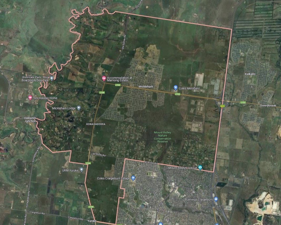
The suburb boundary is located along property boundaries, Gunnes Gully Road and an unnamed dry creek corridor to the North. Deep Creek and Mt Ridley Road make up the western boundary. Mickleham Road, Mt Ridley Road, Craigieburn Road and Whites Lane provide the southern boundary, with property boundaries and Hume Highway providing the eastern boundary.
Mickleham Road and Old Sydney Road provide local road access (north to south), along with Bardwell Drive and Donnybrook Road provide local road access (East to West), which connect the local road network found throughout Mickleham linking to the Hume Highway interchange found to the eastern boundary of the township. An additional southbound off-ramp is found in the south-east suburb corner. The interchanges allow direct access for anyone travelling through the region.
The suburb of Mickleham provides a range of residential property sizes, mix of land uses and a large portion of rural land. Mount Ridley and a large Natural Conservation Reserve are located to the south-east, with a waterway corridor to the west and a series of lakes found scattered throughout the suburb. Mickleham slowly redeveloping, with local retail centres, supermarkets, services, schools and recreational areas being included to support the growth.
Melbourne 2030 (2008 Update) - Victorian Government
In 2002 the Victorian Government's blueprint for managing long-term growth in the surrounding region. The 2008 release of updated population projections in "Victoria in Future 2008" prompts a revaluation of development strategies, ensuring Melbourne remains adaptable. Acknowledging an inevitable population surge, "Melbourne @ 5 million" emphasises readiness and focuses on job creation and service provision in key areas.
The update prioritises preserving liveability and enhancing quality of life. It targets growth towards Melbourne's north and west while exploring expansion possibilities. Moreover, it encourages collaboration with councils to identify suitable redevelopment sites, underscoring the importance of community support for Melbourne's evolution as a top-tier city.
Key Facts:
Melbourne 2030 (2002): Established the Urban Growth Boundary (UGB) to manage expansion
UGB Purpose: Directs growth to areas with infrastructure while protecting land and environment.
2010 UGB Review: Accommodated 600,000 new dwellings, primarily in north and west
Environmental Assessment: rigorous studies and Commonwealth approval to protect natural features.
Funding Infrastructure: Introduction of Growth Areas Infrastructure Contribution (GAIC) and improved Development Contribution Plans (DCP).
2012 Expansion: Added 6,000 hectares to UGB based on recommendations
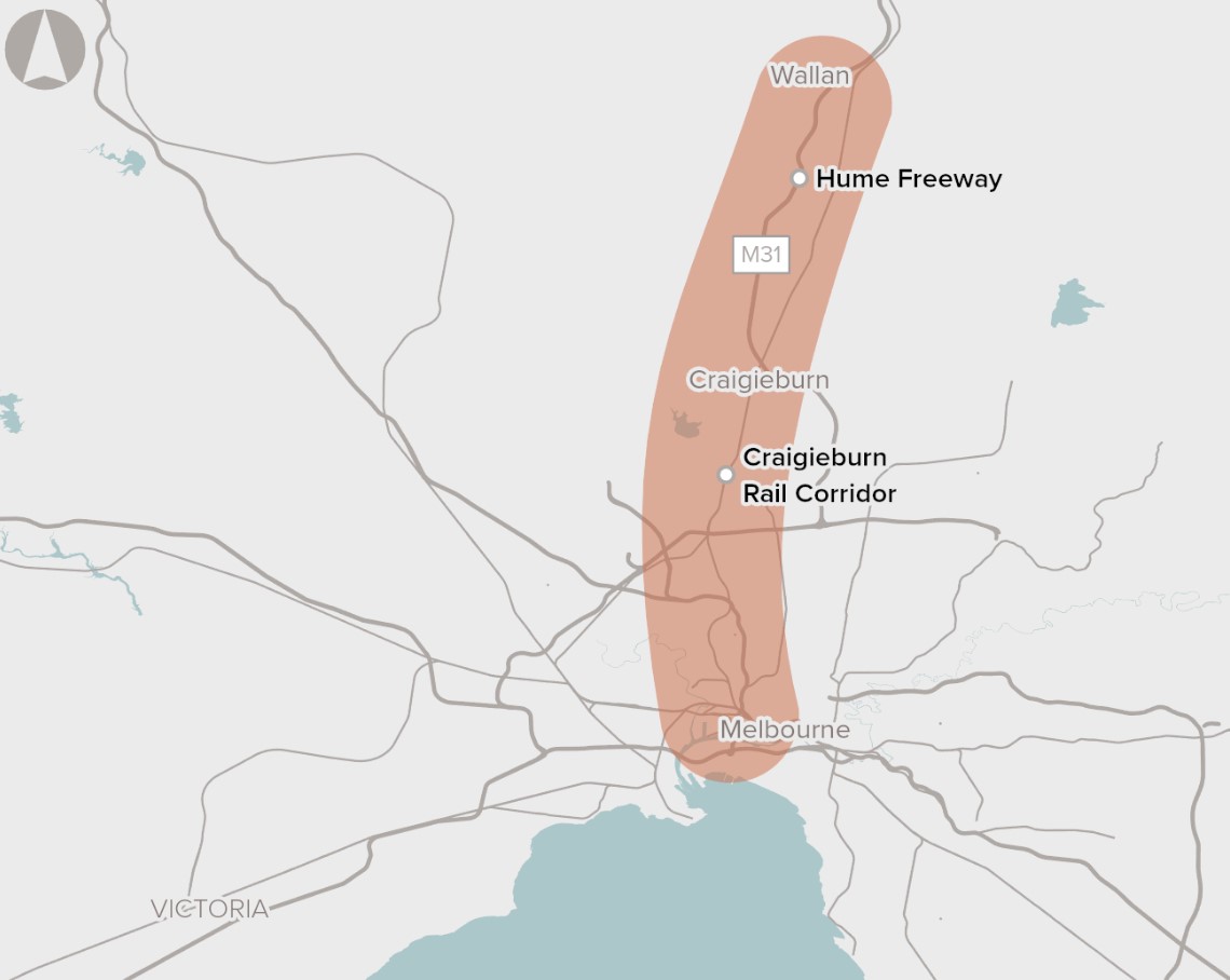
Outer Melbourne Northern Suburbs Upgrade
Infrastructure Australia in 2016 identified the need to improve urban transport networks between Melbourne's Outer Northern Suburbs and the CBD, marking it as crucial within a medium-term timeframe of 5-10 years. The proposal aims to address pressing transportation challenges due to rapid growth in the Northern Growth Corridor. With projections indicating significant population and employment increases by 2031, existing road and rail infrastructure faces strain, leading to anticipated congestion and delays along the Hume Freeway and the Seymour Line.
Recognising the urgency, the Victorian and Australian Governments are collaborating on a comprehensive strategy integrating road and rail network planning. Through various projects and proposed reforms outlined in Victoria’s infrastructure strategy 2021-2051, efforts are underway to alleviate congestion and enhance transportation services in the corridor. Emphasising the need to explore diverse options, including infrastructure upgrades and reforms, this proposal seeks to meet the transportation needs of Melbourne's outer northern suburbs' growing population and employment hub.
Growth Corridor Plans
The Precinct Structure Plans (PSPs) complement the broader land use framework outlined in the Growth Corridor Plans. PSPs are detailed planning documents that guide development within specific precincts, ensuring they align with the overarching goals of the Growth Corridor Plans. Developed through a consultative process involving stakeholders, PSPs provide a strategic blueprint for neighbourhood development.
In 2012, the Growth Areas Authority (GAA) in collaboration with local councils, PSPs define the pattern for neighbourhood growth, ensuring cohesion and sustainability over time. They play a crucial role in creating attractive, convenient, and sustainable local communities within the broader growth framework.
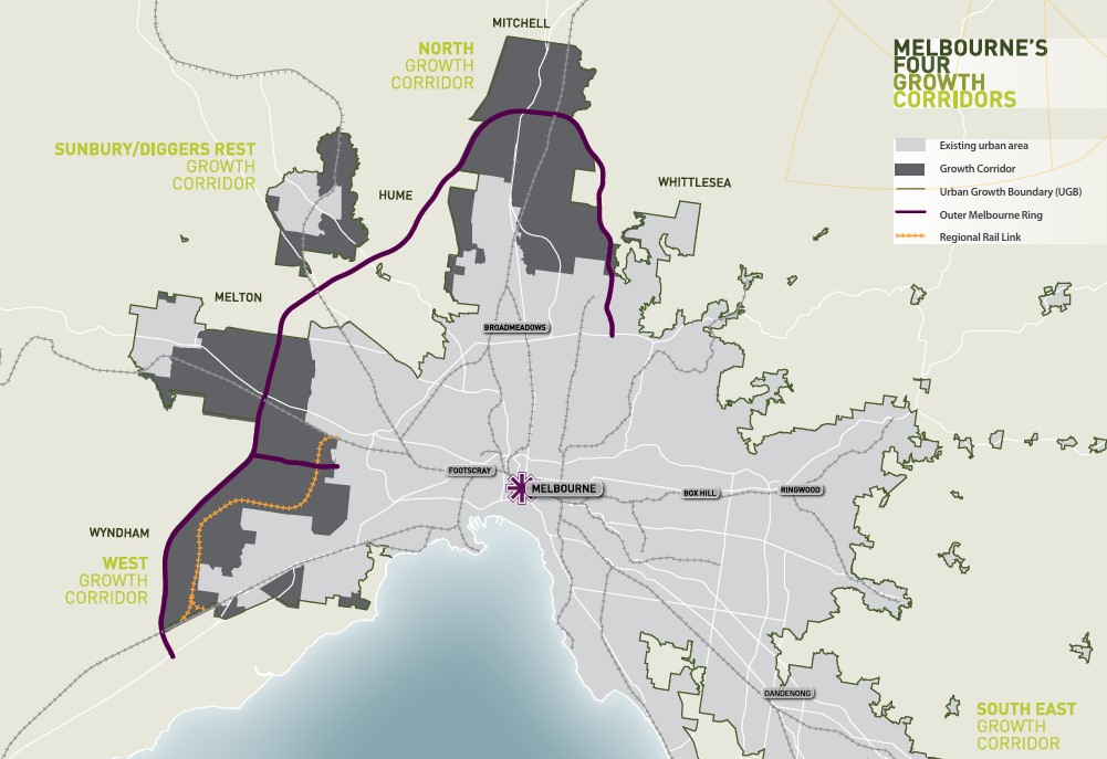
Northern Growth Corridor Plan (Mickleham)
Melbourne's north undergoes significant transformation, driven by a diverse socio-economic landscape and a burgeoning economy, supported by key infrastructure like Melbourne Airport and major transport arteries. The Northern Growth Corridor Plan aims to accommodate 260,000 residents and generate 83,000 jobs, focusing on advanced manufacturing, logistics, and the knowledge economy. The plan prioritizes preserving natural features, improving public transport, and developing new town centres to sustainably support the area's growth, alongside initiatives to provide diverse housing options for evolving community needs.
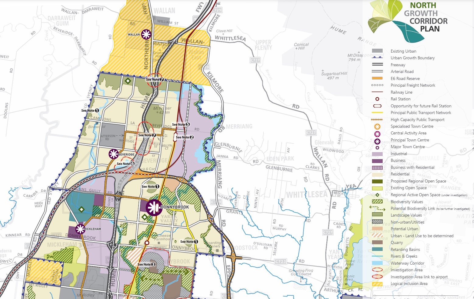
Precinct Structure Plans of Mickleham
The Growth Areas Authority, in collaboration with the Hume City Council, government agencies, service authorities, and key stakeholders, has developed the Precinct Structure Plans (PSP) for Mickleham. These plans are crafted to steer the redevelopment of designated land, creating interconnected neighbourhoods supported by diverse local town centres, schools, and community facilities. Additionally, measures to safeguard natural assets and conservation areas are incorporated to preserve habitats within the planned suburb.
PSP Relevant to Mickleham:
Craigieburn West PSP (September 2021) - updated August 2022
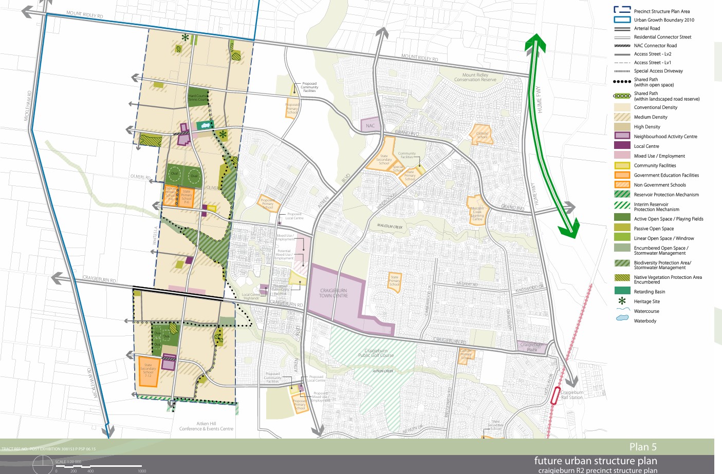
Craigieburn PSP (September 2010) – updated September 2021
Merrifield North (August 2024)
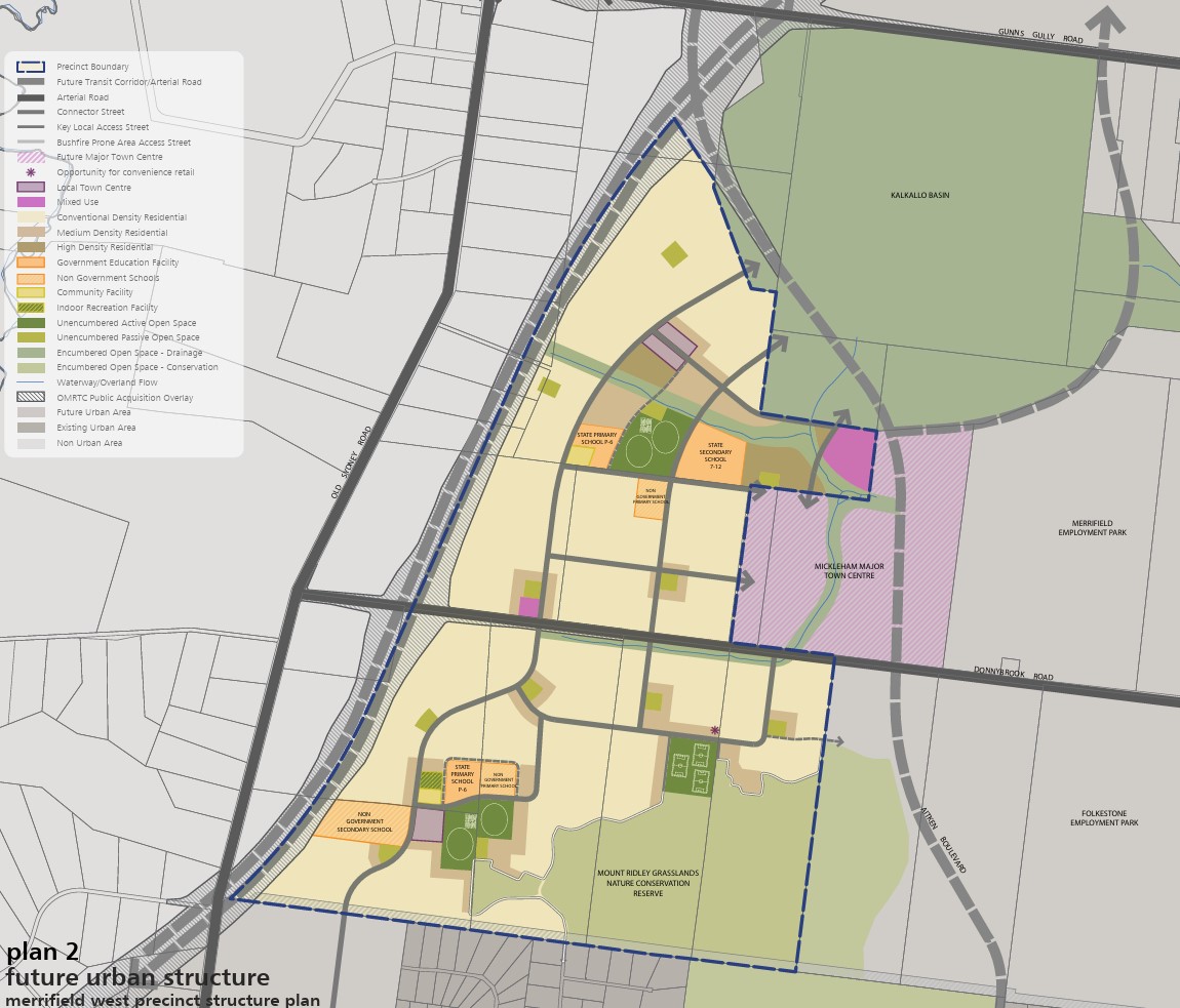
Merrifield West (2012) – New in January 2024
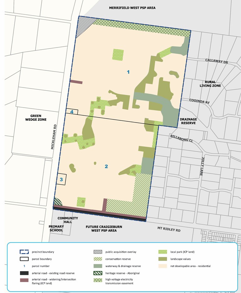
Lindum Vale (2018) – July 2019
Precinct Structure Plan:
Acts as a roadmap for creating a high-quality urban environment
Establishes a vision for land development, outlining future urban structure and development objectives
Identifies necessary projects to ensure timely access to services and transport infrastructure for residents, visitors, and workers
Specifies the form and conditions for future land use and development
Sets the framework for development controls in the Urban Growth Zone
Guides planning permits within the zone
Offers direction for developers, investors, and local communities regarding future development
Complies with the requirements of the EPBC Act 1999
Hume Regional Growth Plan
The Hume Regional Growth Plan was published in 2014 to offer a comprehensive approach to land use planning across the Council area. Accompanied by a background paper detailing considerations, the plan outlines strategies to foster growth and facilitate change over the next three decades. Building upon the Hume Strategy for Sustainable Communities 2010–2020, it aspires to realise a shared vision for the Hume Region. The plan outlines future development locations, preservation strategies for environmental and heritage assets, and regional infrastructure priorities to support growth.
Vision
The Hume Region will be resilient, diverse and thriving. It will capitalise on the strengths and competitive advantages of the four sub-regions, to harness growth for the benefit of the region and to develop liveable and sustainable communities.
Hume Council Planning Scheme (2024)
The council is responsible for ensuring adequate housing, facilities, infrastructure, and services for new residents and businesses. The city of Hume is experiencing rapid growth and to address this, the Council has continuously updated its planning scheme. The population will grow by more than 50% from just under 245,000 in 2021 to nearly 395,000 by 2041. When all current growth area land is developed the population will be around 420,000. Revisions to the plan may occur based on feedback and changes in circumstances, or new planning information.
New development has occurred in the growth areas, supported by the zoning applied by the Hume Planning Scheme and the precinct structure plans. The new urban areas are supported by new schools, parks, sporting grounds, local centres and transport infrastructure.
Mickleham Suburb Summary
References
Hume Council – PSP Locations Map
Melbourne 2030: A Planning Update
Melbourne Urban Growth boundary
Growth Corridor Plan – Managing Melbourne’s Growth
The North Growth Corridor Plan
Melbourne outer northern suburbs to CBD capacity upgrade
Hume-Regional-Growth-Plan-May-2014
Craigieburn West Precinct Structure Plan - VPA
Craigieburn R2 Precinct Structure Plan - VPA
Merrifield North Precinct Structure Plan - VPA
Merrifield West Precinct Structure Plan - VPA
Lindum Vale Precinct Structure Plan - VPA
Reviews & Comments on Trillium Estate - Mickleham
Estate Brochure, Masterplan, Engineering Plan, Plan of Subdivision (POS), Design Guidelines
FAQs about Trillium Estate - Mickleham
View all estates from Villawood Properties
View all estates marketed by Oliver Hume Real Estate Group
- Newbury Primary School - 1.5km east
- Mickleham Primary School - 1.6km north-west
- Oscar Romero Catholic Primary School - 1.8km south
- Aitken Creek Primary School - 1.8km south-east
- Wayi School - 2.5km south-east
- Mount Ridley P-12 College - 2.7km south-east
Popular Estates near Trillium Estate - Mickleham
Latest New Home Articles for You

16/Mar/2026 | OpenLot.com.au
New South Wales: Top 30 Most Searched Housing Developments (February 2026)
If you’ve been considering a move in New South Wales, February 2026 provi...

09/Mar/2026 | OpenLot.com.au
Victoria: Top 30 Most Searched Housing Developments (February 2026)
If you’ve been exploring housing opportunities in Victoria, February 2026...

20/Feb/2026 | OpenLot.com.au
Display Homes at Drouin Fields Estate: A Thriving Community in Drouin
Welcome to Drouin Fields, a place where beauty, space, and modern luxury ...

19/Feb/2026 | OpenLot.com.au
Display Homes at Manor Lakes Esate: A Thriving Waterside Community in Manor Lakes
A place where you can settle in, rather than just settle down. Named for ...

13/Feb/2026 | OpenLot.com.au
🏠 Victoria: Top 30 Most Searched Townhouse Developments – January 2026

11/Feb/2026 | OpenLot.com.au
🏡 Top 30 Most Searched Estates by State - January 2026

10/Feb/2026 | OpenLot.com.au
Victoria: Top 30 Most Searched Housing Developments (January 2026)
If you’ve been considering making a move in Victoria, January 2026 offere...

10/Feb/2026 | OpenLot.com.au
Queensland: Top 30 Most Searched Housing Developments (January 2026)
If you’ve been considering making a move in Queensland, January 2026 offe...

09/Feb/2026 | OpenLot.com.au
Western Australia: Top 30 Most Searched Housing Developments (January 2026)
If you’ve been considering making a move in Western Australia, January 20...