
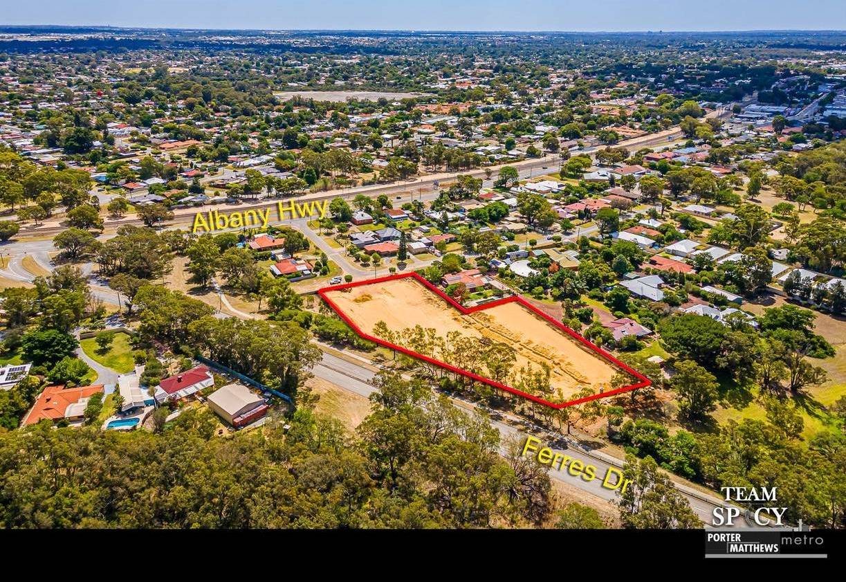
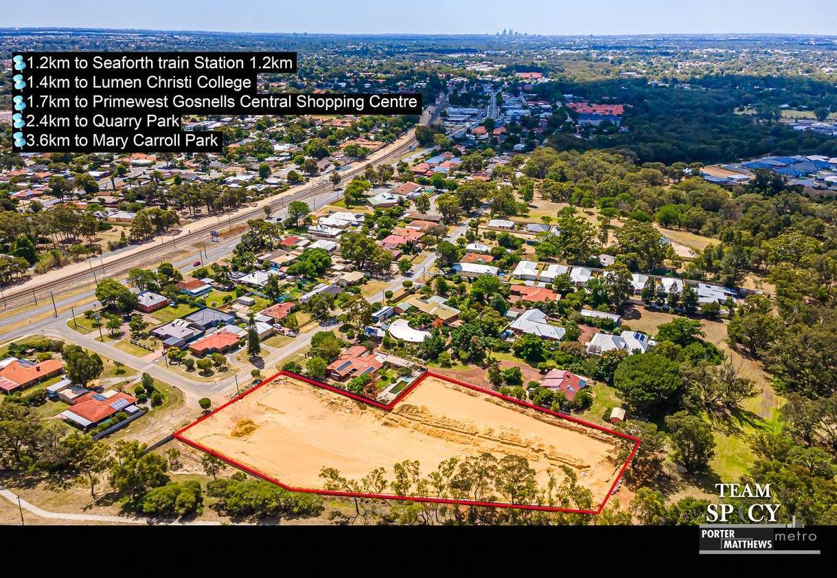
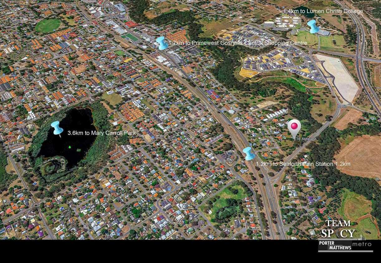
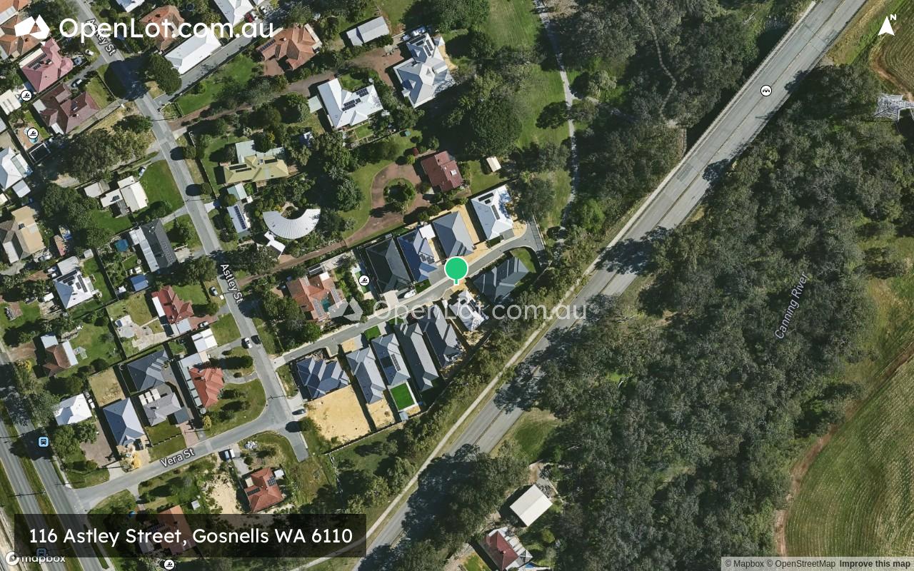
116 Astley Street, Gosnells WA 6110
This information is estimated by the OpenLot research team. Let us know here to provide up-to-date information about this development.
| Total new homes | 12 |
| Area size | N/A |
| Growth Region | Perth South East Growth Areas |
| City council | City of Gosnells |
| Developer | N/A |
| Project marketer | Porter Matthews Metro |
Land for Sale, House and Land Packages:
Popular Estates near 116 Astley Street, Gosnells


Updates for 116 Astley Street, Gosnells
Facebook updates:
Related news:
Missing articles? Send us a link here.
Location & Map for 116 Astley Street, Gosnells
Visit Display Homes near 116 Astley Street, Gosnells


Vacancy Rate in Gosnells WA 6110
View full vacancy rate history in Gosnells WA 6110 via SQM Research.
Schools near 116 Astley Street, Gosnells
Here are 6 schools near 116 Astley Street, Gosnells:
K-6 Government Primary School
7-12 Catholic Secondary School
K-6 Government Primary School
PP-6 Catholic Primary School
K-6 Government Primary School
PP-12 Independent Combined School
Reviews & Comments on 116 Astley Street, Gosnells
Estate Brochure, Masterplan, Engineering Plan, Plan of Subdivision (POS), Design Guidelines
FAQs about 116 Astley Street, Gosnells
View all estates marketed by Porter Matthews Metro
- Gosnells Primary School - 859m west
- Lumen Christi College - 1.1km north
- Seaforth Primary School - 1.8km south-west
- St Munchin's Catholic School - 2.4km west
- Ashburton Drive Primary School - 2.7km west
- John Wollaston Anglican Community School - 2.7km south
Popular Estates near 116 Astley Street, Gosnells
Latest New Home Articles for You

09/Mar/2026 | OpenLot.com.au
Victoria: Top 30 Most Searched Housing Developments (February 2026)
If you’ve been exploring housing opportunities in Victoria, February 2026...

20/Feb/2026 | OpenLot.com.au
Display Homes at Drouin Fields Estate: A Thriving Community in Drouin
Welcome to Drouin Fields, a place where beauty, space, and modern luxury ...

19/Feb/2026 | OpenLot.com.au
Display Homes at Manor Lakes Esate: A Thriving Waterside Community in Manor Lakes
A place where you can settle in, rather than just settle down. Named for ...

13/Feb/2026 | OpenLot.com.au
🏠 Victoria: Top 30 Most Searched Townhouse Developments – January 2026

11/Feb/2026 | OpenLot.com.au
🏡 Top 30 Most Searched Estates by State - January 2026

10/Feb/2026 | OpenLot.com.au
Victoria: Top 30 Most Searched Housing Developments (January 2026)
If you’ve been considering making a move in Victoria, January 2026 offere...

10/Feb/2026 | OpenLot.com.au
Queensland: Top 30 Most Searched Housing Developments (January 2026)
If you’ve been considering making a move in Queensland, January 2026 offe...

09/Feb/2026 | OpenLot.com.au
Western Australia: Top 30 Most Searched Housing Developments (January 2026)
If you’ve been considering making a move in Western Australia, January 20...

06/Feb/2026 | OpenLot.com.au
South Australia: Top 30 Most Searched Housing Developments (January 2026)
If you’ve been considering making a move in South Australia, January 2026...