


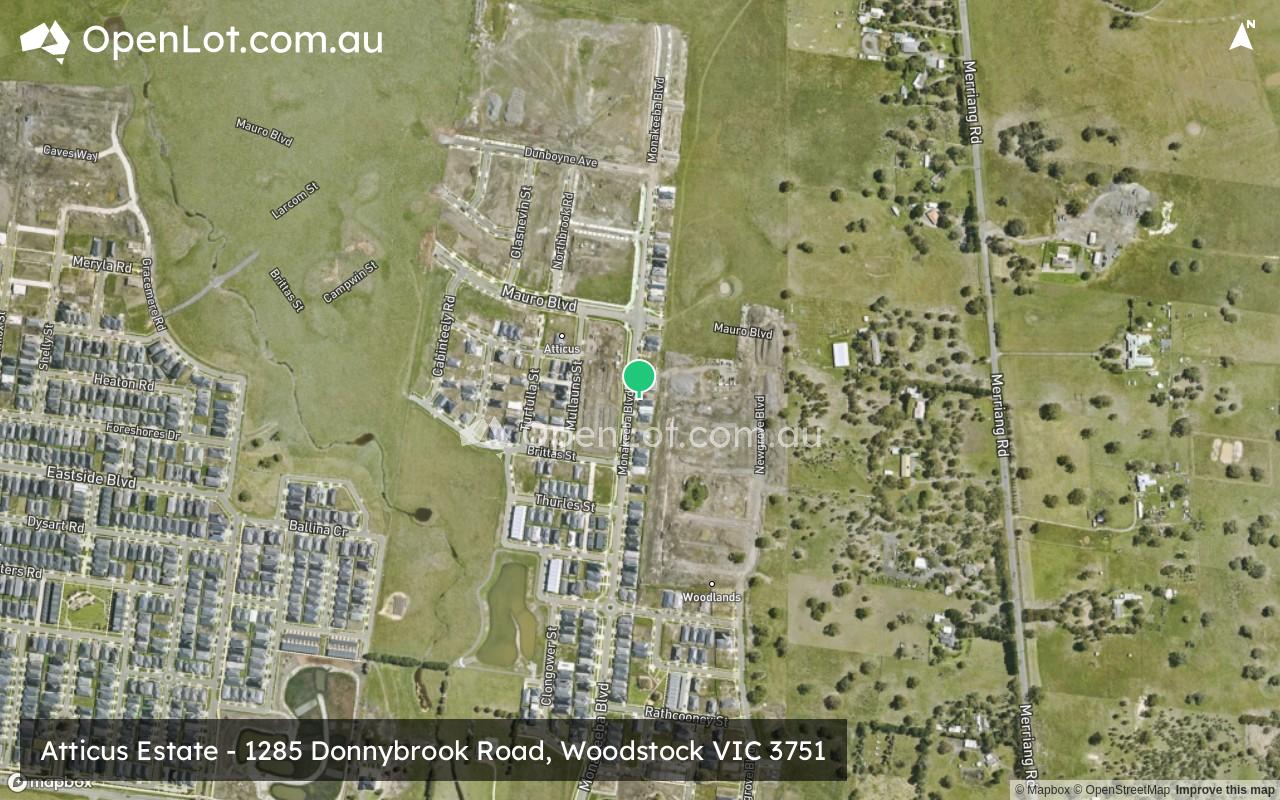
Atticus Estate - Woodstock 6 AVAILABLE
[LIMITED OFFER] Townhouses Now available! Register for your appointment!
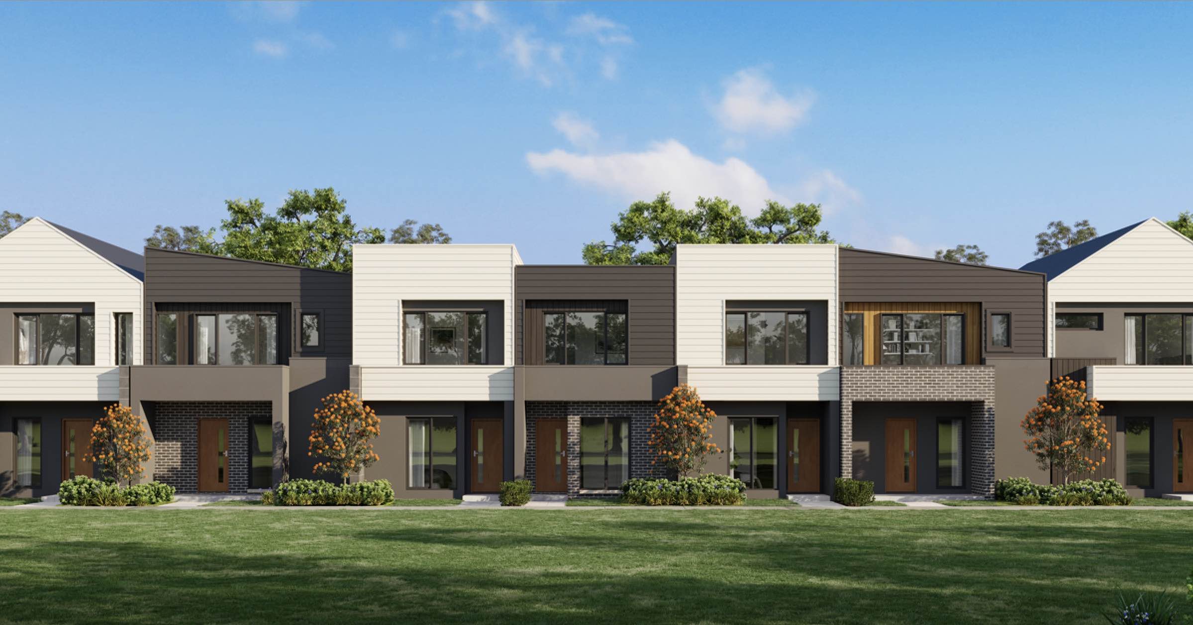
- 4 bed Calluna Townhomes now available
- Limited SMSF Offer!
- 5 Year Rental Guarantee!
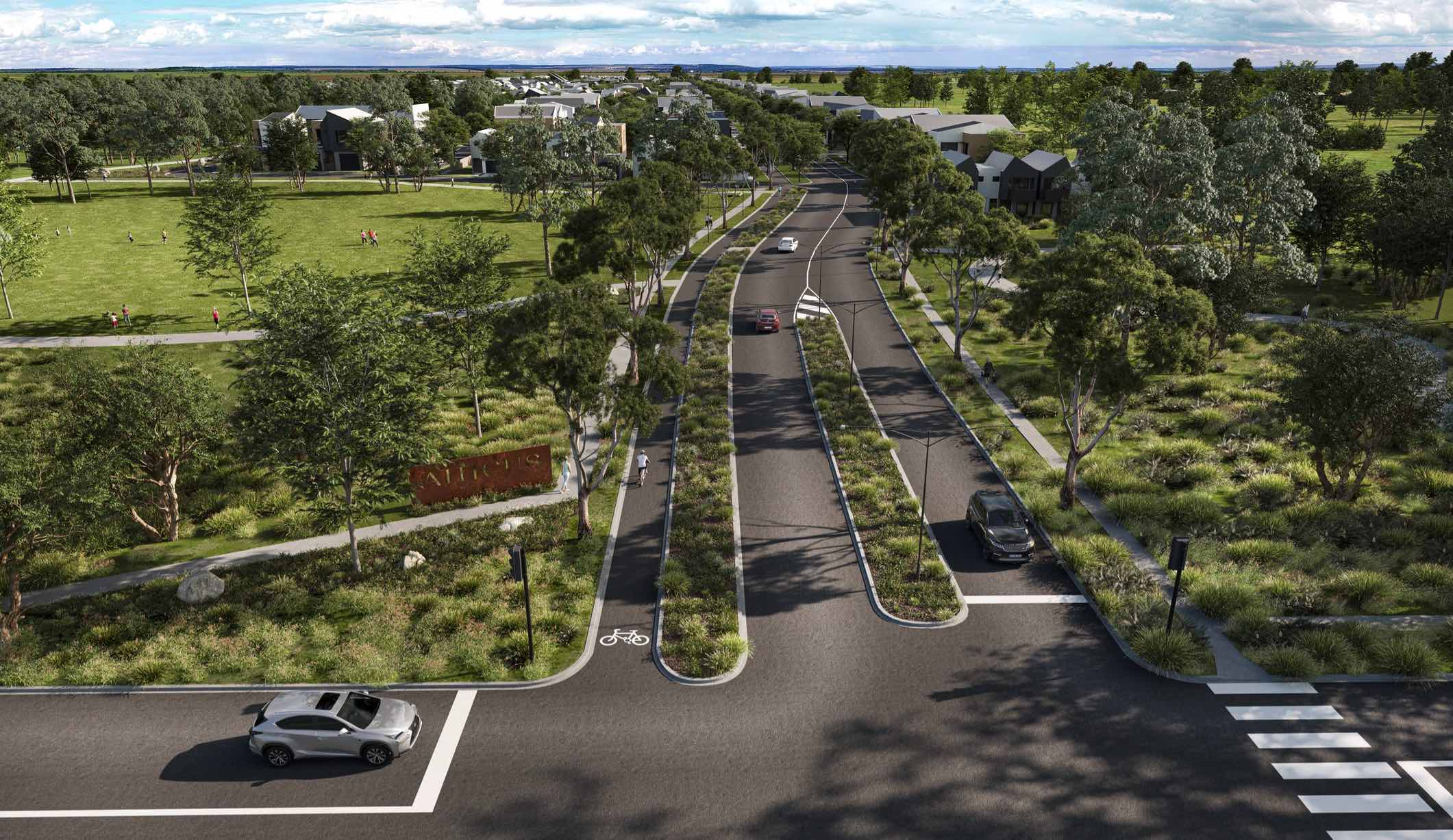
- Low maintenance, high quality living on tree lined streets.
- Close to Donnybrook station, future schools, local town centre and community facilities
- 30 minute to Melbourne airport, 35 minute to Melbourne’s CBD
This information is estimated by the OpenLot research team. Let us know here to provide up-to-date information about this development.
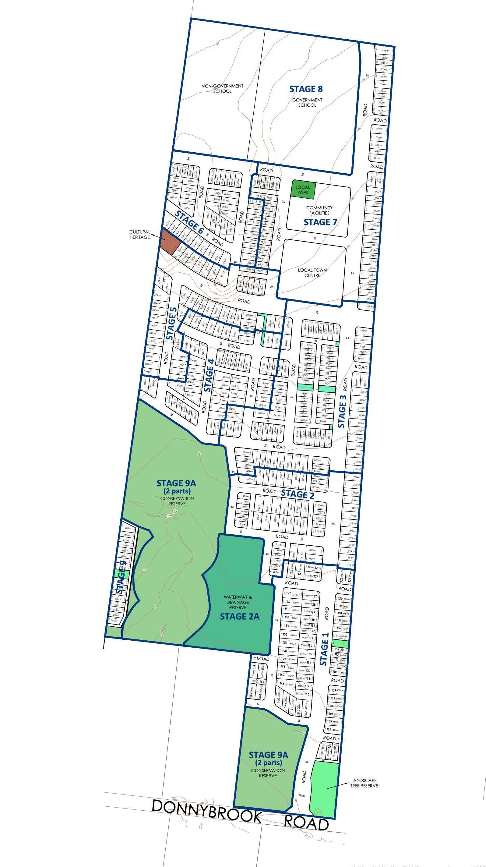
| Total new homes | 750 |
| Area size | 40.16 hectares |
| Growth Region | Melbourne North Growth Corridor |
| City council | Whittlesea City Council |
| Developer | Livv Developments, Universal Corporation |
| Project marketer | Core Projects |
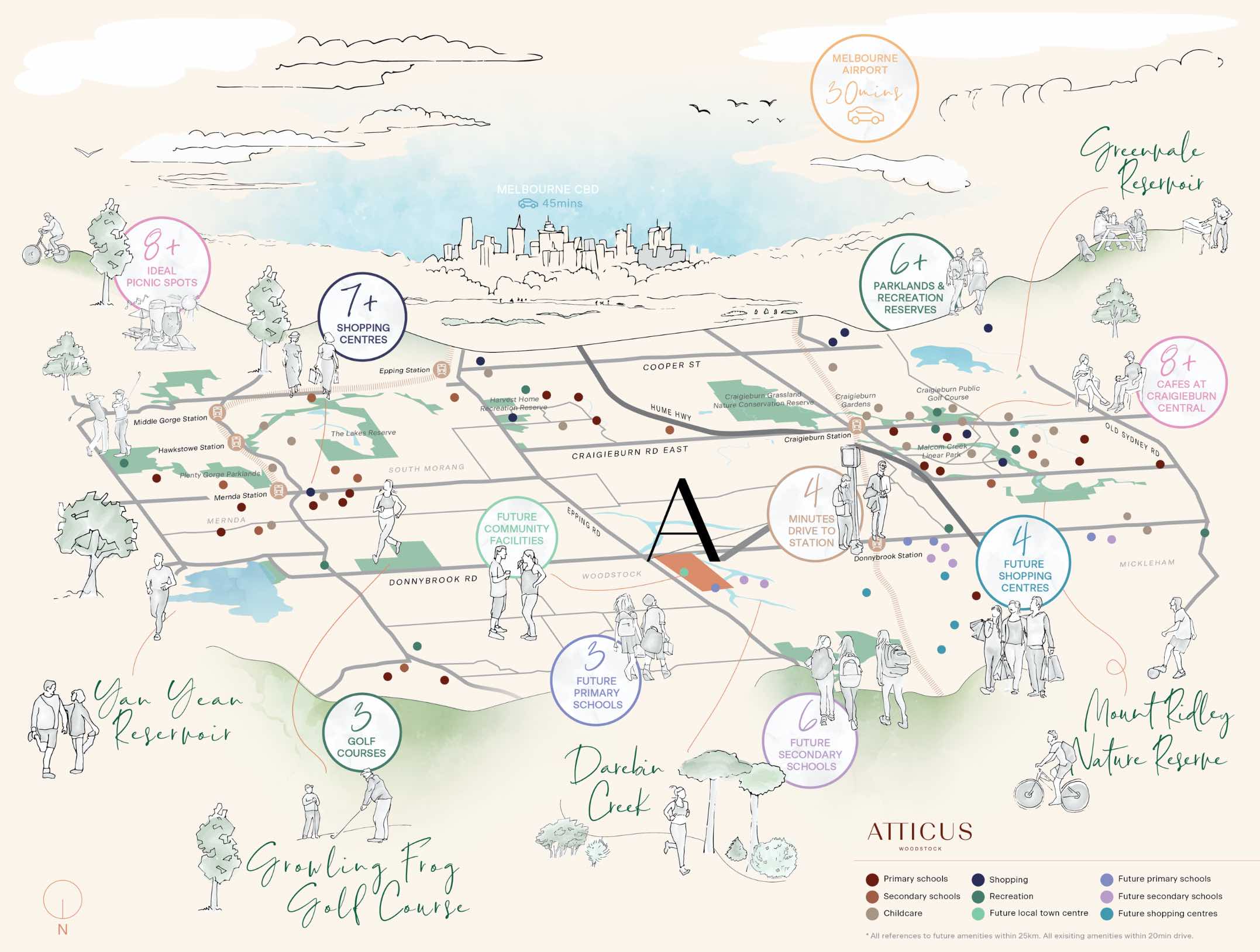
| Distance to | Melbourne Airport - 22 km north-east Melbourne CBD - 31 km north |
Land for Sale, House and Land Packages, Townhomes:
4 House and Land Packages in Atticus Estate - Woodstock

 3
3
 2
2
 1
1
Townhouses in Atticus Estate - Woodstock
Popular Estates near Atticus Estate - Woodstock


Updates for Atticus Estate - Woodstock
Facebook updates:
Related news:
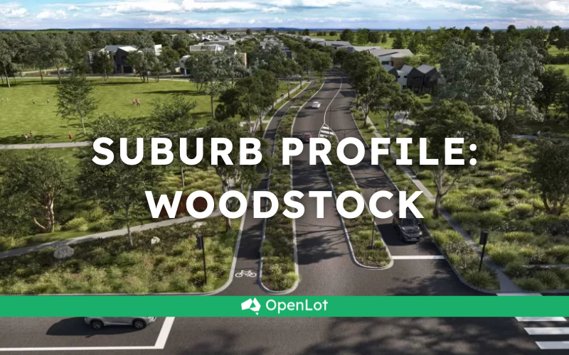
Woodstock is located in the city of Whittlesea, a semi-rural location to the north of Melbourne’s outer suburbs of the Urban Growth Boundary and logical expansion of the former Woodstock township. Woodstock growth area is 760ha and forms part of the new 1,786ha suburb area (Woodstock and Donnybrook) that is located on either side of Cameron Street. The new suburb is bounded by a possible future high-speed rail investigation area and Outer Metropolitan Ring Reservation (OMR / E6) for future road and rail transport links.
We're excited to unveil the lineup of the top 30 most searched housing developments in Victoria for June 2024. These rankings have been meticulously compiled from project page views resulting from organic searches on OpenLot.com.au spanning from 1st June 2024 to 30th June 2024. From tranquil suburban havens to idyllic coastal retreats, Victoria offers a wealth of housing options, and we're here to provide you with the insider information on what's capturing the attention of the masses.

Introducing the Mondina Row collection in Atticus Woodstock; a limited release of 7 townhome residences curated to meet the needs of growing families.

Missing articles? Send us a link here.
Location & Map for Atticus Estate - Woodstock
Visit Display Homes near Atticus Estate - Woodstock


Land Price Trend in Woodstock VIC 3751
- In Oct - Dec 24, the median price for vacant land in Woodstock VIC 3751 was $151,000. *
- From Oct - Dec 24 to Oct - Dec 24, the median price for vacant land in Woodstock VIC 3751 has increased 0%. *
- From 2024 to 2024, the median price for vacant land in Woodstock VIC 3751 has increased 0%. *
Vacancy Rate in Woodstock VIC 3751
View full vacancy rate history in Woodstock VIC 3751 via SQM Research.
Schools near Atticus Estate - Woodstock
Here are 6 schools near Atticus Estate - Woodstock:
Prep-6 Government Primary School
Prep-6 Government Primary School
Prep-6 Government Primary School
Prep-6 Government Primary School
7-9 Government Secondary School
Prep-6 Government Primary School
Suburb Planning Review in Woodstock VIC 3751
Woodstock is located in the city of Whittlesea, a semi-rural location to the north of Melbourne’s outer suburbs of the Urban Growth Boundary and logical expansion of the former Woodstock township. Woodstock growth area is 760ha and forms part of the new 1,786ha suburb area (Woodstock and Donnybrook) that is located on either side of Cameron Street. The new suburb is bounded by a possible future high-speed rail investigation area and Outer Metropolitan Ring Reservation (OMR / E6) for future road and rail transport links.

The Donnybrook-Woodstock Precinct Structure Plan (PSP) was prepared to guide the redevelopment of the released land for a mix of residential neighbourhoods linked by a variety of local town centres, schools and other community facilities. Protection of natural assets along the Merri Creek and Darebin Creek linear conservation corridors are provided to protect the Growling Grass Frog habitat from the planned suburb.

The Donnybrook-Woodstock PSP was prepared by Victorian Planning Authority (VPA) in consultation with the Whittlesea City Council and was approved by the Minister for Planning in November 2017. The decision was officially gazetted on 3 November 2017 under Amendment GC28 of the Whittlesea Planning Scheme.
The Vision of Woodstock
“Development will have a strong emphasis on the retention of natural features and high quality landscaping in an urban environment supported by strong connections to transport and community facilities. Development of the precinct will create a diverse mix of residential neighbourhoods linked by a variety of local town centres, schools and other community facilities.
The distribution of local centres which serve a variety of roles and functions will promote self-sufficiency for residents of the precinct in meeting daily retail and convenience shopping needs. Residential and business development will capitalise on the precinct’s proximity to the existing Donnybrook train station, as well as the future Lockerbie Principal Town Centre and potential future Lockerbie Train Station. The development of the existing Donnybrook Cheese Farm into an agricultural, historical and cultural learning hub will provide new residents with connections to the history of the area”.

Benefits of Woodstock
The existing zoning will be amended to provide for Rural Conservation and Urban Growth Zones, providing a series of greenfield sites in proximity to natural corridors. The amendments provide a new residential community, protection of natural features, parks, and sports and recreation areas. The Structure Plan also supports new schools, local community hubs, local centres to provide employment and services to the new suburb.
Transportation in Woodstock
Woodstock is well connected to public passenger transport, with the Donnybrook train station located to the east outside the new suburb boundary and a future north train station to be built in Lockerbie. The passenger train service connects Melbourne to Sydney and is being considered for a high speed rail project.
The suburb will include a network of shared paths linking the local parks and a new road network. Donnybrook Road and a new future state arterial road will provide access to the Hume Freeway, providing a direct connection to Melbourne CBD or northern Victoria.
Woodstock Suburb Summary
References
Reviews & Comments on Atticus Estate - Woodstock
Estate Brochure, Masterplan, Engineering Plan, Plan of Subdivision (POS), Design Guidelines
FAQs about Atticus Estate - Woodstock
View all estates from Livv Developments
View all estates from Universal Corporation
View all estates marketed by Core Projects
- Donnybrook Primary School - 2.4km west
- Gilgai Plains Primary School - 5.8km west
- Barrawang Primary School - 6.8km south-west
- Edgars Creek Primary School - 7.7km south
- Wollert Secondary College - 7.8km south
- Wollert Primary School - 7.8km south
Popular Estates near Atticus Estate - Woodstock
Latest New Home Articles for You

16/Mar/2026 | OpenLot.com.au
New South Wales: Top 30 Most Searched Housing Developments (February 2026)
If you’ve been considering a move in New South Wales, February 2026 provi...

09/Mar/2026 | OpenLot.com.au
Victoria: Top 30 Most Searched Housing Developments (February 2026)
If you’ve been exploring housing opportunities in Victoria, February 2026...

20/Feb/2026 | OpenLot.com.au
Display Homes at Drouin Fields Estate: A Thriving Community in Drouin
Welcome to Drouin Fields, a place where beauty, space, and modern luxury ...

19/Feb/2026 | OpenLot.com.au
Display Homes at Manor Lakes Esate: A Thriving Waterside Community in Manor Lakes
A place where you can settle in, rather than just settle down. Named for ...

13/Feb/2026 | OpenLot.com.au
🏠 Victoria: Top 30 Most Searched Townhouse Developments – January 2026

11/Feb/2026 | OpenLot.com.au
🏡 Top 30 Most Searched Estates by State - January 2026

10/Feb/2026 | OpenLot.com.au
Victoria: Top 30 Most Searched Housing Developments (January 2026)
If you’ve been considering making a move in Victoria, January 2026 offere...

10/Feb/2026 | OpenLot.com.au
Queensland: Top 30 Most Searched Housing Developments (January 2026)
If you’ve been considering making a move in Queensland, January 2026 offe...

09/Feb/2026 | OpenLot.com.au
Western Australia: Top 30 Most Searched Housing Developments (January 2026)
If you’ve been considering making a move in Western Australia, January 20...