


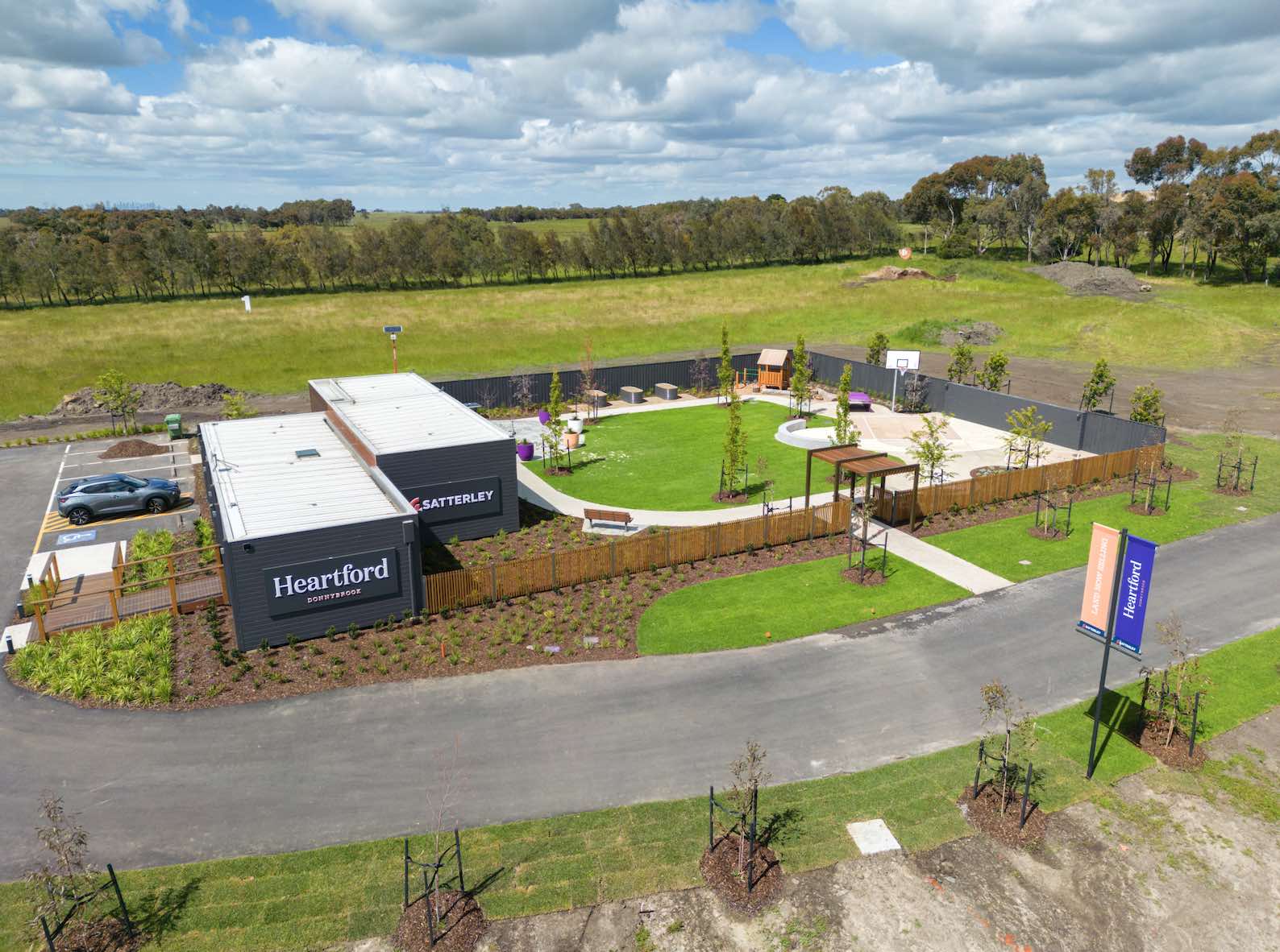

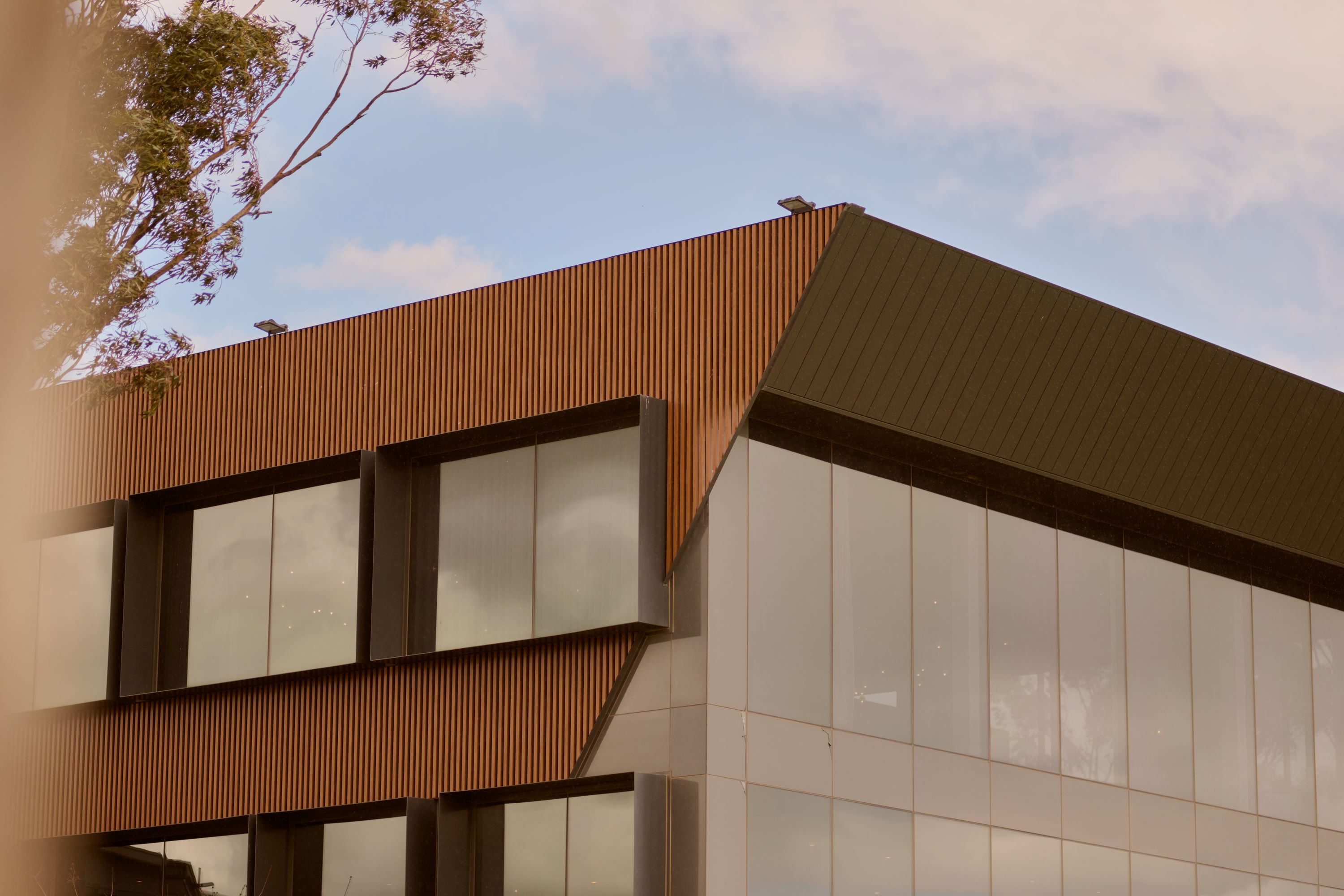

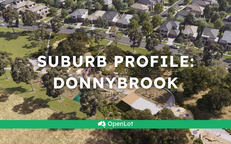
Heartford Estate - Donnybrook 15 AVAILABLE
[NEW RELEASE] Stage 5 Now Selling
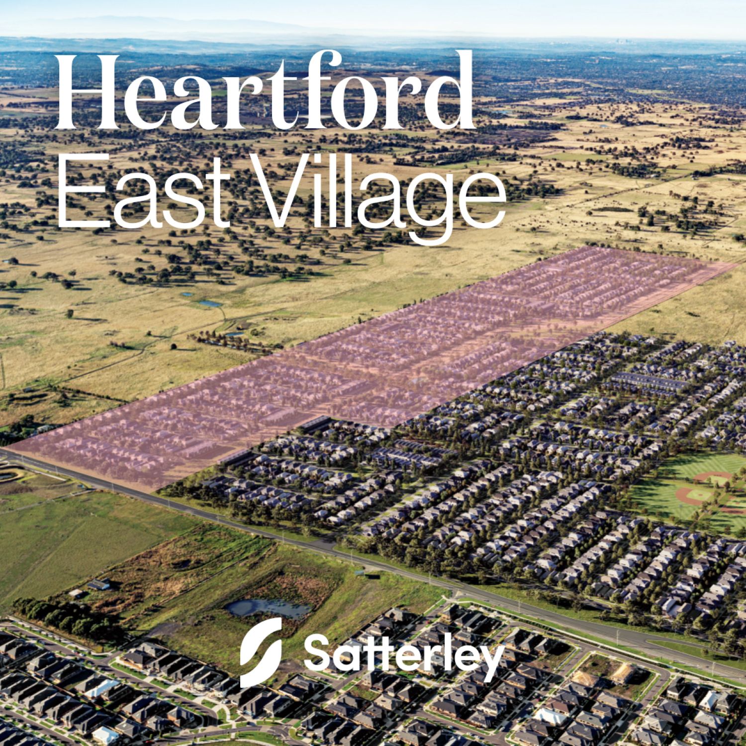
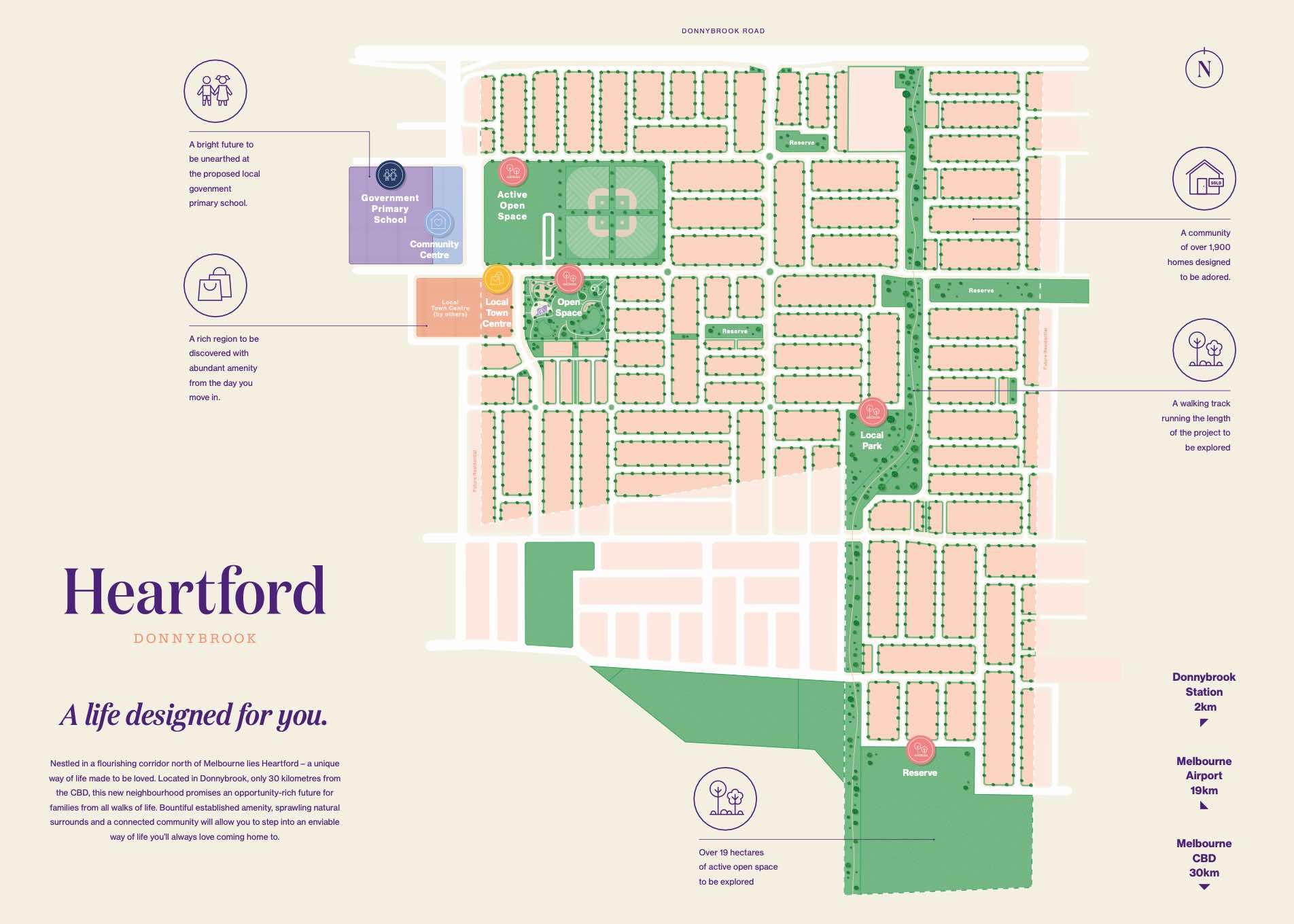
- Nestled in a flourishing corridor north of Melbourne lies Heartford - a unique way of life made to be loved.
- Located in Donnybrook, only 30 kilometres from the CBD offering just over 1900 Lots.
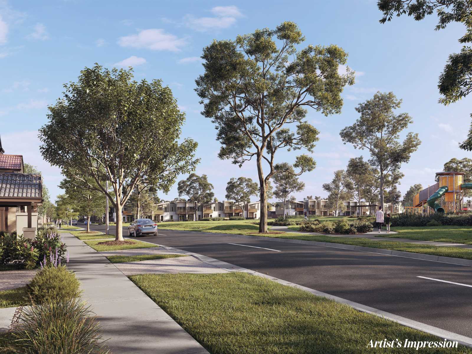
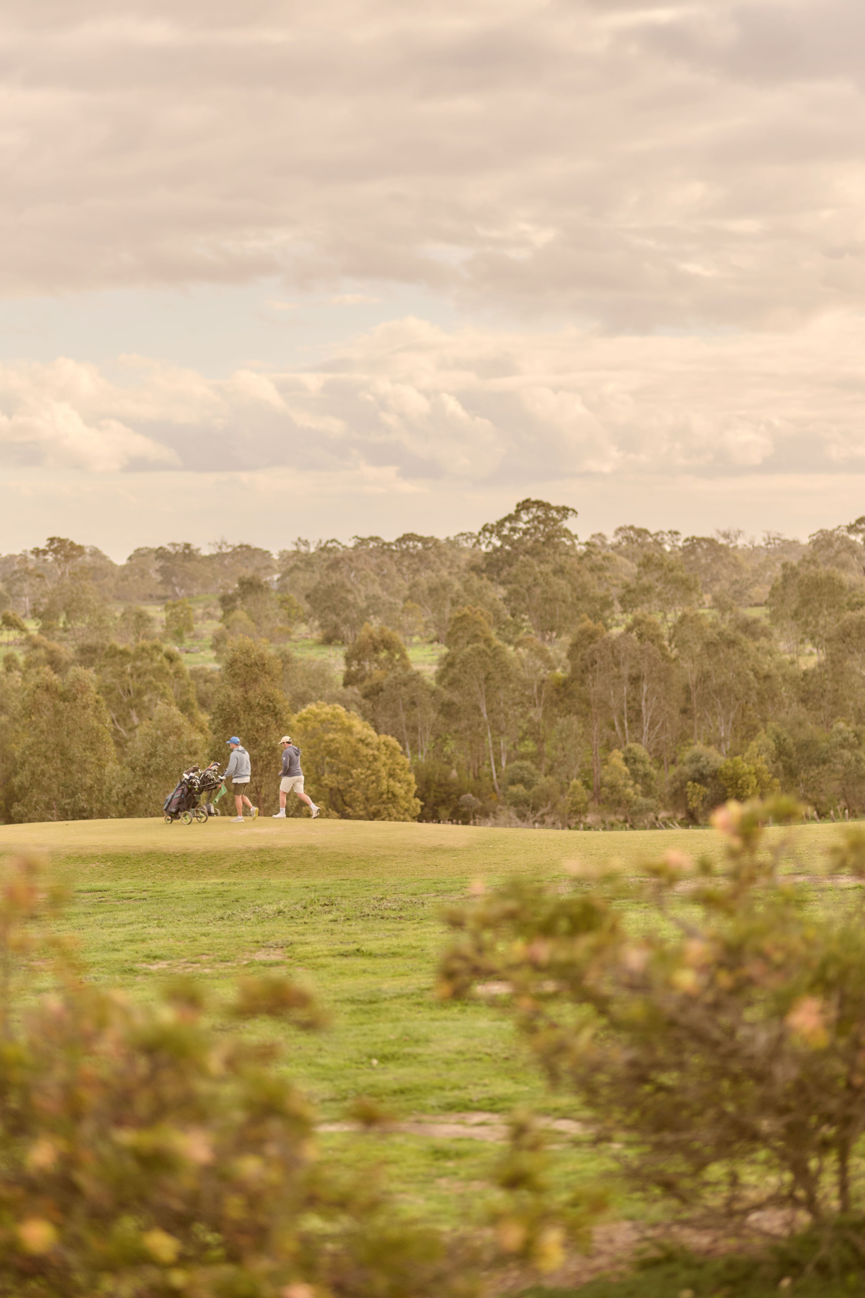
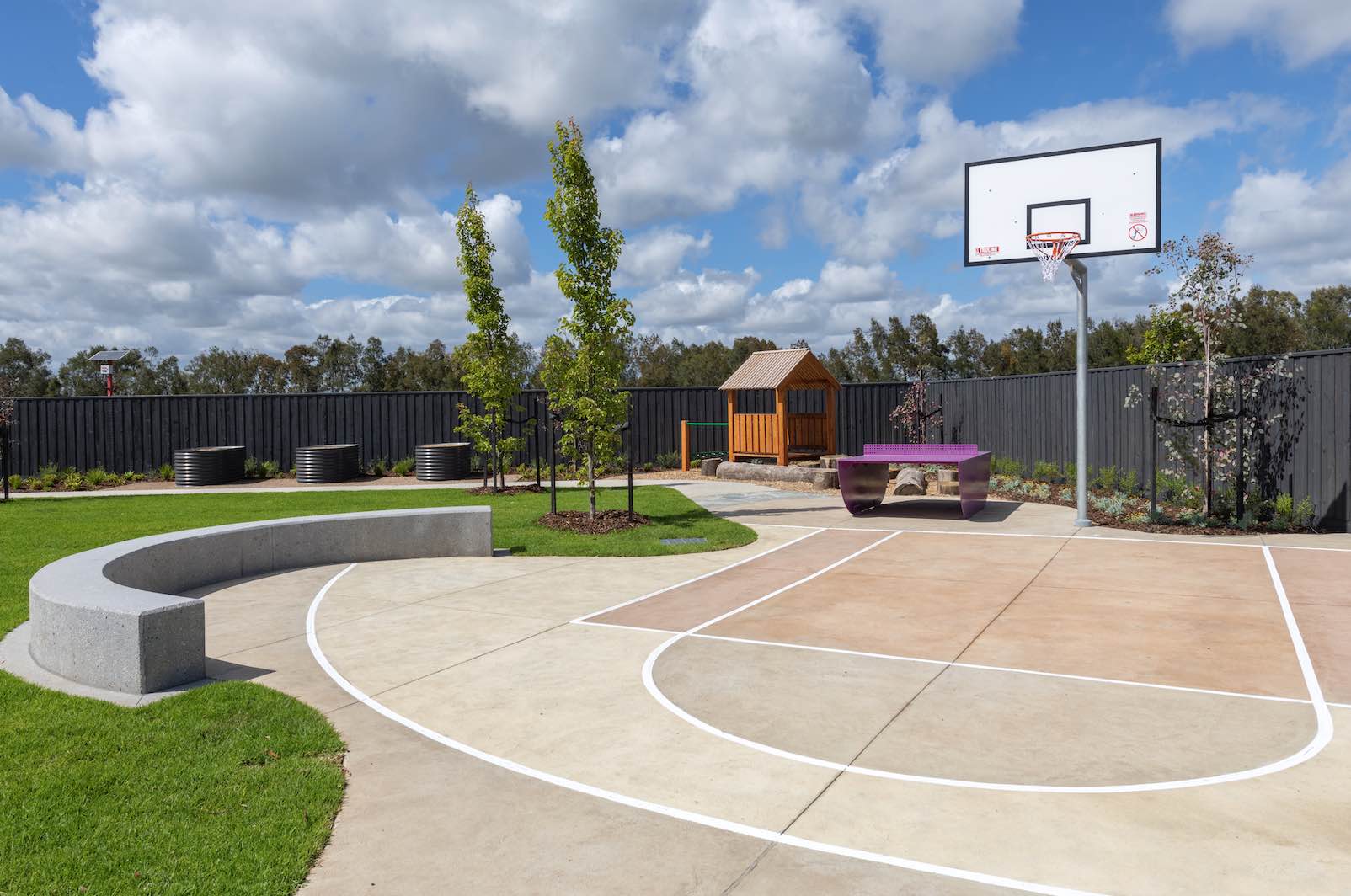
- Embrace community living amongst 19 hectares of active open space and a proposed local park.
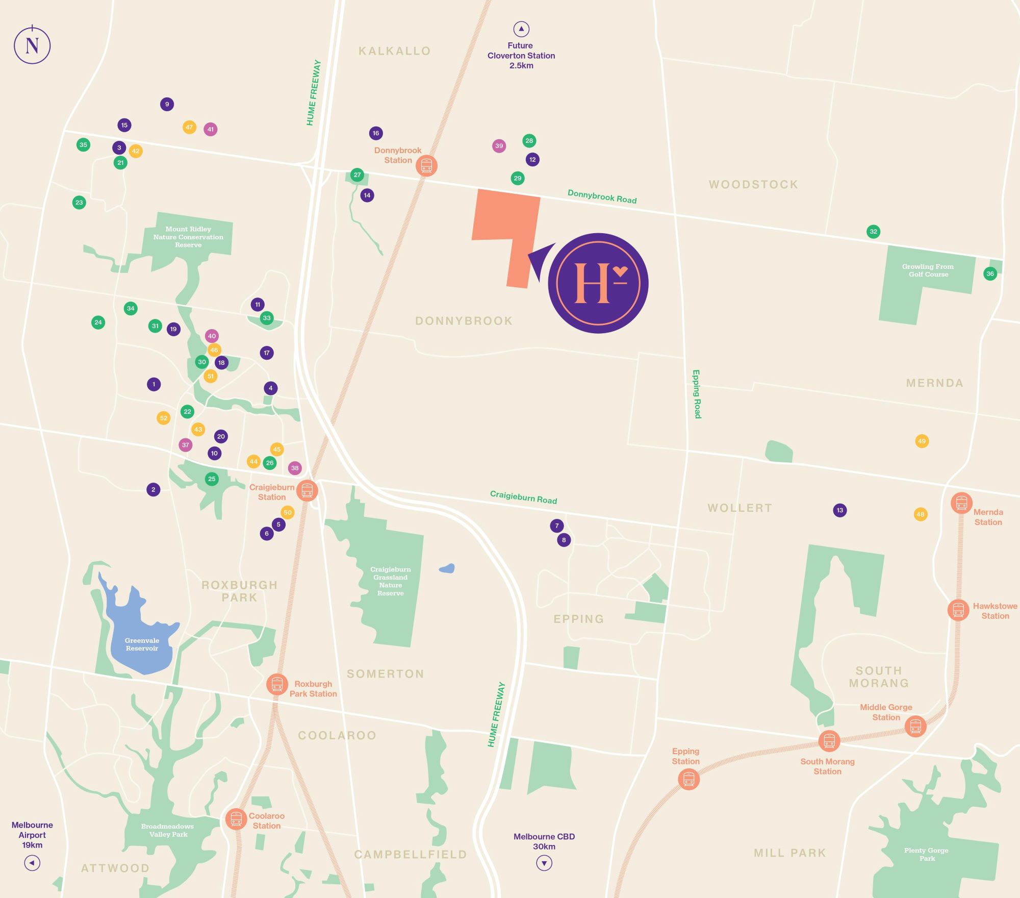
- Short drive to established shopping amenities including Craigieburn Central and Merrifield City Shopping Centres
- Donnybrook Railway Station located approximately 2kms away
- Less than 1km away from Hume Anglican Grammar School
- Proposed Community Centre & Government Primary School located within Heartford
This information is estimated by the OpenLot research team. Let us know here to provide up-to-date information about this development.
| Total new homes | 2,000 |
| Area size | 67.42 hectares |
| Growth Region | Melbourne North Growth Corridor |
| City council | Whittlesea City Council |
| Developer | Satterley Property Group |
| Distance to | Melbourne Airport - 19 km north-east Melbourne CBD - 30 km north |
Land for Sale, House and Land Packages:
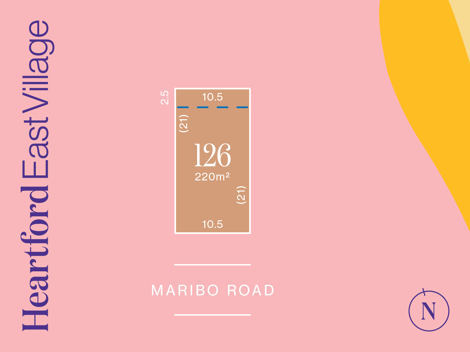
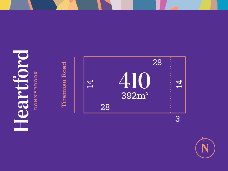
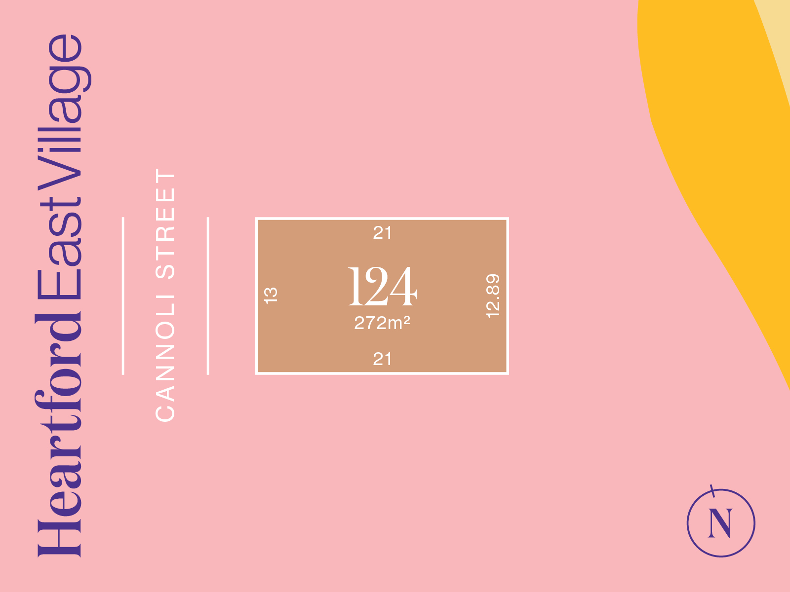
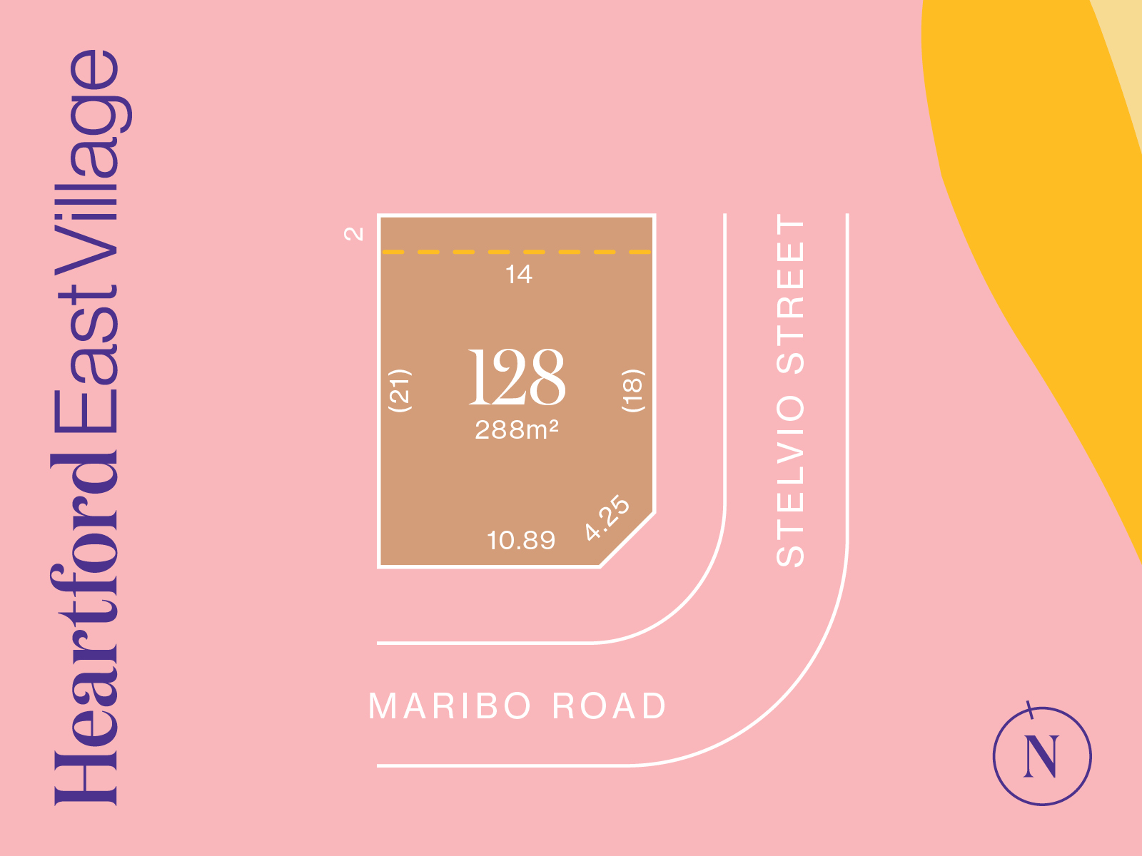
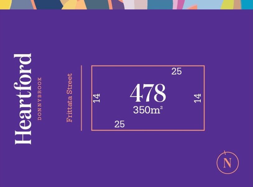
36 Land Lots in Heartford Estate - Donnybrook
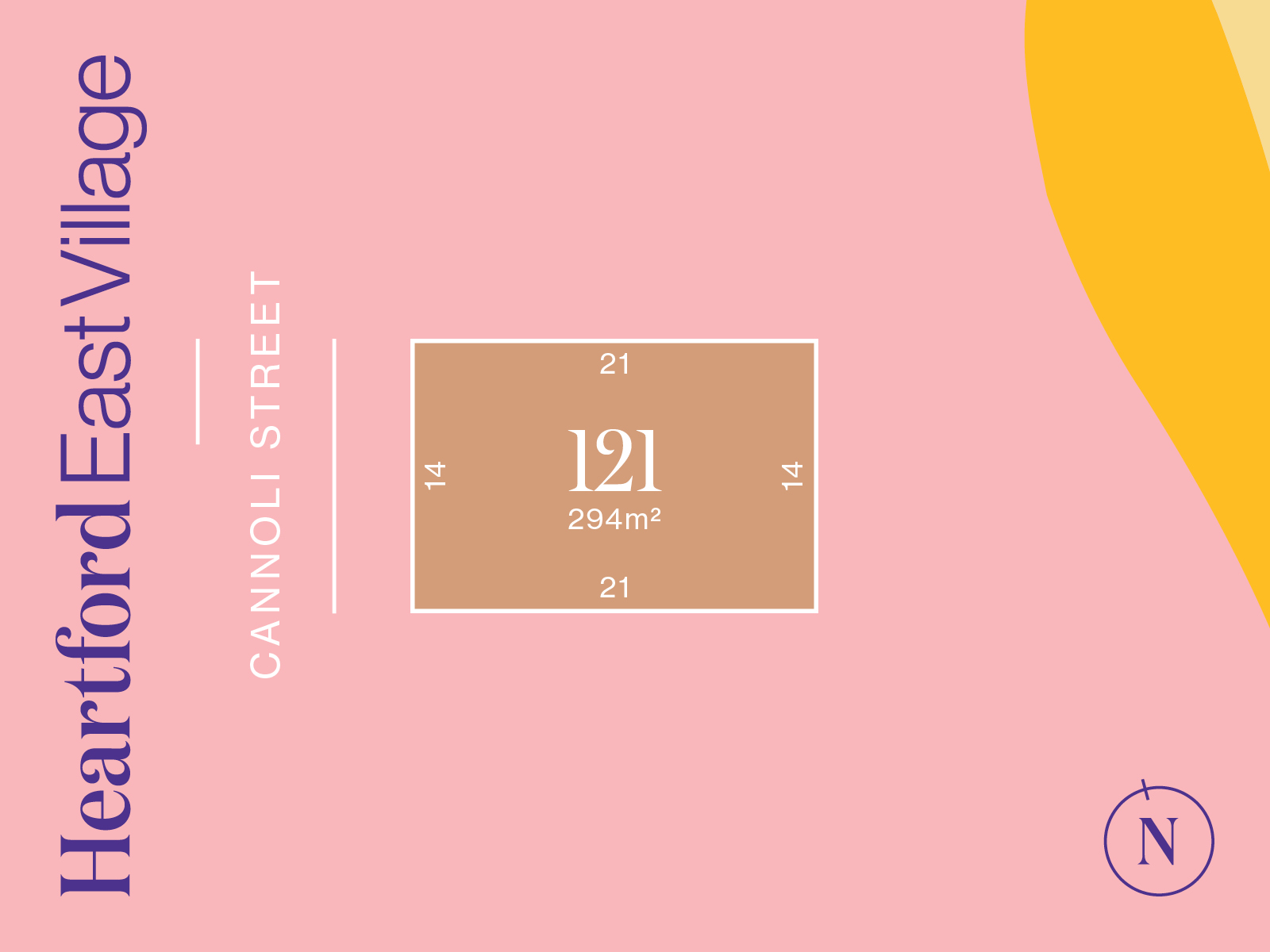
- Titled and ready to build
- Close to Donnybrook Station and Hume Freeway
- Minutes from Merrifield City and Craigieburn Central
- Surrounded by future parklands and local amenities
- Don’t miss this opportunity to build your future in Melbourne’s thriving north
- Titled and ready to build
- Close to Donnybrook Station and Hume Freeway
- Minutes from Merrifield City and Craigieburn Central
- Surrounded by future parklands and local amenities
- Don’t miss this opportunity to build your future in Melbourne’s thriving north
- Titled and ready to build
- Close to Donnybrook Station and Hume Freeway
- Minutes from Merrifield City and Craigieburn Central
- Surrounded by future parklands and local amenities
- Don’t miss this opportunity to build your future in Melbourne’s thriving north
- Titled and ready to build
- Close to Donnybrook Station and Hume Freeway
- Minutes from Merrifield City and Craigieburn Central
- Surrounded by future parklands and local amenities
- Don’t miss this opportunity to build your future in Melbourne’s thriving north
- Close to Donnybrook Station and Hume Freeway
- Minutes from Merrifield City and Craigieburn Central
- Surrounded by future parklands and local amenities
- Don’t miss this opportunity to build your future in Melbourne’s thriving north
22 House and Land Packages in Heartford Estate - Donnybrook

 3
3
 2
2
 2
2
Updates for Heartford Estate - Donnybrook
Facebook updates:
Related news:
Donnybrook is located in the Shire of Mitchell, a semi-rural location to the north of Melbourne’s outer suburbs of the Urban Growth Boundary and logical expansion of the former Donnybrook township. Donnybrook growth area is 1,026ha and forms part of the new 1,786ha suburb area (Woodstock and Donnybrook) that is located on either side of Cameron Street.
20 December 2018 Donnybrook sale update The Company advises that it has today received payment of $5.5million from the... | April 5, 2022

In February, SIG and the Scerri family paid c$100m for a 454ha block at Beveridge, north of Donnybrook. Satterley Property Group is speculated to be paying $68 million for another low density housing site in

Missing articles? Send us a link here.
Location & Map for Heartford Estate - Donnybrook
Visit Display Homes near Heartford Estate - Donnybrook


Land Price Trend in Donnybrook VIC 3064
- In Oct - Dec 24, the median price for vacant land in Donnybrook VIC 3064 was $378,000. *
- From Oct - Dec 17 to Oct - Dec 24, the median price for vacant land in Donnybrook VIC 3064 has increased 98.95%. *
- From 2014 to 2024, the median price for vacant land in Donnybrook VIC 3064 has increased 86.26%. *
Vacancy Rate in Donnybrook VIC 3064
View full vacancy rate history in Donnybrook VIC 3064 via SQM Research.
Schools near Heartford Estate - Donnybrook
Here are 6 schools near Heartford Estate - Donnybrook:
Prep-6 Government Primary School
Prep-6 Government Primary School
Prep-6 Government Primary School
Prep-12 Independent Combined School - School Head Campus
Prep-6 Catholic Primary School
Prep-6 Government Primary School
Suburb Planning Review in Donnybrook VIC 3064
Donnybrook is located in the Shire of Mitchell, a semi-rural location to the north of Melbourne’s outer suburbs of the Urban Growth Boundary and logical expansion of the former Donnybrook township. Donnybrook growth area is 1,026ha and forms part of the new 1,786ha suburb area (Woodstock and Donnybrook) that is located on either side of Cameron Street.
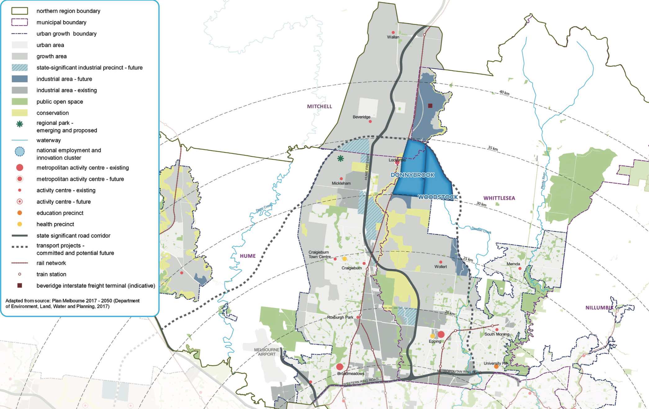
The new suburb is bounded by a possible future high-speed rail investigation area and Outer Metropolitan Ring Reservation (OMR / E6) for future road and rail transport links.
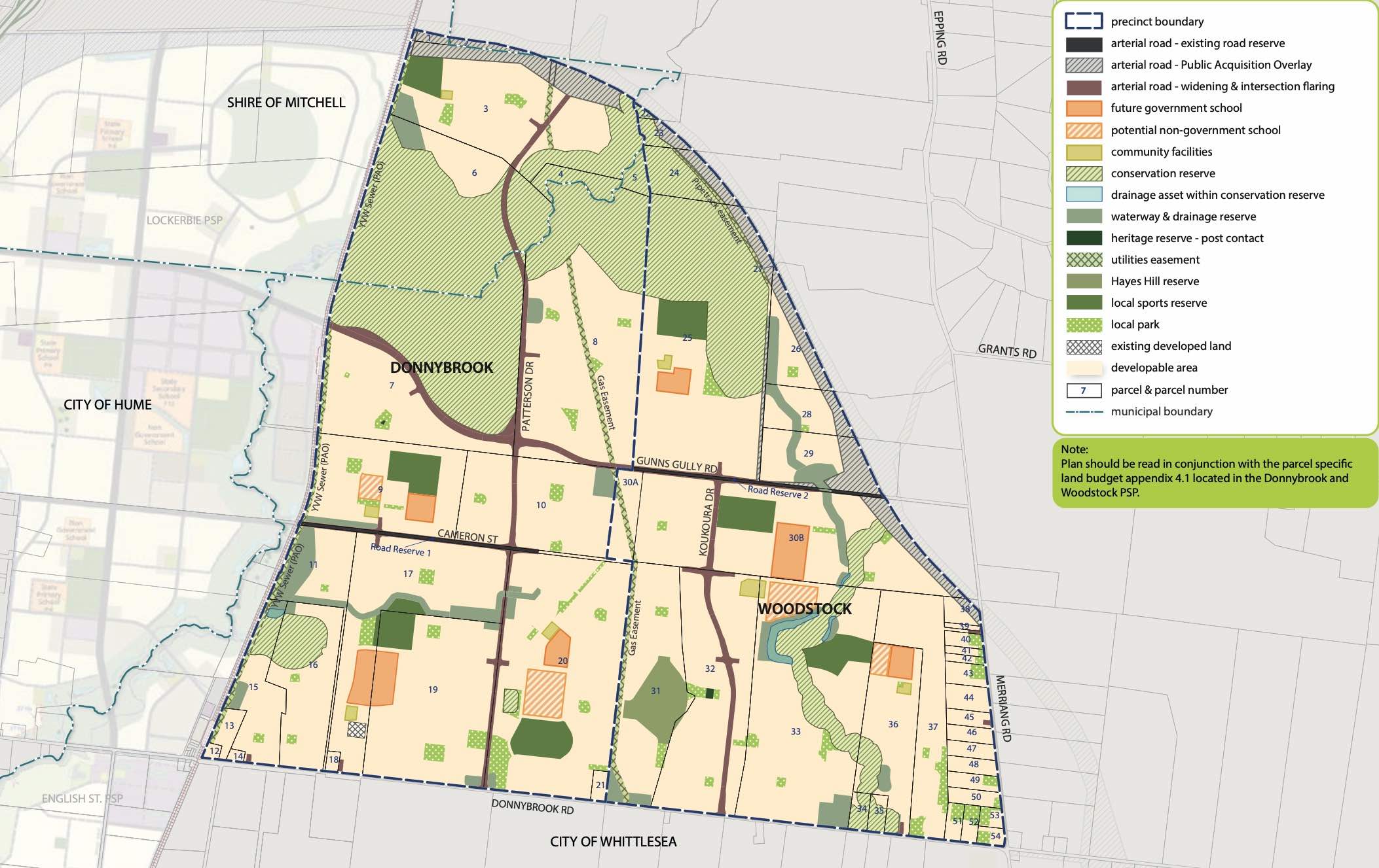
The Donnybrook-Woodstock Precinct Structure Plan (PSP) was prepared to guide the redevelopment of the released land for a mix of residential neighbourhoods linked by a variety of local town centres, schools and other community facilities. Protection of natural assets along the creek corridor and conservation area are provided to protect the Growling Grass Frog habitat from the planned suburb.
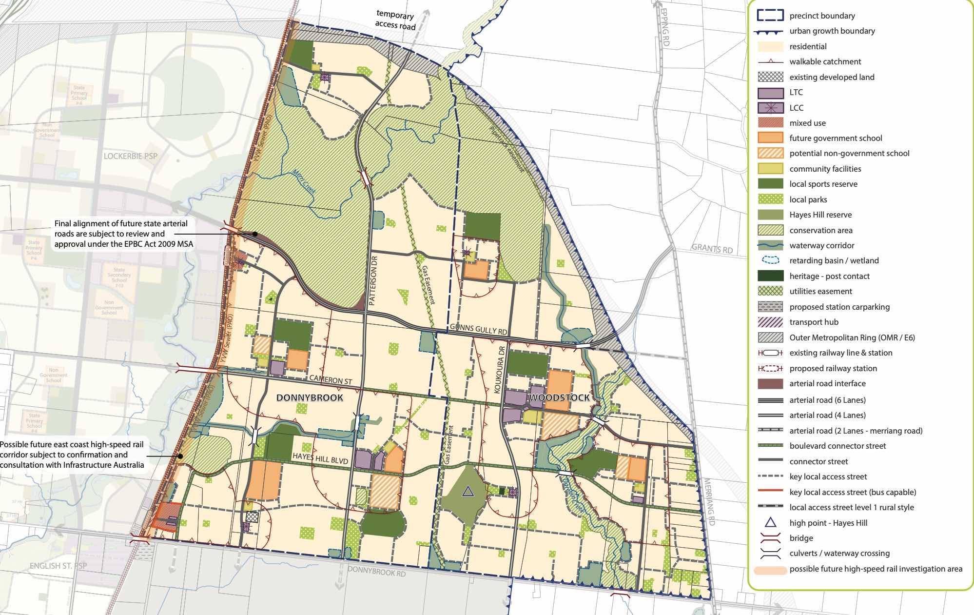
The Donnybrook-Woodstock PSP was prepared by Victorian Planning Authority (VPA) in consultation with the Whittlesea City Council and was approved by the Minister for Planning in November 2017. The decision was officially gazetted on 3 November 2017 under Amendment GC28 of the Whittlesea Planning Scheme.
The Vision of Donnybrook
“Development will have a strong emphasis on the retention of natural features and high quality landscaping in an urban environment supported by strong connections to transport and community facilities. Development of the precinct will create a diverse mix of residential neighbourhoods linked by a variety of local town centres, schools and other community facilities.
The distribution of local centres which serve a variety of roles and functions will promote self-sufficiency for residents of the precinct in meeting daily retail and convenience shopping needs. Residential and business development will capitalise on the precinct’s proximity to the existing Donnybrook train station, as well as the future Lockerbie Principal Town Centre and potential future Lockerbie Train Station. The development of the existing Donnybrook Cheese Farm into an agricultural, historical and cultural learning hub will provide new residents with connections to the history of the area”.
Benefits of Donnybrook
The Structure Plan also supports new schools, local community hubs, local centres to provide employment and services to the new suburb. The amendments provide a new residential community, protection of natural features, parks, and sports and recreation areas. The existing zoning will be amended to provide for Rural Conservation and Urban Growth Zones, providing a series of greenfield sites in proximity to natural water corridors and reserves.
Transportation in Donnybrook
Donnybrook is well connected to public passenger transport, with a future train station to be in Lockerbie and an existing train station located in Donnybrook train station outside the new suburb boundary. The passenger train service connects Melbourne to Sydney and is being considered for a high speed rail project.
The suburb will include a network of shared paths linking the local parks and a new road network. Donnybrook Road and a new future state arterial road will provide access to the Hume Freeway, providing a direct connection to Melbourne CBD or northern Victoria.
Donnybrook Suburb Summary
References
City of Whittlesea - Donnybrook
Victoria Planning Authority – Planning Schemes
Victoria Planning Authority – Donnybrook – Woodstock PSP
Reviews & Comments on Heartford Estate - Donnybrook
Estate Brochure, Masterplan, Engineering Plan, Plan of Subdivision (POS), Design Guidelines
FAQs about Heartford Estate - Donnybrook
View all estates from Satterley Property Group
- Donnybrook Primary School - 1.4km north
- Gilgai Plains Primary School - 3.7km north-west
- Barrawang Primary School - 5.4km south
- Hume Anglican Grammar - 6.0km west
- Mother Teresa School - 6.2km south-west
- Craigieburn Primary School - 6.6km south-west
Popular Estates near Heartford Estate - Donnybrook


Latest New Home Articles for You

16/Mar/2026 | OpenLot.com.au
New South Wales: Top 30 Most Searched Housing Developments (February 2026)
If you’ve been considering a move in New South Wales, February 2026 provi...

09/Mar/2026 | OpenLot.com.au
Victoria: Top 30 Most Searched Housing Developments (February 2026)
If you’ve been exploring housing opportunities in Victoria, February 2026...

20/Feb/2026 | OpenLot.com.au
Display Homes at Drouin Fields Estate: A Thriving Community in Drouin
Welcome to Drouin Fields, a place where beauty, space, and modern luxury ...

19/Feb/2026 | OpenLot.com.au
Display Homes at Manor Lakes Esate: A Thriving Waterside Community in Manor Lakes
A place where you can settle in, rather than just settle down. Named for ...

13/Feb/2026 | OpenLot.com.au
🏠 Victoria: Top 30 Most Searched Townhouse Developments – January 2026

11/Feb/2026 | OpenLot.com.au
🏡 Top 30 Most Searched Estates by State - January 2026

10/Feb/2026 | OpenLot.com.au
Victoria: Top 30 Most Searched Housing Developments (January 2026)
If you’ve been considering making a move in Victoria, January 2026 offere...

10/Feb/2026 | OpenLot.com.au
Queensland: Top 30 Most Searched Housing Developments (January 2026)
If you’ve been considering making a move in Queensland, January 2026 offe...

09/Feb/2026 | OpenLot.com.au
Western Australia: Top 30 Most Searched Housing Developments (January 2026)
If you’ve been considering making a move in Western Australia, January 20...