La Sal - Chelsea
This information is estimated by the OpenLot research team. Let us know here to provide up-to-date information about this development.
| Total new homes | 9 |
| Area size | 0.12 hectares |
| Growth Region | Melbourne South East Growth Corridor |
| City council | Kingston City Council |
| Developer | Lowe Living |
| Creative agency | Cassette |
| Distance to | Melbourne CBD - 30 km south-east Melbourne Airport - 50 km south-east |
Townhomes:
Popular Estates near La Sal - Chelsea


 3
3
 3
3
 2
2


Updates for La Sal - Chelsea
Facebook updates:
Related news:
Drawing inspiration from the salt and sand of the sea nearby.

HOMES on the water side of the Nepean Highway can be hard to come by. But a new development is offering buyers a chance to break into a seriously sought-after patch of real estate in Chelsea.

LA SAL | CHELSEA A contemporary beachside lifestyle
Off The Plan Apartment Guides. Independent. Honest. Informed. Bringing transparency to the home buying experience and advocating for the best building designs in Australia - Sustainable, Beautiful, Good Value

Missing articles? Send us a link here.
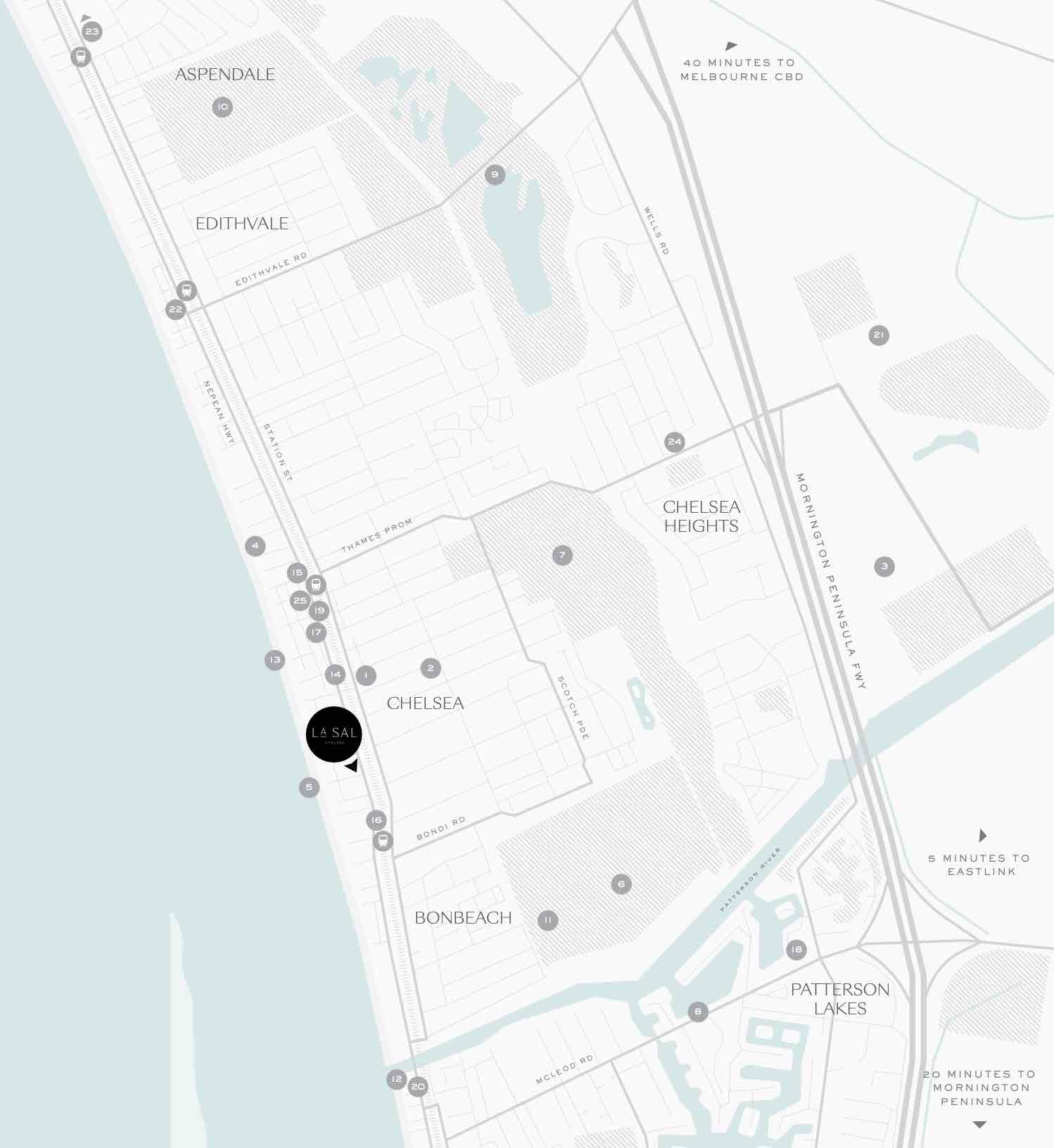
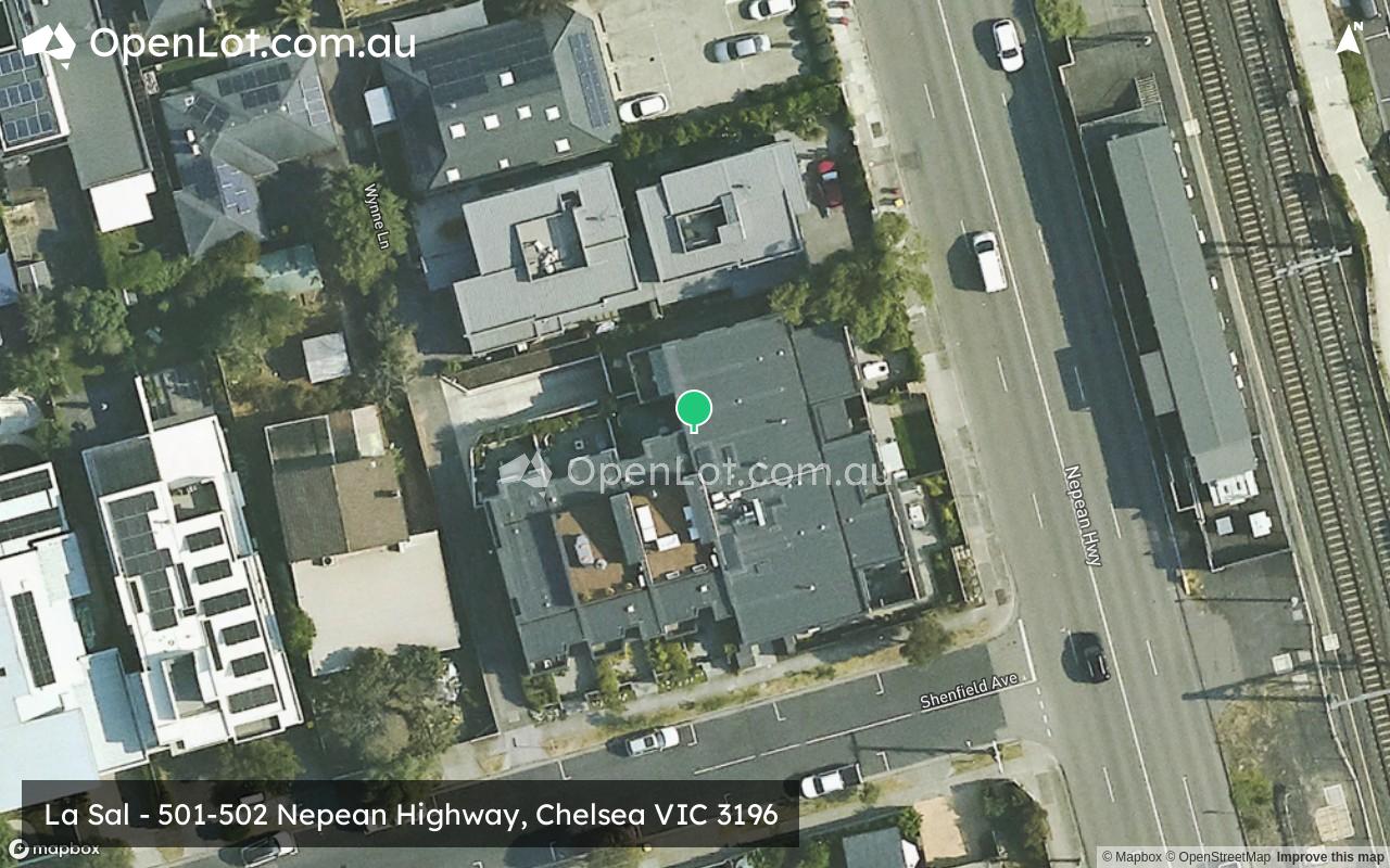
Location & Map for La Sal - Chelsea
Vacancy Rate in Chelsea VIC 3196
View full vacancy rate history in Chelsea VIC 3196 via SQM Research.
Schools near La Sal - Chelsea
Here are 6 schools near La Sal - Chelsea:
Prep-6 Catholic Primary School
Prep-6 Government Primary School
Prep-6 Government Primary School
Prep-6 Government Primary School
Prep-6 Government Primary School
Prep-6 Government Primary School
Reviews & Comments on La Sal - Chelsea
Estate Brochure, Masterplan, Engineering Plan, Plan of Subdivision (POS), Design Guidelines
FAQs about La Sal - Chelsea
View all estates from Lowe Living
- St Joseph's School - 441m north
- Chelsea Primary School - 601m north-east
- Bonbeach Primary School - 1.1km south-east
- Carrum Primary School - 2.2km south
- Chelsea Heights Primary School - 2.4km north-east
- Edithvale Primary School - 2.5km north
Popular Estates near La Sal - Chelsea
Latest New Home Articles for You

09/Mar/2026 | OpenLot.com.au
Victoria: Top 30 Most Searched Housing Developments (February 2026)
If you’ve been exploring housing opportunities in Victoria, February 2026...

20/Feb/2026 | OpenLot.com.au
Display Homes at Drouin Fields Estate: A Thriving Community in Drouin
Welcome to Drouin Fields, a place where beauty, space, and modern luxury ...

19/Feb/2026 | OpenLot.com.au
Display Homes at Manor Lakes Esate: A Thriving Waterside Community in Manor Lakes
A place where you can settle in, rather than just settle down. Named for ...

13/Feb/2026 | OpenLot.com.au
🏠 Victoria: Top 30 Most Searched Townhouse Developments – January 2026

11/Feb/2026 | OpenLot.com.au
🏡 Top 30 Most Searched Estates by State - January 2026

10/Feb/2026 | OpenLot.com.au
Victoria: Top 30 Most Searched Housing Developments (January 2026)
If you’ve been considering making a move in Victoria, January 2026 offere...

10/Feb/2026 | OpenLot.com.au
Queensland: Top 30 Most Searched Housing Developments (January 2026)
If you’ve been considering making a move in Queensland, January 2026 offe...

09/Feb/2026 | OpenLot.com.au
Western Australia: Top 30 Most Searched Housing Developments (January 2026)
If you’ve been considering making a move in Western Australia, January 20...

06/Feb/2026 | OpenLot.com.au
South Australia: Top 30 Most Searched Housing Developments (January 2026)
If you’ve been considering making a move in South Australia, January 2026...