Mambourin is approximately 248 square kilometres located within the City of Wyndham forming part of the Victorian west growth corridor area, located 38 kilometres south-west of Melbourne, 45 kilometres from Geelong. The suburb is a result of two large master planned community projects in the area, in proximity to the existing Regional Rail Link between Werribee and Wyndham Vale. The existing suburb was originally primarily grazing land holdings and the residents relied on adjoining urban residential suburbs for services and retail convenience.
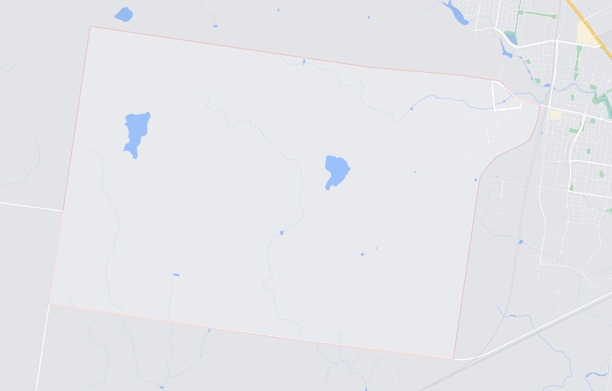
Mambourin - Suburb Location
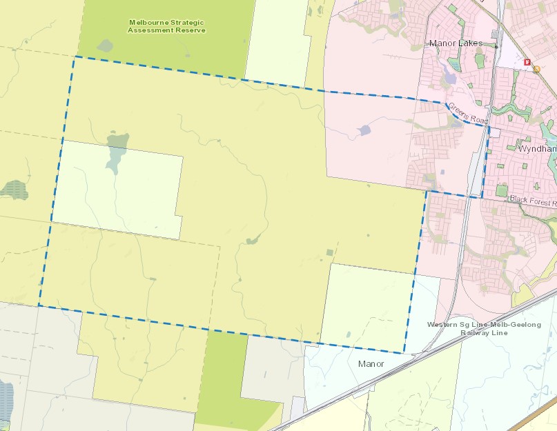
The suburb is bounded by Argoona Road and Greens Road in the north, Edgers Road to the west, Bulvan Road to the south and property boundaries to the east. The suburb is bare, with pockets of trees found near dry dams, a handful of dwellings and sheds. Dry river beds traverse the site and an existing quarry is positioned in the western portion of the site.
The only portion of the site that will be considered for the new urban redevelopment, is the area in the north-east corner (marked in red). A future Precinct has also been prepared for the south of Black Forest Road.
The Black Forest Road North Precinct Structure Plan (PSP) was prepared by Victorian Planning Authority (VPA) in consultation with the Wyndham City Council and approved by the Minister for Planning. The PSP was officially gazetted on 11 February 2016 under Amendment C170 of the Wyndham Planning Scheme. The PSP covers only the north-east portion of the site, with the balance land subject to future Precinct Structure Plans.
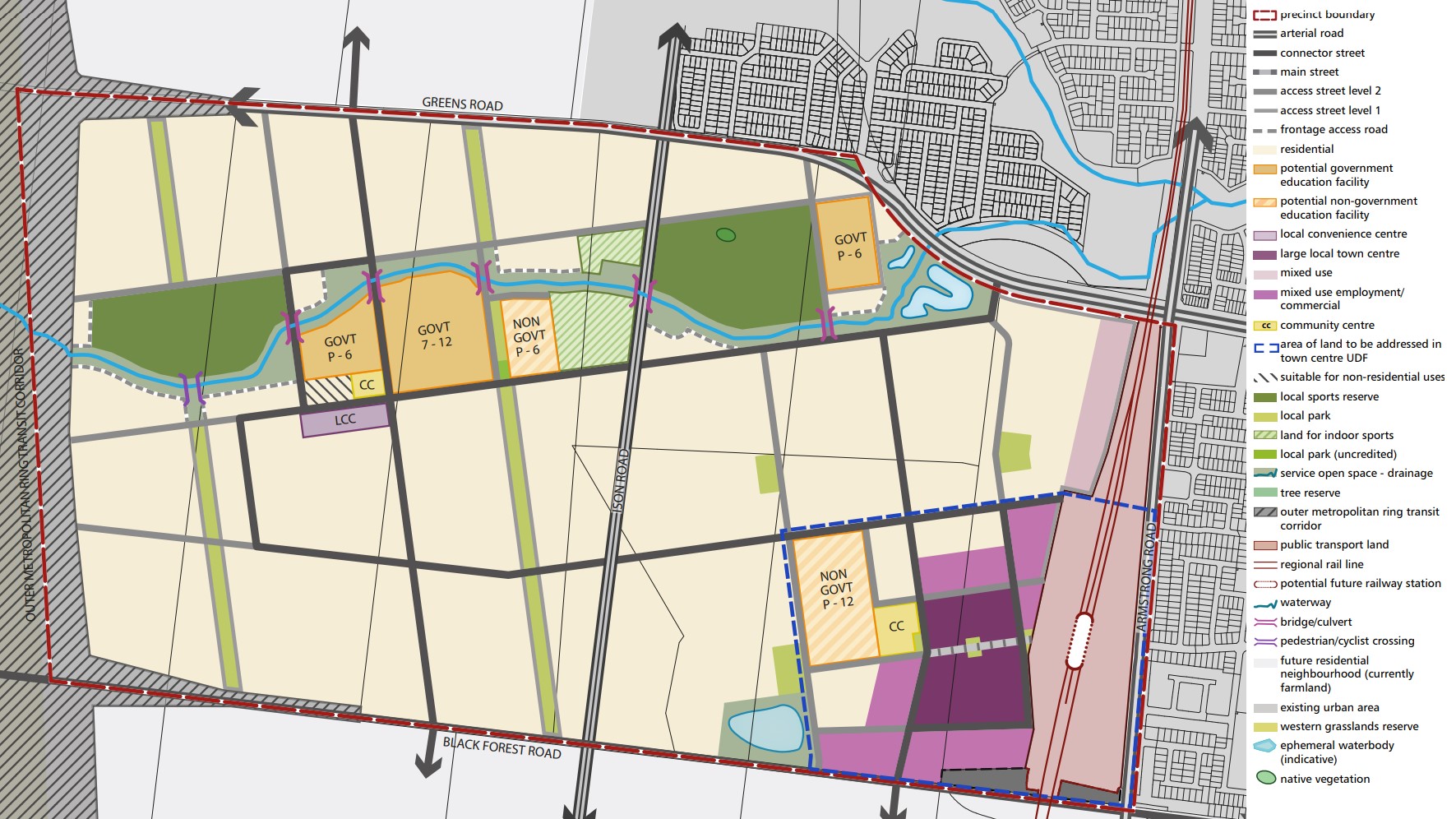
Black Forest Road North Precinct Structure Plan – Future Urban Structure
The Vision of Mambourin
“Black Forest Road North will be a community where a distinct urban form, characterised by a strong grid of high quality streets, is complemented by an extensive and innovative park network focused on the main east-west waterway and key north-south streets. It will also contain attractive and integrated town centres and significant educational and community facilities.
A town centre integrated with a railway station precinct, together with extensive parkland along an existing ephemeral waterway, will provide the principal character elements. The town centre will be an active and vibrant place providing services, facilities and local amenity to the surrounding residential catchment. Due to the centre’s proximity to the railway station, bus routes and the potential future population beyond the boundaries of the PSP area, the town centre will have scope for additional growth in the longer term.
The open space network has been created through a grid of formal and informal green spaces. Meandering west to east across the precinct, the waterway corridor provides a naturally landscaped link between schools and formal open spaces. Traversing these corridors and running northsouth are two linear parks. These unique green spines extend the width of the precinct and will provide a range of recreation opportunities through footpaths, cycling tracks, play equipment, picnic areas and informal sports infrastructure. Additional pocket parks will be scattered throughout the precinct to complete an accessible open space structure”.
Transportation in Mambourin
An Outer Metropolitan Ring Transit Corridor has been proposed along the western boundary of the Black Forest Road North Precinct Structure Plan and a Future Railway Station and Line along the eastern boundary. A 500m development setback has also been applied to the gas transmission line that traverses the site.
Mambourin will be well connected to public passenger transport, with a future train station to be located just outside the suburb boundary and the passenger train service connects to Melbourne, via the Sunshine Station transport node connection.
The suburb will include a network of shared paths linking the local parks and a new road network.
Greens Road and Bulban Road provide access to the Princes Freeway, providing a direct connection to Melbourne CBD or Geelong in south-west Victoria.
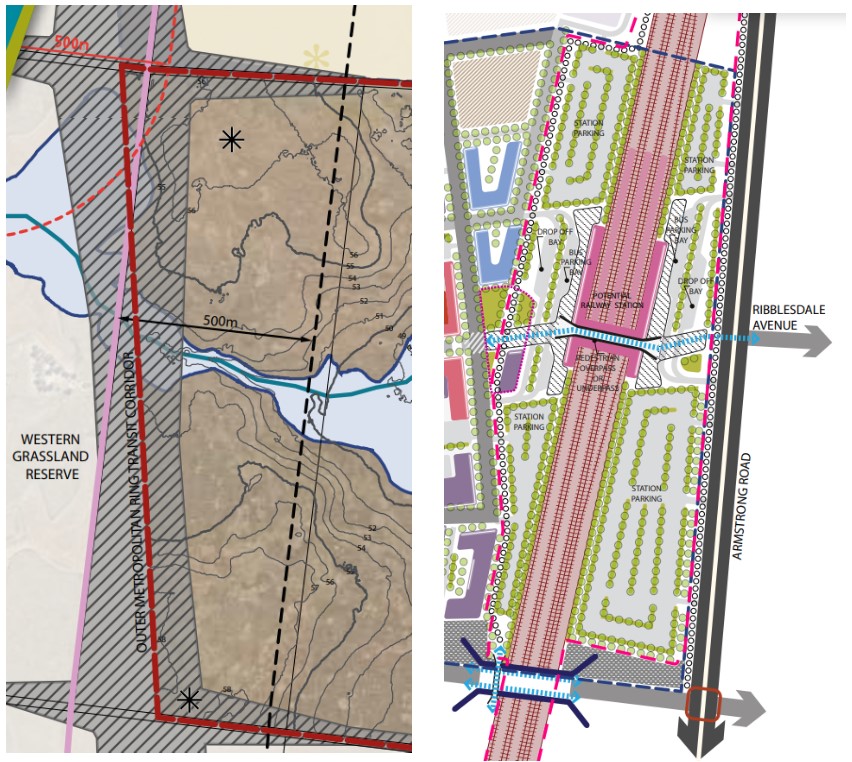
Black Forest Road North Precinct Structure Plan – Major Infrastructure
Local Town Centre of Mambourin
The Black Forest Road North PSP required an urban design framework plan to be prepared to guide the development of the large local town centre to the satisfaction of the Council and Victorian Planning Authority and Public Transport Victoria due to the new train station. The proposed layout was provided to the public for comment as well as a 1-10+ year staging of how the town centre will transform, taking in key considerations of high density residential, retail, civic and interim uses until fully developed.
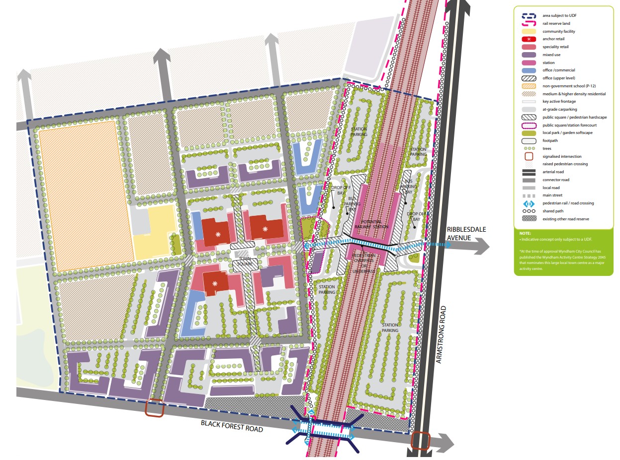
Black Forest Road North Precinct Structure Plan – Large Town Centre
Benefits of Mambourin
The PSP also supports new schools, higher density of residential development, retail, and office, in a mixed use town centre with employment opportunities. The new residential community will enhance and protect the existing natural features, parks, and sports and recreation areas. The existing zoning will be amended to provide for Rural Conservation and Urban Growth Zones, providing a series of greenfield sites in proximity to natural water corridors and reserves.
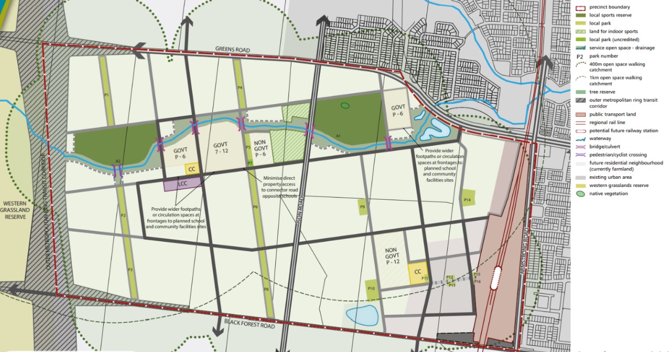
Black Forest Road North Precinct Structure Plan – Open Space and Community
Black Forest Road North Precinct Structure Plan – Full Suburb Land Use
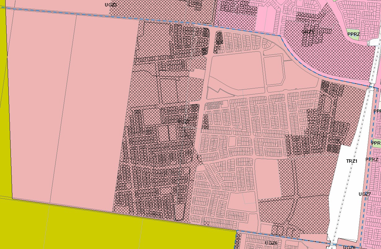
Black Forest Road North Precinct Structure Plan – New Suburb Area
Windermere Residential Community
Country Garden Australia has begun to establish a large residential community within the growth suburb of Mambourin, in accordance with the Black Forest Road North Precinct PSP. The new master planned community is named ‘Windermere’ and provides a variety of residential allotments, types of dwellings, schools, parks and a local road network. The redevelopment has protected and rejuvenated the creek corridor to support the provision of amenities and facilities for the residential dwellings intended for the redevelopment of the Urban Growth Zone.
.jpg)
Windermere Master planned Community (source: Windermere )
Mambourin Residential Community
Property developer Frasers Property has begun to establish a large residential community over the Mambourin suburb, in accordance with the Black Forest Road North Precinct PSP. The new master planned community is named after the suburb ‘Mambourin’ and provides the town centre, school, shopping centre, parkland and a mixed use centre in proximity to the potential new train station.
.jpg)
Mambourin Master planned Community (source Frasers Property)
Featured Developments in Mambourin


Suburb Summary
References
City of Wyndham
Victoria Planning Authority – Planning Scheme
Victoria Planning Authority – Black Forest Road North PSP
Frasers Property - Mambourin
Country Garden Australia - Windermere
Building resilient communities: Mambourin and the model of a 20-minute cit


