

What's within 10 km of Sandy Creek Road, Southern Cross QLD 4820 - Southern Cross
-
-
 Distance
- 5.3km
-
 Approximate drive time
- 12min
-
 Approximate walk time
- 1h 26min
-
-
-
Distance
- 5.6km
-
Approximate drive time
- 13min
-
Approximate walk time
- 1h 31min
-
-
-
Distance
- 6.0km
-
Approximate drive time
- 13min
-
Approximate walk time
- 1h 38min
-
-
-
Distance
- 6.3km
-
Approximate drive time
- 14min
-
Approximate walk time
- 1h 43min
-
-
-
Distance
- 6.8km
-
Approximate drive time
- 15min
-
Approximate walk time
- 1h 50min
-
-
-
Distance
- 5.5km
-
Approximate drive time
- 12min
-
Approximate walk time
- 1h 30min
-
-
-
Distance
- 5.6km
-
Approximate drive time
- 12min
-
Approximate walk time
- 1h 31min
-
-
-
Distance
- 5.6km
-
Approximate drive time
- 13min
-
Approximate walk time
- 1h 31min
-
-
-
Distance
- 5.8km
-
Approximate drive time
- 13min
-
Approximate walk time
- 1h 35min
-
-
-
Distance
- 6.3km
-
Approximate drive time
- 14min
-
Approximate walk time
- 1h 42min
-
-
-
Distance
- 5.7km
-
Approximate drive time
- 13min
-
Approximate walk time
- 1h 33min
-
-
-
Distance
- 5.7km
-
Approximate drive time
- 13min
-
Approximate walk time
- 1h 33min
-
-
-
Distance
- 6.1km
-
Approximate drive time
- 14min
-
Approximate walk time
- 1h 39min
-
-
-
Distance
- 6.4km
-
Approximate drive time
- 14min
-
Approximate walk time
- 1h 45min
-
-
-
Distance
- 5.4km
-
Approximate drive time
- 12min
-
Approximate walk time
- 1h 28min
-
-
-
Distance
- 5.6km
-
Approximate drive time
- 12min
-
Approximate walk time
- 1h 30min
-
-
-
Distance
- 6.1km
-
Approximate drive time
- 14min
-
Approximate walk time
- 1h 39min
-
-
-
Distance
- 5.3km
-
Approximate drive time
- 12min
-
Approximate walk time
- 1h 27min
-
-
-
Distance
- 5.4km
-
Approximate drive time
- 12min
-
Approximate walk time
- 1h 27min
-
-
-
Distance
- 5.4km
-
Approximate drive time
- 12min
-
Approximate walk time
- 1h 27min
-
-
-
Distance
- 5.5km
-
Approximate drive time
- 12min
-
Approximate walk time
- 1h 29min
-
-
-
Distance
- 5.5km
-
Approximate drive time
- 12min
-
Approximate walk time
- 1h 29min
-
-
-
Distance
- 5.3km
-
Approximate drive time
- 12min
-
Approximate walk time
- 1h 27min
-
-
-
Distance
- 5.4km
-
Approximate drive time
- 12min
-
Approximate walk time
- 1h 27min
-
-
-
Distance
- 5.4km
-
Approximate drive time
- 12min
-
Approximate walk time
- 1h 28min
-
-
-
Distance
- 6.5km
-
Approximate drive time
- 14min
-
Approximate walk time
- 1h 45min
-
Straight-line distance. Drive and walk times are estimates.
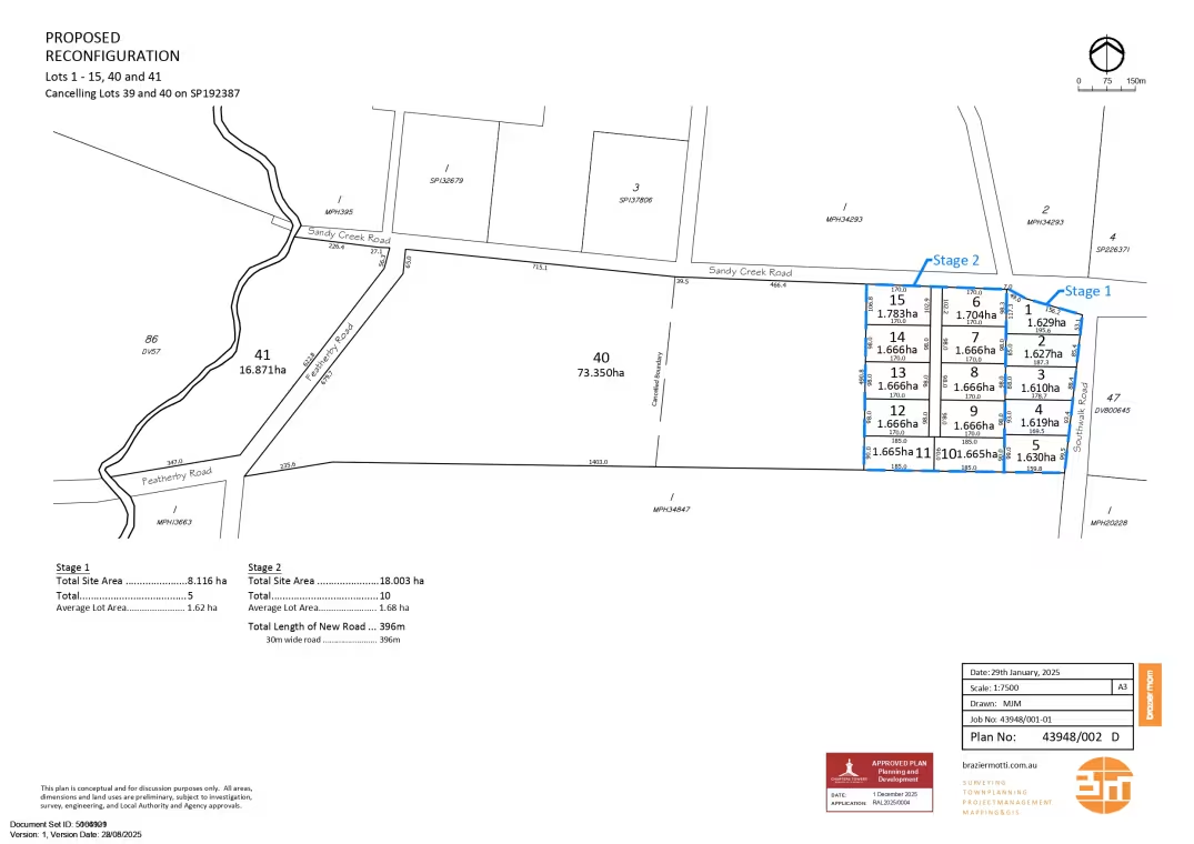
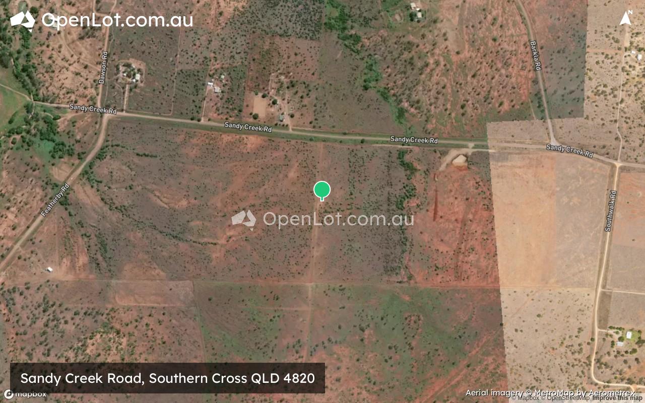
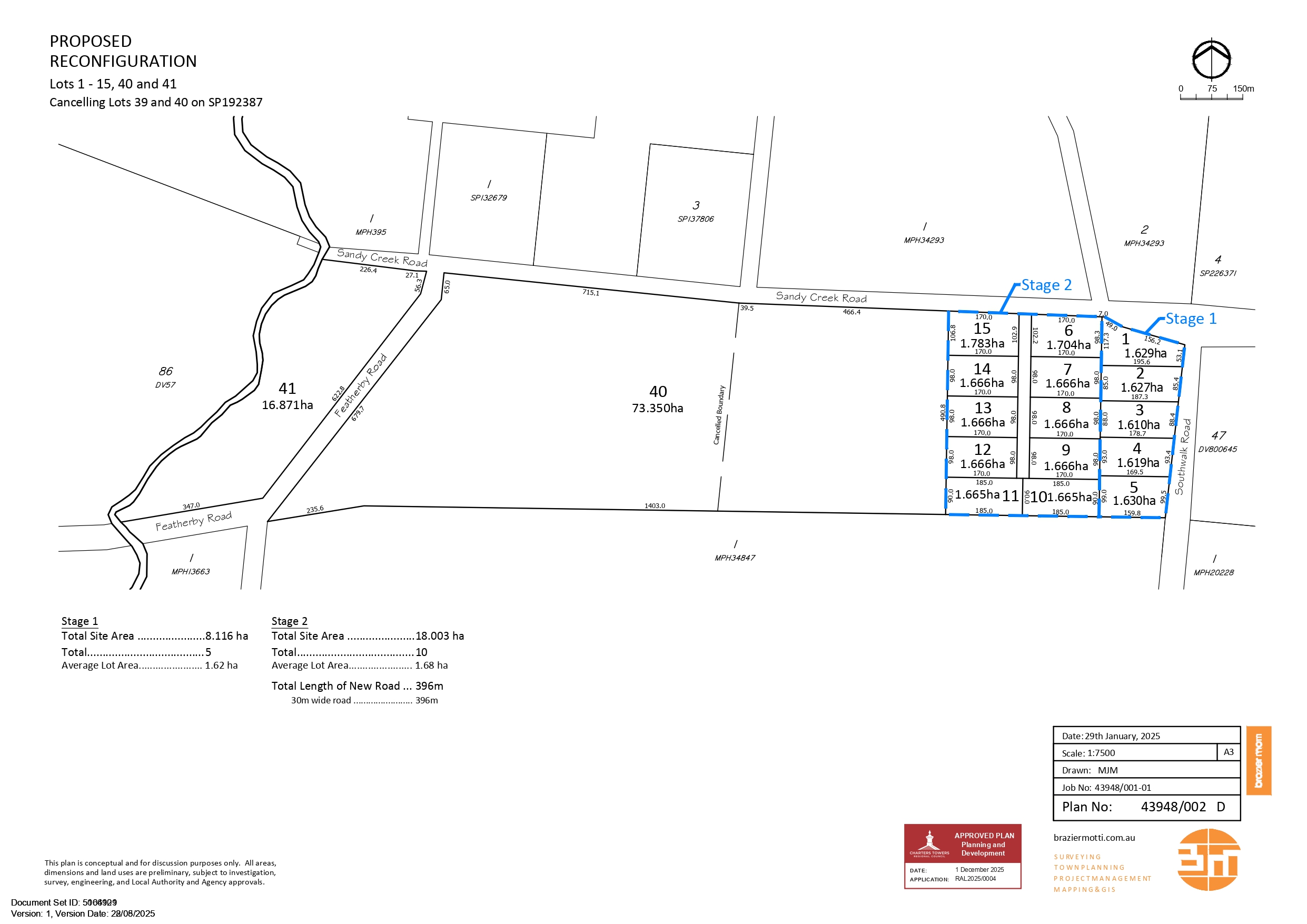
Location & Masterplan for Sandy Creek Road, Southern Cross QLD 4820
Popular Estates near Sandy Creek Road, Southern Cross


 413m²
- 1,243m²
 3
 2
 2


Development overview of Sandy Creek Road, Southern Cross QLD 4820
This information is estimated by the OpenLot research team. Let us know here to provide up-to-date information about this development.
Schools near Sandy Creek Road, Southern Cross QLD 4820
Popular Estates near Sandy Creek Road, Southern Cross
Not exactly what you're looking for? Try surrounding suburbs

Kelso QLD 4815
3 estates | Townsville City Council
89.3km north-east
Rasmussen QLD 4815
3 estates | Townsville City Council
93.3km north-east
Alice River QLD 4817
1 estate | Townsville City Council
87.1km north-east
Grand Secret QLD 4820
1 estate | Charters Towers Regional Council
10.9km south-east
Queenton QLD 4820
1 estate | Charters Towers Regional Council
13.8km south-east
Gumlow QLD 4815
1 estate | Townsville City Council
91.4km north-east
Latest published articles







FAQs about Sandy Creek Road, Southern Cross QLD 4820
Sandy Creek Road, Southern Cross QLD 4820 consists of 17 homes.
Sandy Creek Road, Southern Cross QLD 4820 falls under Charters Towers Regional Council.
Nearby schools for Sandy Creek Road, Southern Cross QLD 4820:
- Blackheath and Thornburgh College - 5.3km east
- Charters Towers State High School - 5.6km east
- Charters Towers Central State School - 6.0km east
- Richmond Hill State School - 6.3km east
- Charters Towers School of Distance Education - 6.7km east
- Columba Catholic College - 7.1km east