

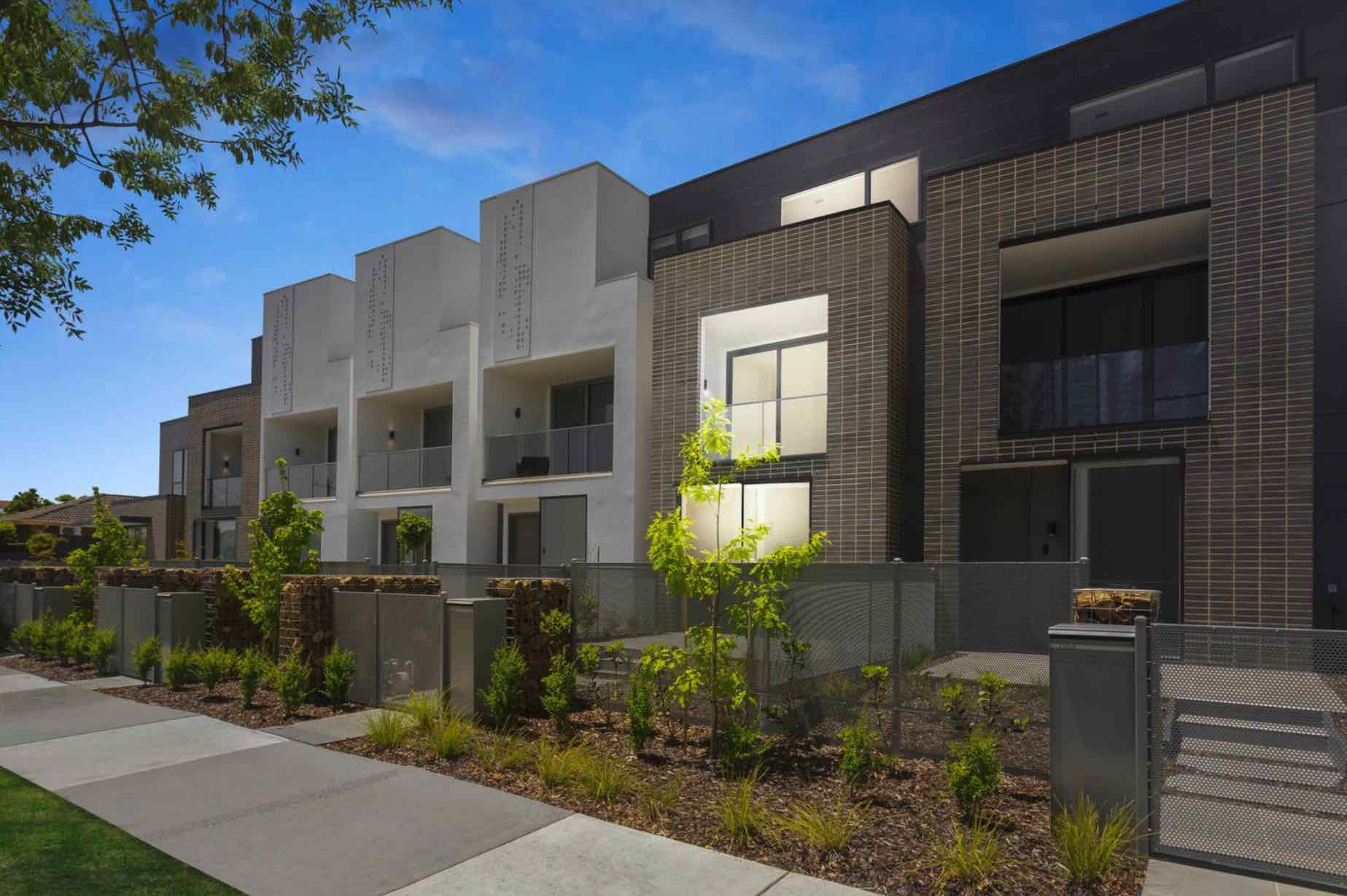
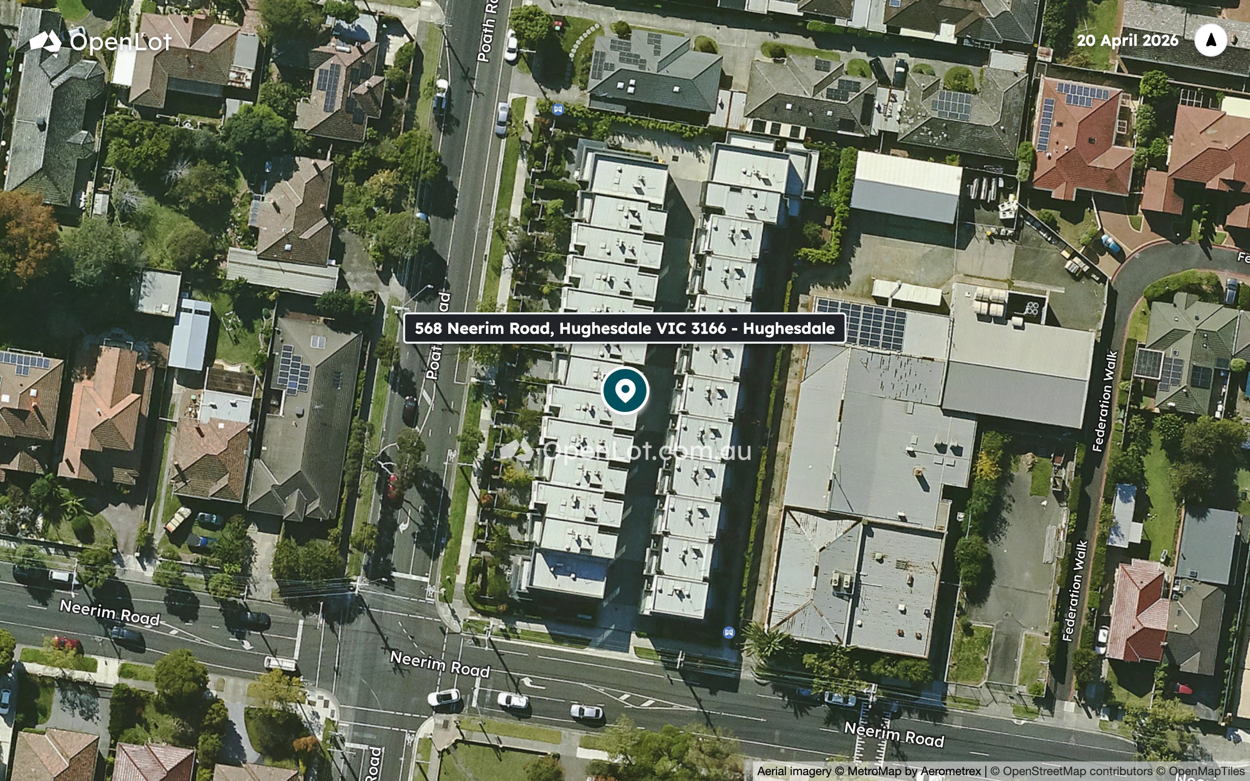
What's within 5 km of 568 Neerim Road, Hughesdale VIC 3166 - Hughesdale
-
-
 Distance
- 700m
-
 Approximate drive time
- 2min
-
 Approximate walk time
- 11min
-
-
-
Distance
- 850m
-
Approximate drive time
- 2min
-
Approximate walk time
- 14min
-
-
-
Distance
- 1.0km
-
Approximate drive time
- 2min
-
Approximate walk time
- 17min
-
-
-
Distance
- 1.2km
-
Approximate drive time
- 3min
-
Approximate walk time
- 20min
-
-
-
Distance
- 1.4km
-
Approximate drive time
- 3min
-
Approximate walk time
- 23min
-
-
-
Distance
- 350m
-
Approximate drive time
- 1min
-
Approximate walk time
- 6min
-
-
-
Distance
- 350m
-
Approximate drive time
- 1min
-
Approximate walk time
- 6min
-
-
-
Distance
- 500m
-
Approximate drive time
- 1min
-
Approximate walk time
- 8min
-
-
-
Distance
- 550m
-
Approximate drive time
- 1min
-
Approximate walk time
- 9min
-
-
-
Distance
- 600m
-
Approximate drive time
- 1min
-
Approximate walk time
- 10min
-
-
-
Distance
- 300m
-
Approximate drive time
- 1min
-
Approximate walk time
- 5min
-
-
-
Distance
- 500m
-
Approximate drive time
- 1min
-
Approximate walk time
- 8min
-
-
-
Distance
- 750m
-
Approximate drive time
- 2min
-
Approximate walk time
- 12min
-
-
-
Distance
- 750m
-
Approximate drive time
- 2min
-
Approximate walk time
- 13min
-
-
-
Distance
- 850m
-
Approximate drive time
- 2min
-
Approximate walk time
- 14min
-
-
-
Distance
- 300m
-
Approximate drive time
- 1min
-
Approximate walk time
- 4min
-
-
-
Distance
- 500m
-
Approximate drive time
- 1min
-
Approximate walk time
- 8min
-
-
-
Distance
- 550m
-
Approximate drive time
- 1min
-
Approximate walk time
- 9min
-
-
-
Distance
- 600m
-
Approximate drive time
- 1min
-
Approximate walk time
- 10min
-
-
-
Distance
- 700m
-
Approximate drive time
- 2min
-
Approximate walk time
- 11min
-
-
-
Distance
- 400m
-
Approximate drive time
- 1min
-
Approximate walk time
- 7min
-
-
-
Distance
- 650m
-
Approximate drive time
- 1min
-
Approximate walk time
- 10min
-
-
-
Distance
- 800m
-
Approximate drive time
- 2min
-
Approximate walk time
- 13min
-
-
-
Distance
- 800m
-
Approximate drive time
- 2min
-
Approximate walk time
- 13min
-
-
-
Distance
- 850m
-
Approximate drive time
- 2min
-
Approximate walk time
- 14min
-
-
-
Distance
- 250m
-
Approximate drive time
- 1min
-
Approximate walk time
- 4min
-
-
-
Distance
- 250m
-
Approximate drive time
- 1min
-
Approximate walk time
- 4min
-
-
-
Distance
- 250m
-
Approximate drive time
- 1min
-
Approximate walk time
- 4min
-
-
-
Distance
- 250m
-
Approximate drive time
- 1min
-
Approximate walk time
- 4min
-
-
-
Distance
- 300m
-
Approximate drive time
- 1min
-
Approximate walk time
- 5min
-
-
-
Distance
- 350m
-
Approximate drive time
- 1min
-
Approximate walk time
- 5min
-
-
-
Distance
- 350m
-
Approximate drive time
- 1min
-
Approximate walk time
- 6min
-
-
-
Distance
- 550m
-
Approximate drive time
- 1min
-
Approximate walk time
- 9min
-
-
-
Distance
- 750m
-
Approximate drive time
- 2min
-
Approximate walk time
- 12min
-
-
-
Distance
- 750m
-
Approximate drive time
- 2min
-
Approximate walk time
- 12min
-
Straight-line distance. Drive and walk times are estimates.
Property types for sale
Location & Masterplan for 568 Neerim Road, Hughesdale VIC 3166
Popular Estates near 568 Neerim Road, Hughesdale


 3
 2-3
 1-2


Construction updates for 568 Neerim Road, Hughesdale VIC 3166
Development overview of 568 Neerim Road, Hughesdale VIC 3166
This information is estimated by the OpenLot research team. Let us know here to provide up-to-date information about this development.
Project team of 568 Neerim Road, Hughesdale VIC 3166
Updates for 568 Neerim Road, Hughesdale

Visit Display Homes near 568 Neerim Road, Hughesdale VIC 3166


Schools near 568 Neerim Road, Hughesdale VIC 3166
Popular Estates near 568 Neerim Road, Hughesdale
Not exactly what you're looking for? Try surrounding suburbs

Malvern East VIC 3145
2 estates | Stonnington City Council
2.7km north-west
Ormond VIC 3204
3 estates | Glen Eira City Council
3.3km west
Oakleigh South VIC 3167
2 estates | Monash City Council
3.5km south-east
Murrumbeena VIC 3163
3 estates | Glen Eira City Council
1.1km west
Carnegie VIC 3163
1 estate | Glen Eira City Council
1.7km west
Mckinnon VIC 3204
3 estates | Glen Eira City Council
3.3km south-west
Latest published articles







FAQs about 568 Neerim Road, Hughesdale VIC 3166
568 Neerim Road, Hughesdale VIC 3166 consists of 25 homes.
The total area for 568 Neerim Road, Hughesdale VIC 3166 is 0.34 hectares.
568 Neerim Road, Hughesdale VIC 3166 falls under Monash City Council.
568 Neerim Road, Hughesdale VIC 3166 is 13 km south-east of Melbourne CBD.
Buxton Oakleigh is the project marketer for 568 Neerim Road, Hughesdale VIC 3166.
Nearby schools for 568 Neerim Road, Hughesdale VIC 3166:
- Oakleigh Grammar - 679m south-east
- Murrumbeena Primary School - 859m north-west
- Oakleigh Primary School - 1.0km east
- Malvern Valley Primary School - 1.2km north
- Sacred Heart Girls' College - 1.4km south-east
- Sacred Heart School - 1.4km south-east