


Averley Estate - Nar Nar Goon North
 55 Apsley Parkway, Nar Nar Goon North VIC 3812
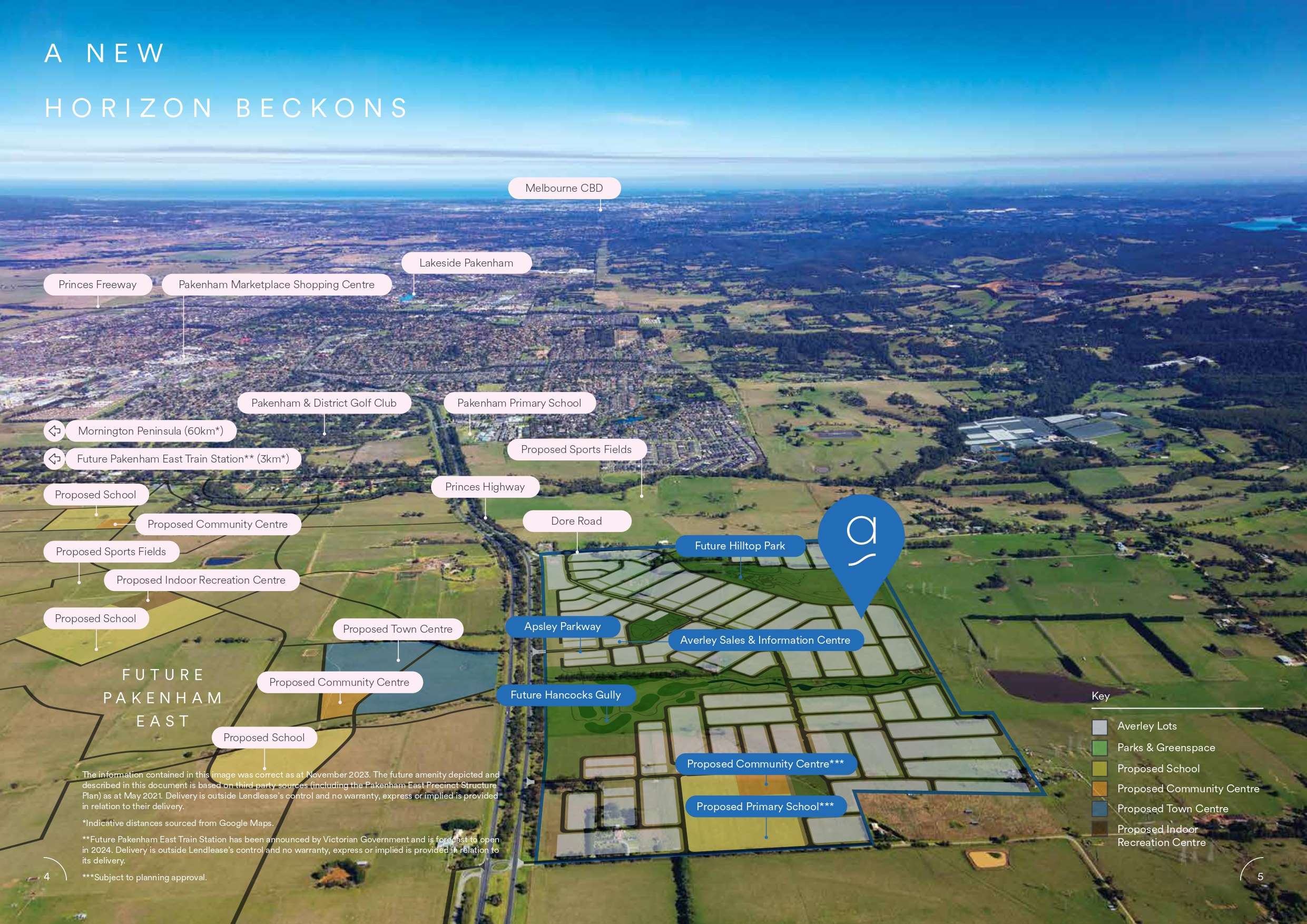
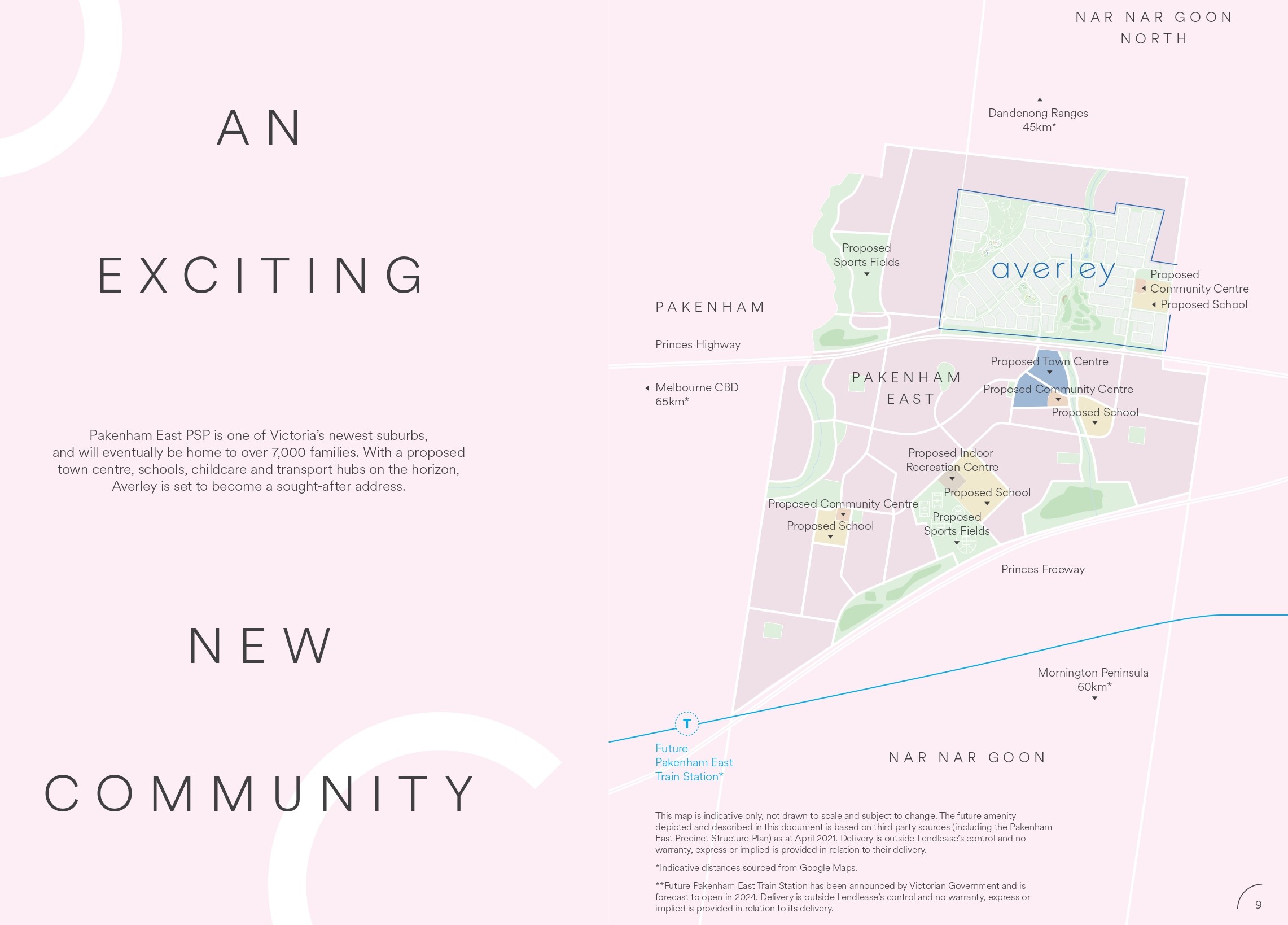
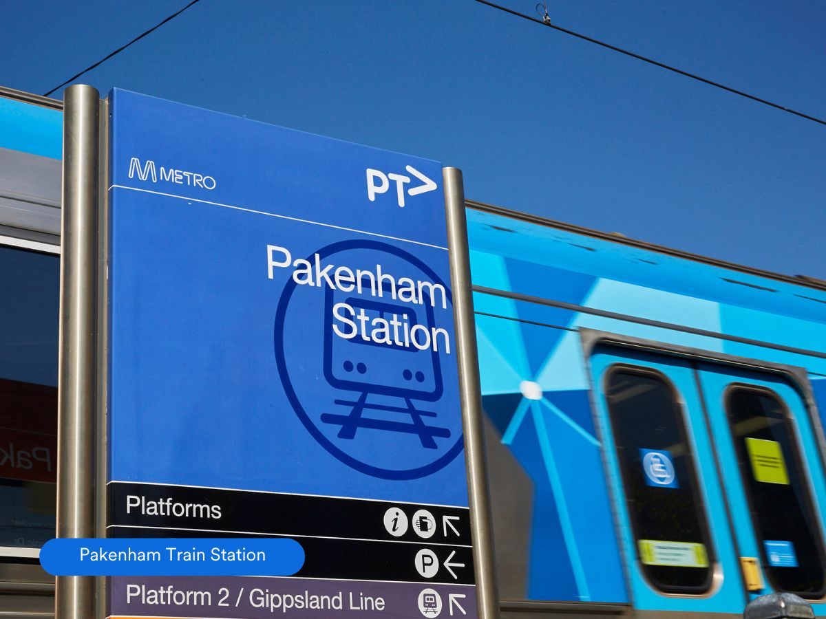
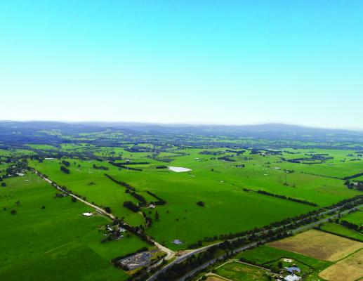
- Located in Pakenham East PSP, 65km south east of Melbourne's CBD and 5km from Pakenham Town Centre and Pakenham Train Station
- Approximately 1,500 lots with a diverse choice of sizes and elevations and home to 4,400 residents on completion
- Within easy reach of the Dandenong Ranges and Mornington Peninsula
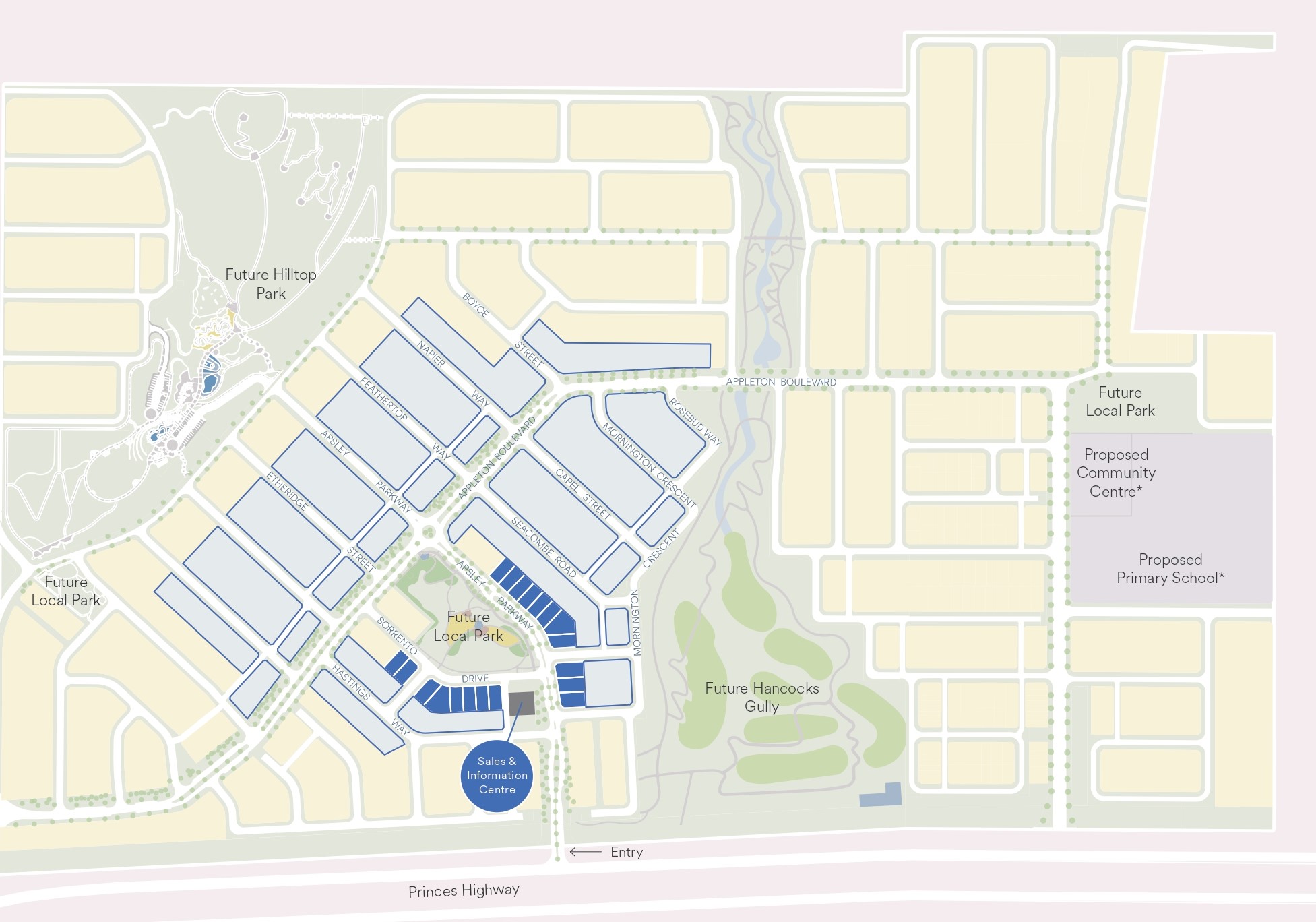
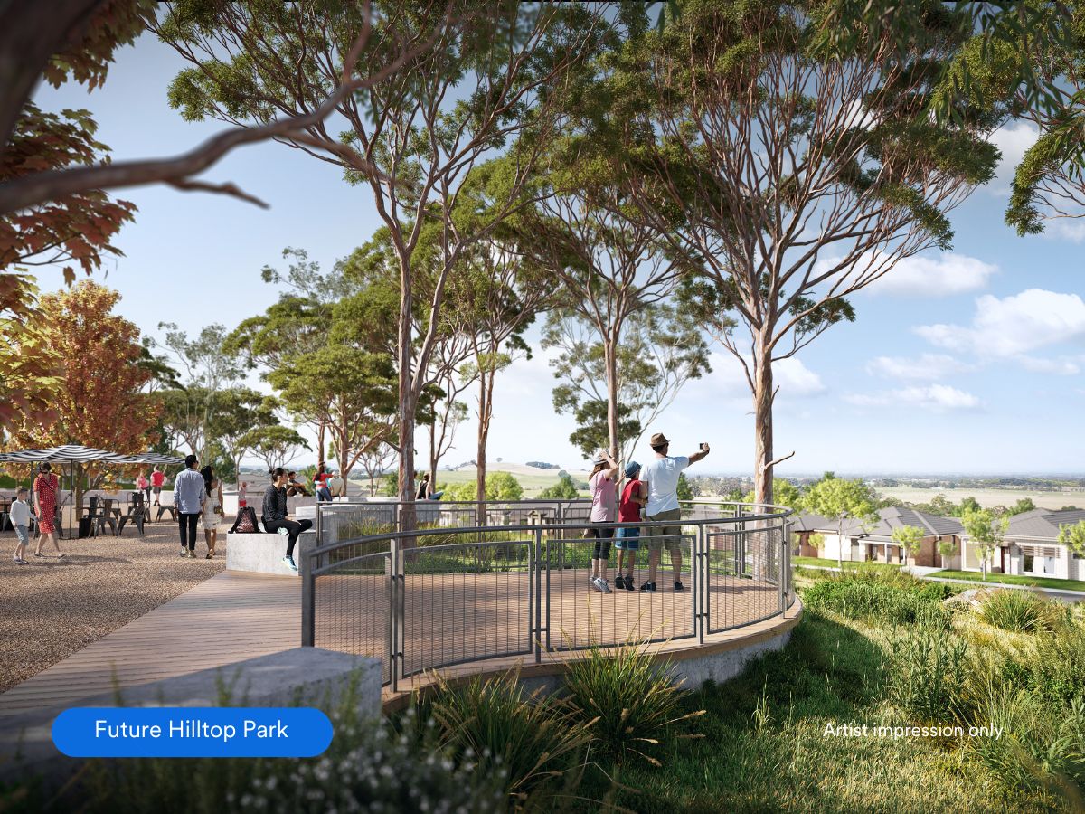
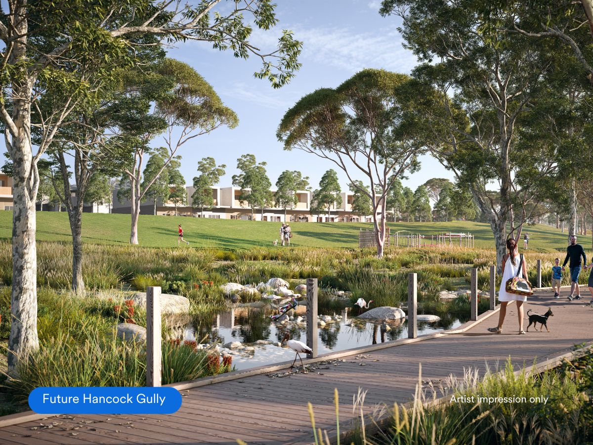
- 20% of the Averley community dedicated to open spaces, with a 10 hectare Future Hilltop Park and 11 hectares of wetland reserve and trails
- Over 14 parks and 2 sports reserves to be built in the Pakenham PSP in the coming years
- Targeting a 6 Star Green Star Communities rating
This information is estimated by the OpenLot research team. Let us know here to provide up-to-date information about this development.
| Total new homes | 1,500 |
| Area size | 113.00 hectares |
| Growth Region | Melbourne South East Growth Corridor |
| City council | Cardinia Shire Council |
| Developer | Lendlease Group |
| Distance to | Melbourne CBD - 57 km south-east |
Land for Sale, House and Land Packages, Townhomes:
Popular Estates near Averley Estate - Nar Nar Goon North

Maple Grove Estate - Pakenham East

Ridgelea Estate - Pakenham East

Officer Fields Estate - Officer

Arcadia Estate - Officer

Tommys Run Estate - Pakenham

Banyan Place Estate - Officer

Officer Central Estate - Officer

Kala - Pakenham East

Carrington Estate - Officer
Updates for Averley Estate - Nar Nar Goon North
Facebook updates:
Related news:
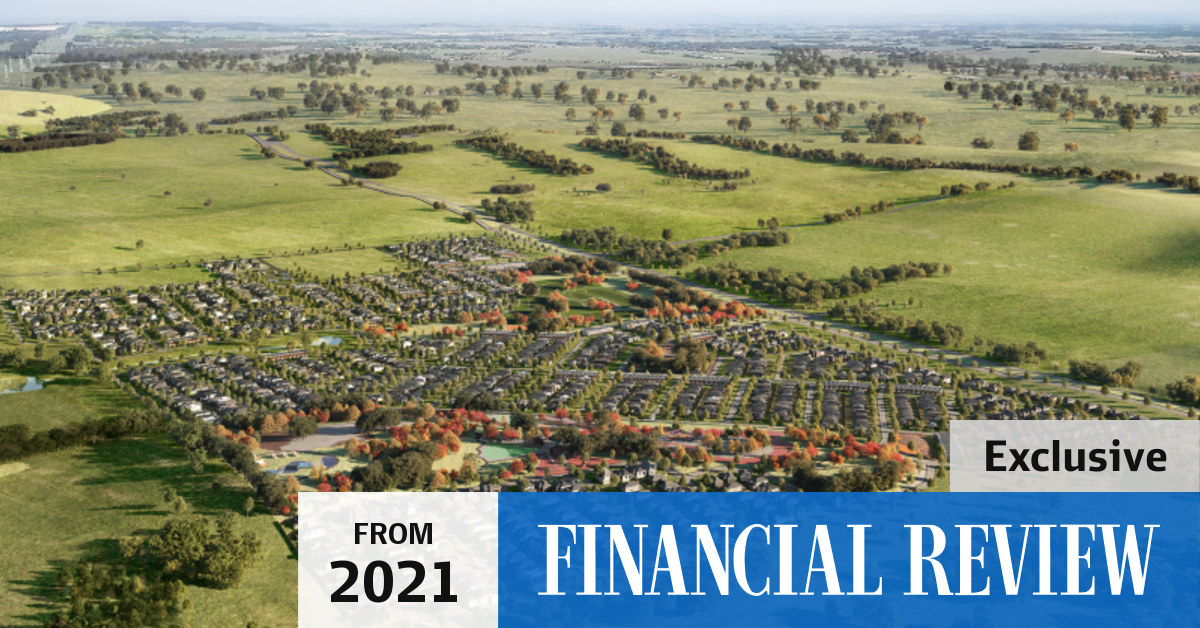
The global construction giant’s Averley Estate in the newly approved suburb of Pakenham East will accommodate more than 1500 homes about 60 kilometres from the centre of Melbourne.
A pair of cattle-herding brothers will make upwards of $80m in a huge land deal — but they almost missed out.

A relatively small piece of grazing country on the south-east of Melbourne has sold to developers for more than $80 million.

The developers behind Lakeside will transform an 83 hectare cattle farm into a brand new estate within the upcoming Pakenham …
Missing articles? Send us a link here.
Location & Map for Averley Estate - Nar Nar Goon North
Land Price Trend in Nar Nar Goon North VIC 3812
- In Jul - Sep 23, the median price for vacant land in Nar Nar Goon North VIC 3812 was $155,600. *
- From Jan - Mar 23 to Jul - Sep 23, the median price for vacant land in Nar Nar Goon North VIC 3812 has decreased 29.11%. *
Vacancy Rate in Nar Nar Goon North VIC 3812
View full vacancy rate history in Nar Nar Goon North VIC 3812 via SQM Research.
Schools near Averley Estate - Nar Nar Goon North
Here are 6 schools near Averley Estate - Nar Nar Goon North:
Prep-6 Government Primary School
Prep-6 Government Primary School
Prep-6 Catholic Primary School
Prep-6 Government Primary School
Prep-6 Catholic Primary School
7-12 Government Secondary School
Land Release Applications for Averley Estate - Nar Nar Goon North
Reviews & Comments on Averley Estate - Nar Nar Goon North
Estate Brochure, Masterplan, Engineering Plan, Plan of Subdivision (POS), Design Guidelines
FAQs about Averley Estate - Nar Nar Goon North
View all estates from Lendlease Group
- Pakenham Primary School - 2.0km west
- Pakenham Hills Primary School - 3.3km west
- St James School - 3.8km east
- Nar Nar Goon Primary School - 4.3km south-east
- St Patrick's School - 5.2km west
- Pakenham Secondary College - 5.5km west
Popular Estates near Averley Estate - Nar Nar Goon North
Maple Grove Estate - Pakenham East
Ridgelea Estate - Pakenham East
Officer Fields Estate - Officer
Arcadia Estate - Officer
Tommys Run Estate - Pakenham
Banyan Place Estate - Officer
Officer Central Estate - Officer
Kala - Pakenham East
Carrington Estate - Officer
Latest New Home Articles for You

06/May/2024
Essential Tips for Home Builders: Top 10 Considerations You Shouldn't Overlook
In the ever-evolving landscape of home construction, it's crucial to stay...

01/May/2024
New Homes vs. Secondhand: Why Building New Might Be Your Best Choice
In the latest episode of The Home Building Hub podcast, hosts Colin Bisch...

30/Apr/2024
The Power of Co Living Investing
In the latest episode of The Property Now Podcast, hosts Matt Ellul and B...

29/Apr/2024
Titled Land vs Non-titled Land - Which is better?
In the latest episode of the Home Building Hub podcast, hosts Colin Bisch...

26/Apr/2024
Navigating the Path to Homeownership: Insights from Home Loan Expert
The lates episode of Home Builder Hub sets the stage for an insightful co...

24/Apr/2024
Delving into Design and Structural Changes: Balancing Risk and Reward
In a recent episode of their podcast, hosts Colin Bischof and Darren Bren...

23/Apr/2024
The Property Now Podcast: Using Your Super to Buy Property Like Never Before
In an innovative episode of the esteemed series, hosts Matt Ellul and Bob...

22/Apr/2024
Should Home Buyers Act Before Seven-Star Pricing Kicks In?
In the latest episode of *The Home Building Hub*, hosts Colin Bischof and...

22/Apr/2024
How to Determine Which House Design Will Fit on Your Lot
In the latest episode of the Home Building Hub podcast, hosts Colin Bisch...