


Kala - Pakenham East 13 AVAILABLE
[LIMITED OFFER] Stage 2 Sold Out! Only a Handful of Stage 1 Lots Remain!
- Lock in your dream lot at Kala with just a $10K deposit — available on all lots for deposits made in December only!
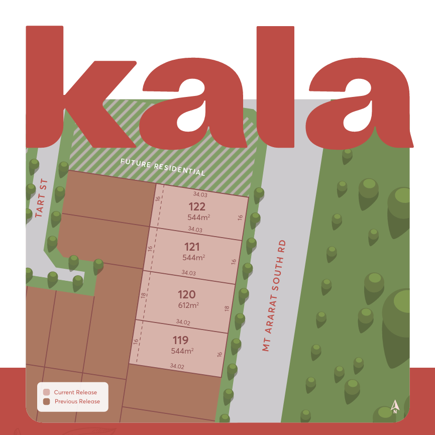
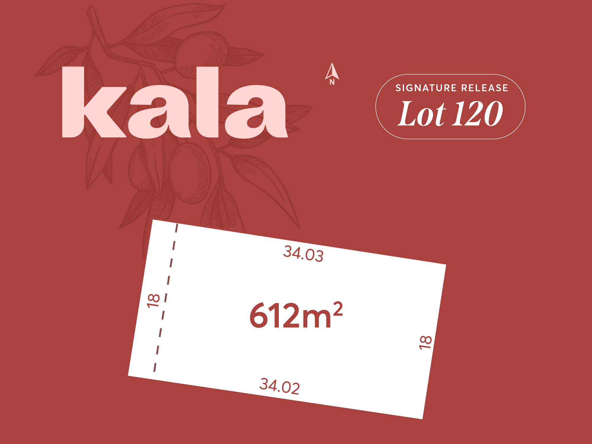
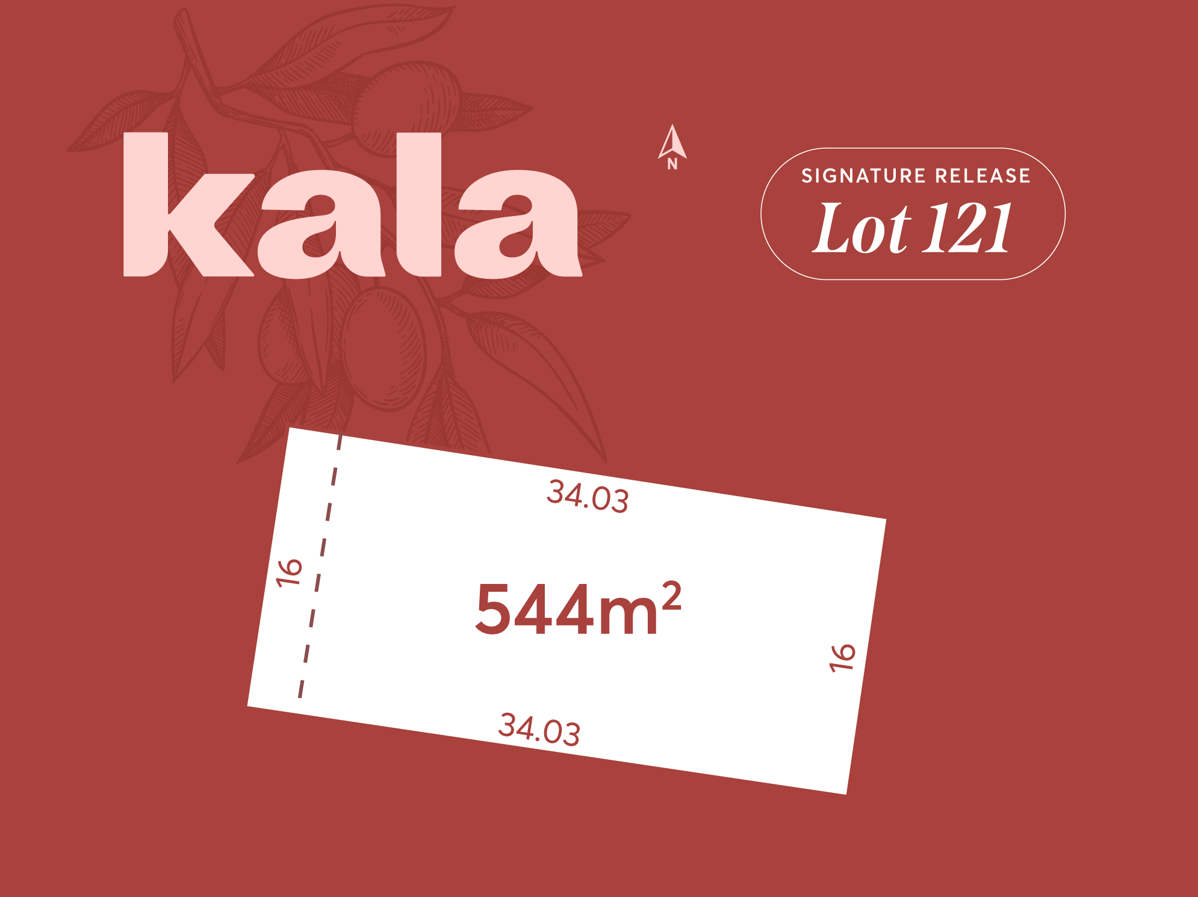
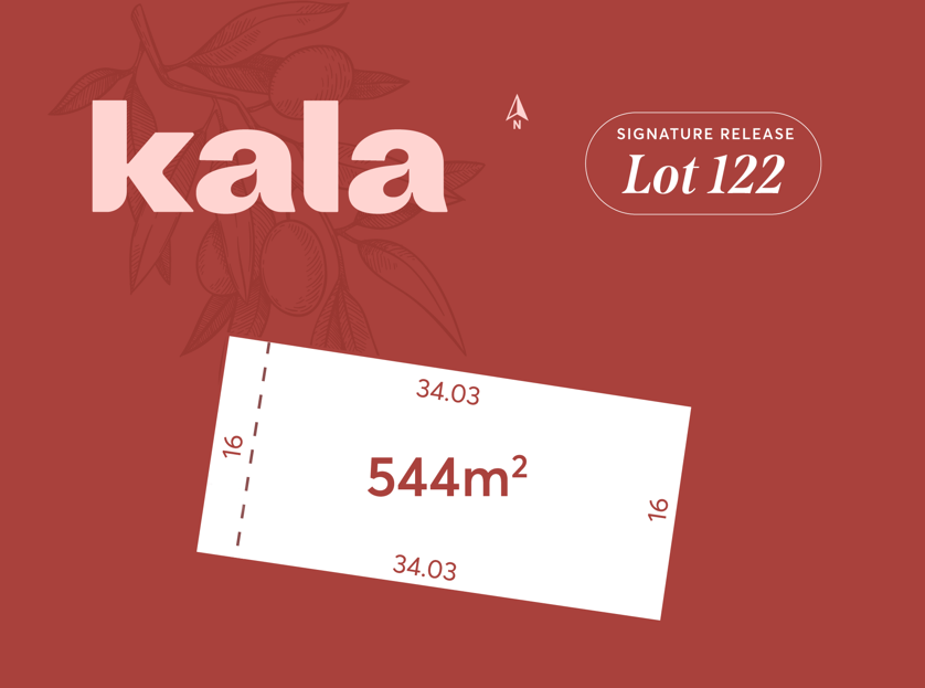
- Kala’s Signature Release is now selling! This boutique release presents only four exclusive homesites, each thoughtfully designed with wide frontages, generous dimensions, and views across undeveloped land.
- Boutique community that offers a wide range of land sizes to suit your first home, your second home or your forever home
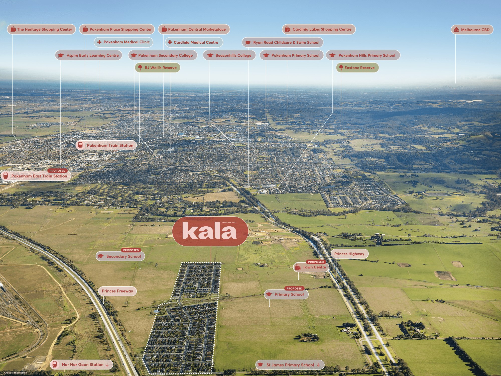
- Just 5 minutes from the bustling Pakenham Town Centre
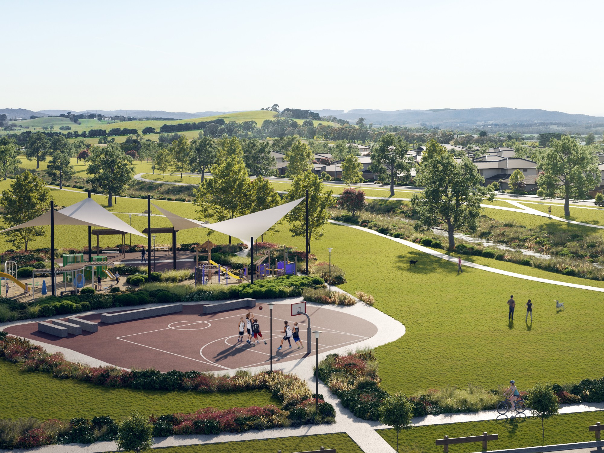
- Gorgeous Central Park and playground, green belt and natural wetlands
- Princes Highway and Princes Freeway at your doorstep
- Just minutes from the future Pakenham East Train Station
This information is estimated by the OpenLot research team. Let us know here to provide up-to-date information about this development.
| Total new homes | 525 |
| Area size | 28.53 hectares |
| Growth Region | Melbourne South East Growth Corridor |
| City council | Cardinia Shire Council |
| Developer | SIG Group |
| Project marketer | Core Projects |
| Other names | Wrenford Estate |
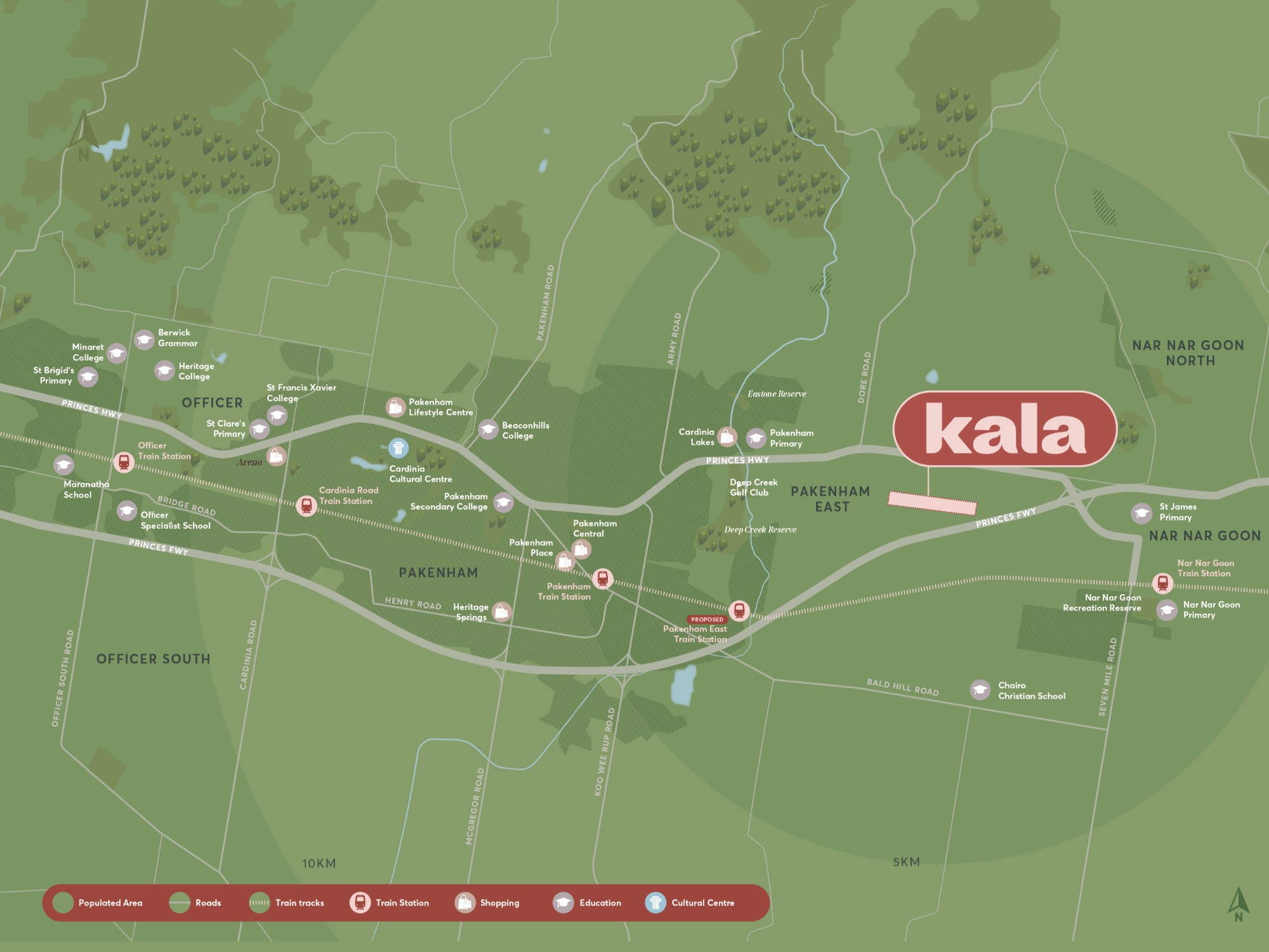
| Distance to | Melbourne CBD - 58 km south-east |
Land for Sale, House and Land Packages:
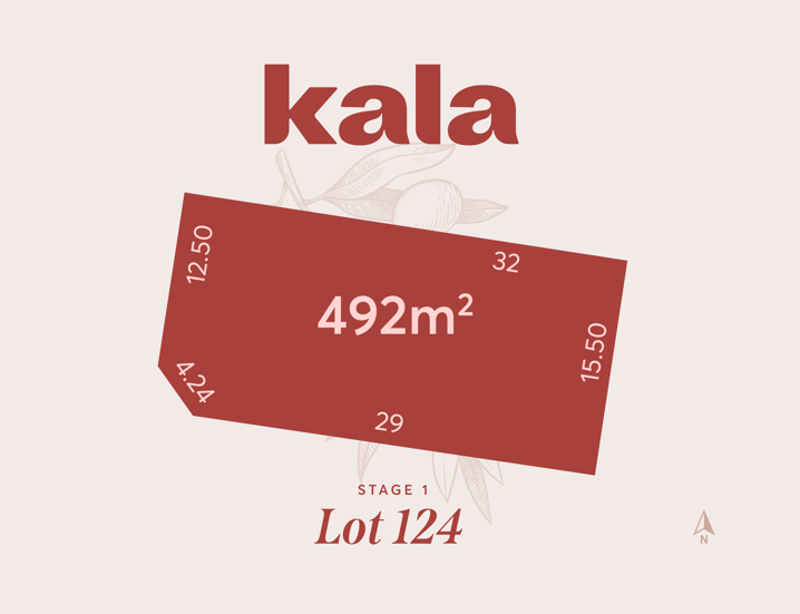
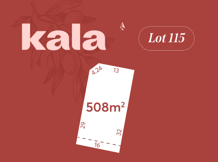
7 Land Lots in Kala - Pakenham East
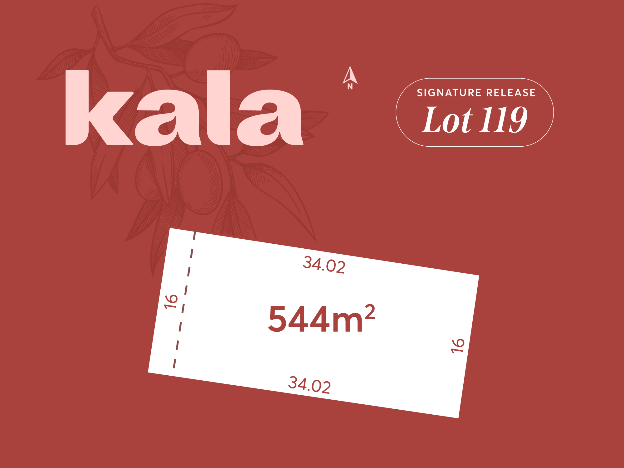
Kala’s Signature Release is now selling! This boutique release presents only four exclusive homesites, each thoughtfully designed with wide frontages, generous dimensions, and views across undeveloped land. It’s a rare opportunity to build a home that’s truly your own in a premium location, just minutes from Pakenham’s town centre.
Your dream home deserves a dream location. With only four homesites available in this limited release, now is the time to secure your place at Kala.
8 House and Land Packages in Kala - Pakenham East

 4
4
 2
2
 2
2
Updates for Kala - Pakenham East
Facebook updates:
Related news:
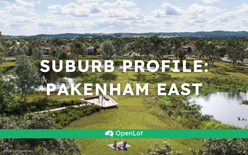
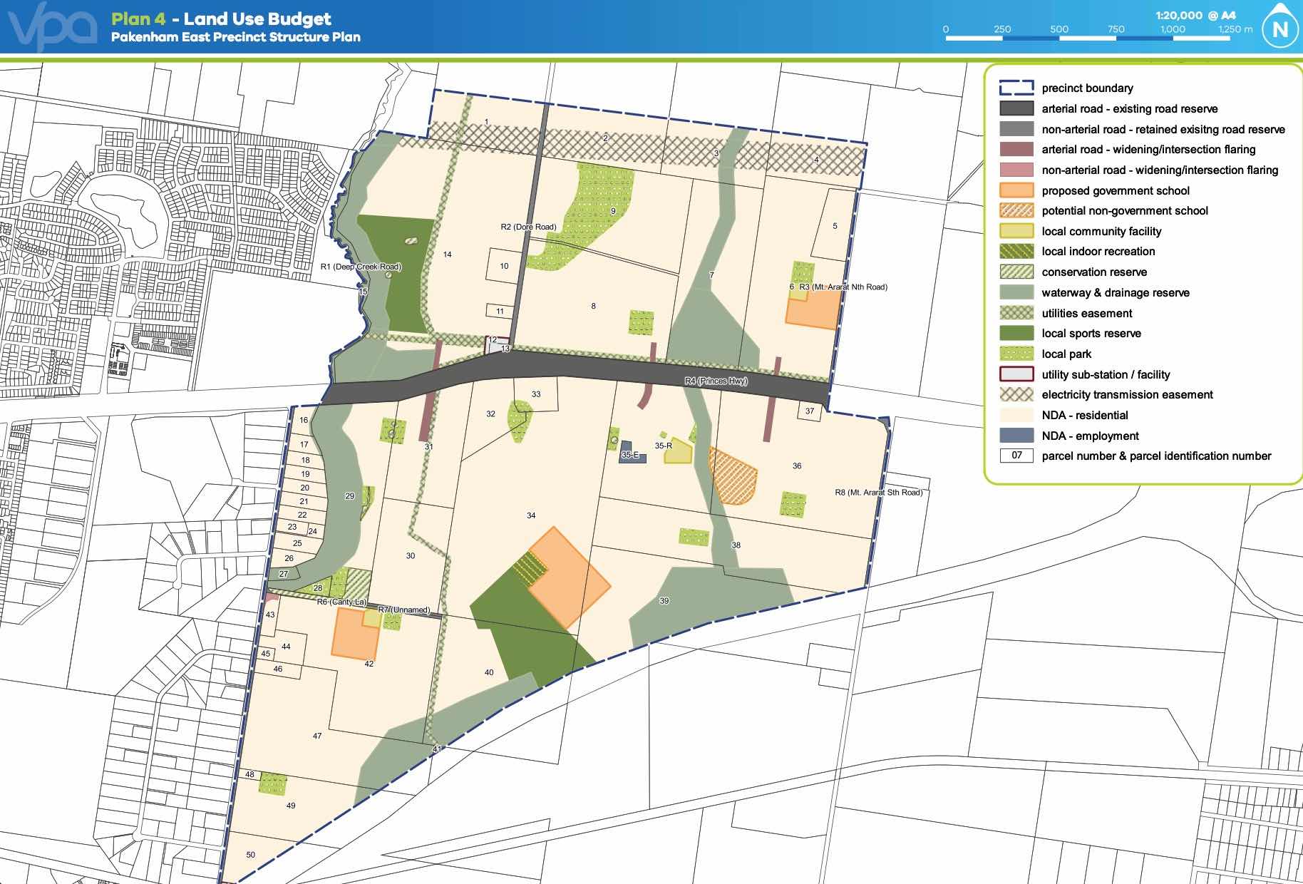
Pakenham East is located in the Shire of Cardinia, the fringe of Melbourne’s Urban Growth Boundary and logical expansion of the existing Pakenham township. The new 630ha suburb area is located on either side of the Princes Highway and is bounded by natural features, existing urban community, infrastructure and farmland.
Discover the hidden gem of Pakenham East, just 10 minutes away from the bustling township of Pakenham.
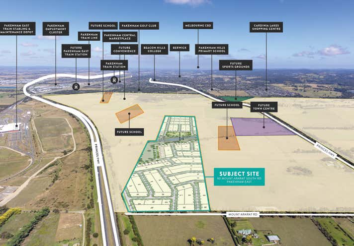
Property development and investment house SIG Group has announced the acquisition of a 28.2 ha site in Victoria’s future suburb of Pakenham East, which will offer future homeowners the chance to purchase affordable land lots in the Pakenham corridor.

The site (outlined) forms part of a 630 hectare area recently rezoned for development. National Pacific Properties – an arm of Burbank Group – is paying $48.5 million for a Nar Nar Goon farm with

Sold development sites & land at 90 Mount Ararat South Road, Pakenham, VIC 3810. Find more about the sold price, property information, and photos on realcommercial.com.au.
Missing articles? Send us a link here.
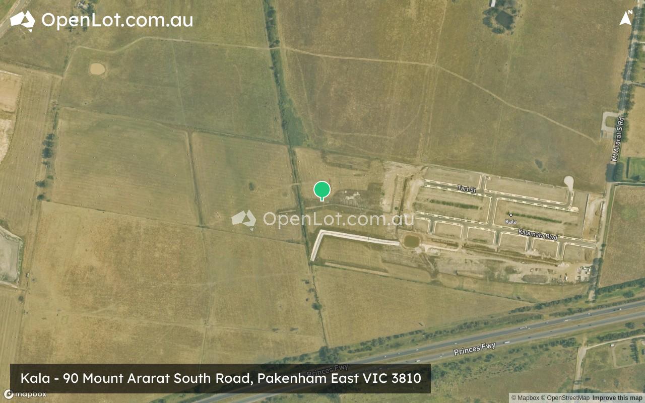
Location & Map for Kala - Pakenham East
Visit Display Homes near Kala - Pakenham East


Vacancy Rate in Pakenham East VIC 3810
View full vacancy rate history in Pakenham East VIC 3810 via SQM Research.
Schools near Kala - Pakenham East
Here are 6 schools near Kala - Pakenham East:
Prep-6 Government Primary School
Prep-6 Catholic Primary School
Prep-6 Government Primary School
Prep-6 Government Primary School
Prep-6 Catholic Primary School
7-12 Government Secondary School
Suburb Planning Review in Pakenham East VIC 3810
Pakenham East is located in the Shire of Cardinia, the fringe of Melbourne’s Urban Growth Boundary and logical expansion of the existing Pakenham township. The new 630ha suburb area is located on either side of the Princes Highway and is bounded by natural features, existing urban community, infrastructure and farmland.
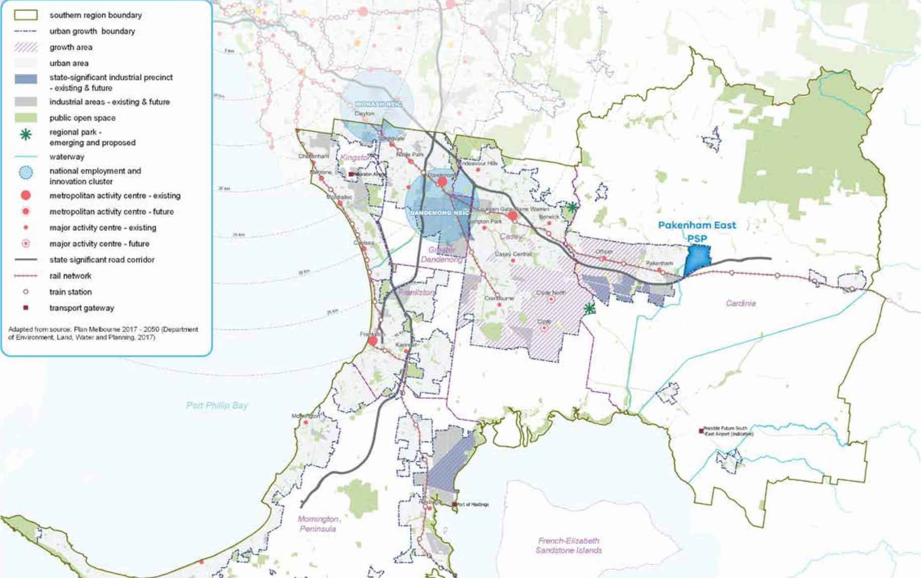
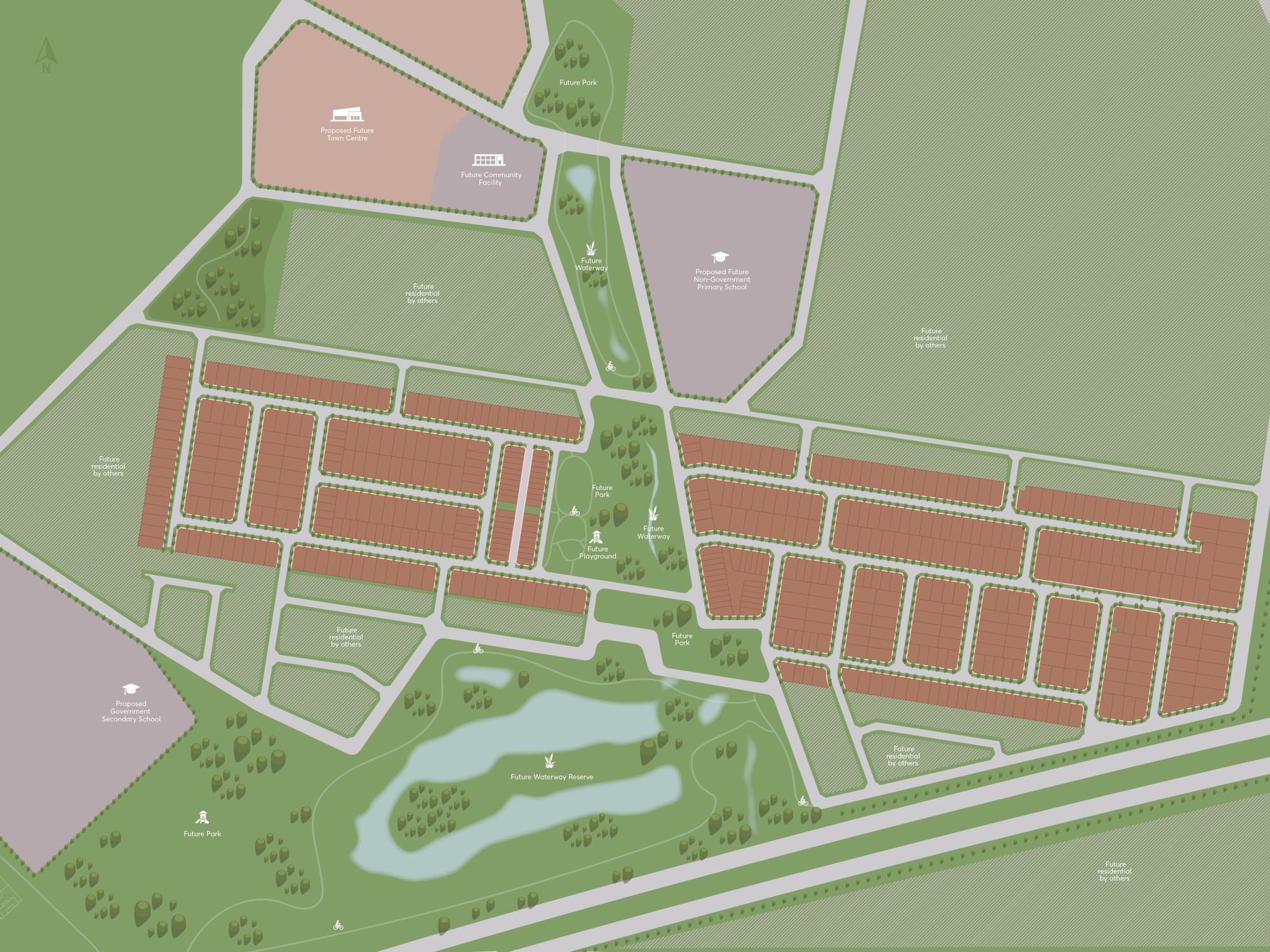
The Pakenham East Precinct Structure Plan (PSP) and Native Vegetation Precinct Plan (NVPP) were prepared to guide the redevelopment of the released land, protection of natural assets and where services are planned to support the suburb growth. This includes local heritage, landscape and environmental values of the area while delivering a variety of housing options and community and recreational facilities as a logical extension of the Pakenham township.
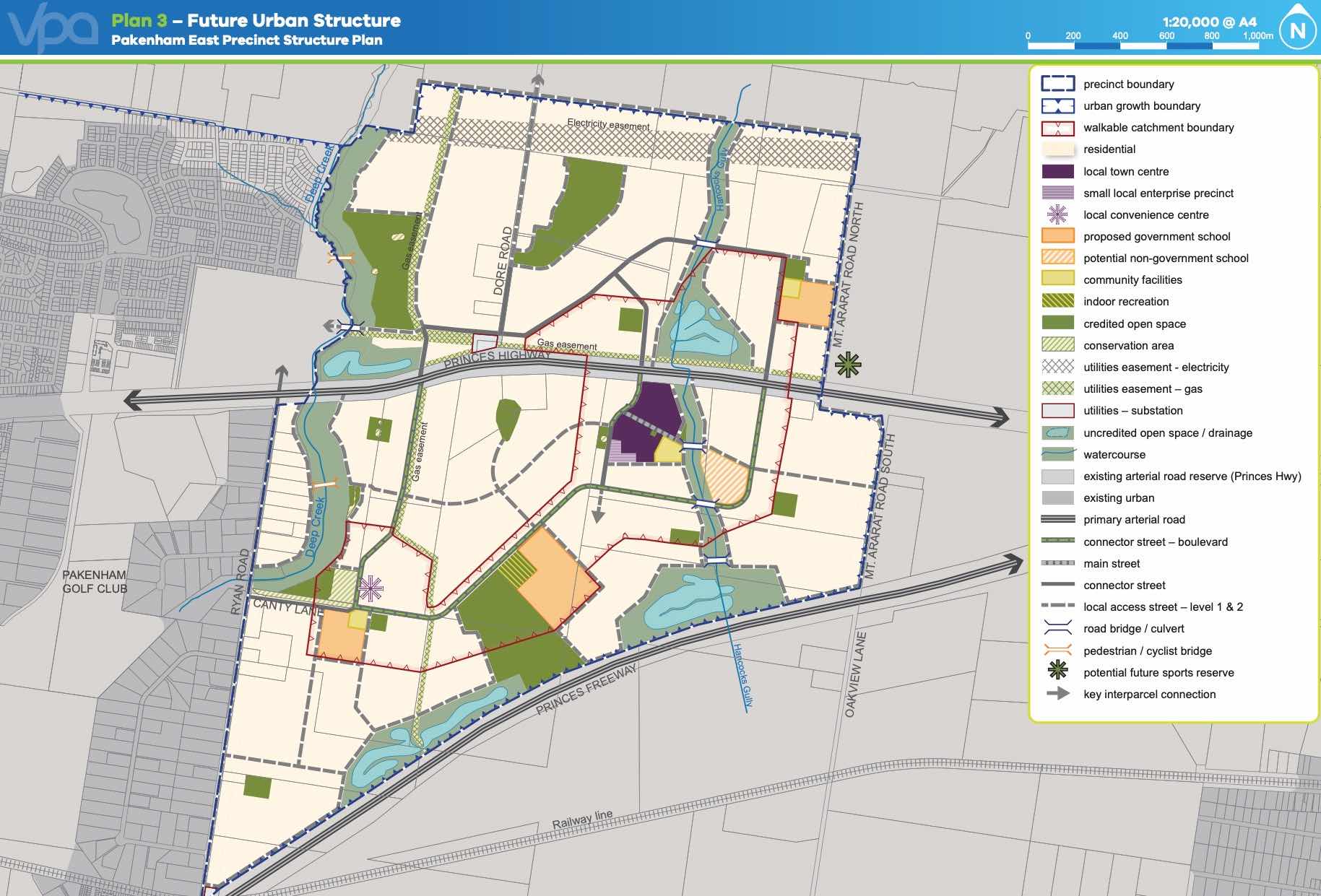
Both the Pakenham East PSP and NVPP were prepared by Victorian Planning Authority (VPA) in consultation with the Cardinia Shire Council and was approved on 2 January 2021 by the Minister for Planning in December 2020. The decision was officially gazetted on 21 January 2021 under Amendment C234 of the Cardinia Planning Scheme.
The Vision of Pakenham East
“for a sustainable and resilient community with plenty of housing choices, open space, well-connected streets, future schools and a local town centre and convenience centre. It will complement Pakenham, with an extensive network of cycling paths, public transport and pedestrian links to central Pakenham”.
Benefits of Pakenham East
The amendments allow the rezoning of Farming and Low Density Residential Zones to Urban Growth Zone. This allows the new greenfield sites to provide for a new residential community, protect natural features and sports and recreation areas. A series of new schools, local community hubs, a town centre and a convenience centre will provide local employment.
Transportation in Pakenham East
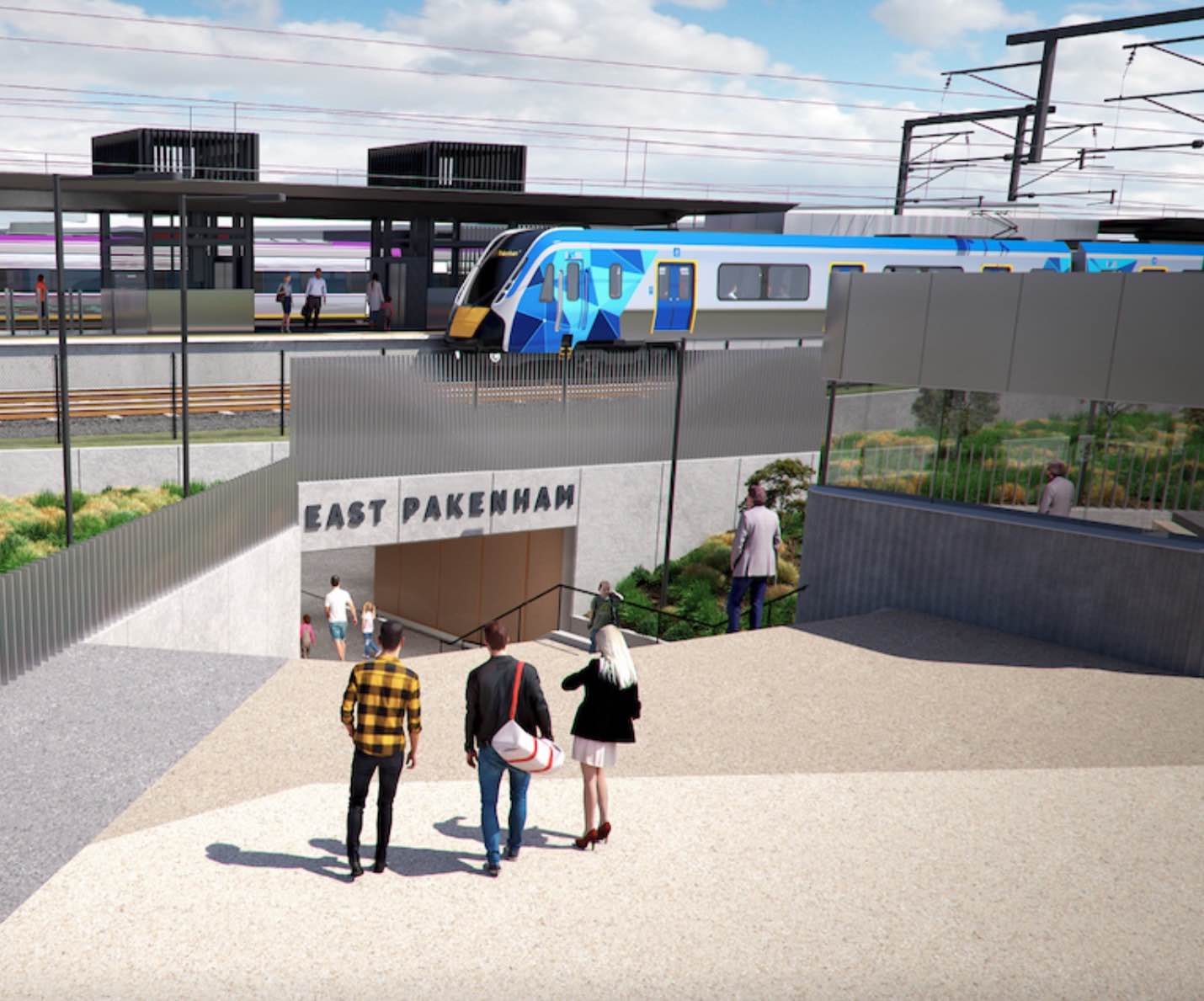
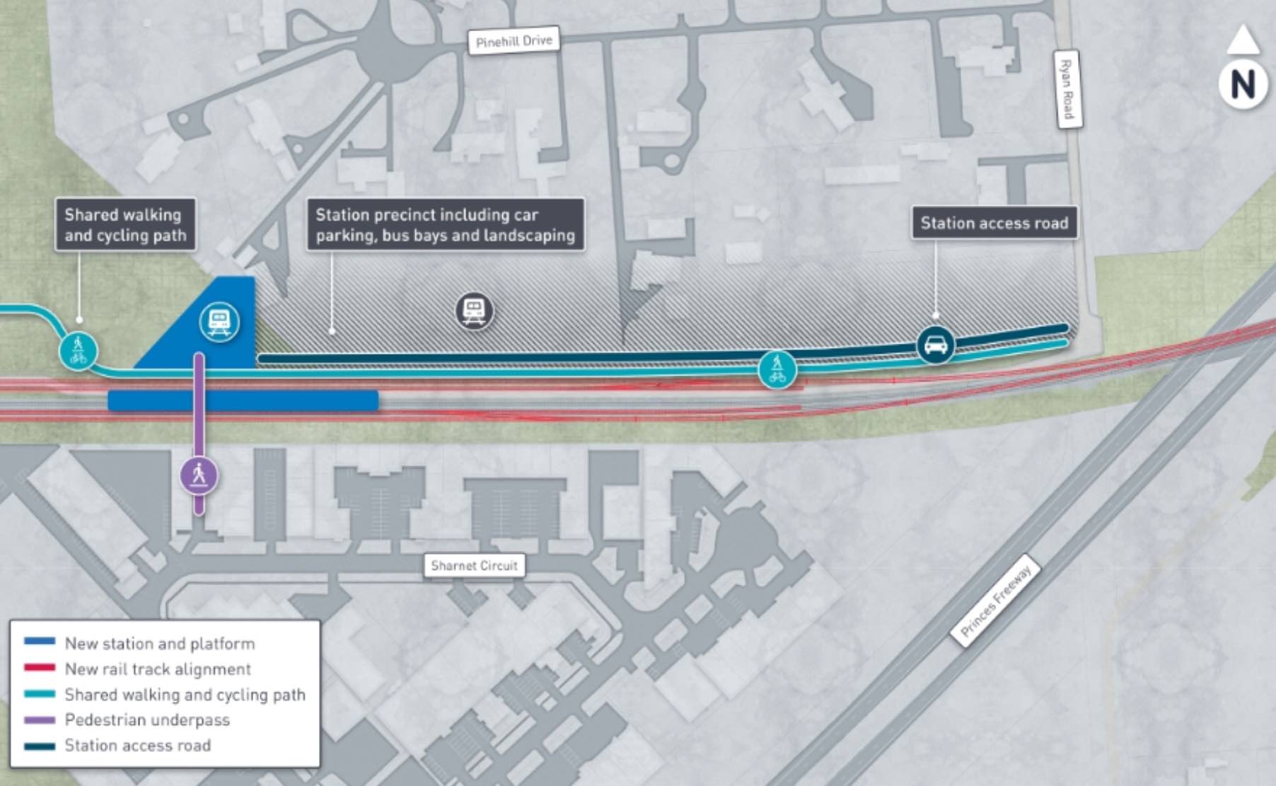
Pakenham East is well connected to public passenger transport, with the Pakenham rail line set to be extended to a new station to be built adjacent to Deep Creek Reserve within the Pakenham community fringe and car parking access from Ryan Road. The passenger train service on the Orbost mainline will connect Flinders Street and the new Pakenham East train station.
While located just outside the new suburb boundary the train station will be well connected to a network of shared paths including cycle links and the local road network. The Princes Highway will provide vehicle access to the Princes Freeway and a direct connection to Melbourne CBD or the east coastline of Victoria.
Pakenham East Suburb Summary
References
- Cardinia Shire Council
- Victoria Planning Authority
- Premier of Victoria – New Station
- Premier of Victoria – New Suburb
- Level Crossing Removal Project
Reviews & Comments on Kala - Pakenham East
Estate Brochure, Masterplan, Engineering Plan, Plan of Subdivision (POS), Design Guidelines
FAQs about Kala - Pakenham East
View all estates from SIG Group
View all estates marketed by Core Projects
- Pakenham Primary School - 2.6km west
- St James School - 3.1km east
- Nar Nar Goon Primary School - 3.3km east
- Pakenham Hills Primary School - 3.9km west
- St Patrick's School - 5.6km west
- Pakenham Secondary College - 5.9km west
Popular Estates near Kala - Pakenham East


Latest New Home Articles for You

09/Mar/2026 | OpenLot.com.au
Victoria: Top 30 Most Searched Housing Developments (February 2026)
If you’ve been exploring housing opportunities in Victoria, February 2026...

20/Feb/2026 | OpenLot.com.au
Display Homes at Drouin Fields Estate: A Thriving Community in Drouin
Welcome to Drouin Fields, a place where beauty, space, and modern luxury ...

19/Feb/2026 | OpenLot.com.au
Display Homes at Manor Lakes Esate: A Thriving Waterside Community in Manor Lakes
A place where you can settle in, rather than just settle down. Named for ...

13/Feb/2026 | OpenLot.com.au
🏠 Victoria: Top 30 Most Searched Townhouse Developments – January 2026

11/Feb/2026 | OpenLot.com.au
🏡 Top 30 Most Searched Estates by State - January 2026

10/Feb/2026 | OpenLot.com.au
Victoria: Top 30 Most Searched Housing Developments (January 2026)
If you’ve been considering making a move in Victoria, January 2026 offere...

10/Feb/2026 | OpenLot.com.au
Queensland: Top 30 Most Searched Housing Developments (January 2026)
If you’ve been considering making a move in Queensland, January 2026 offe...

09/Feb/2026 | OpenLot.com.au
Western Australia: Top 30 Most Searched Housing Developments (January 2026)
If you’ve been considering making a move in Western Australia, January 20...

06/Feb/2026 | OpenLot.com.au
South Australia: Top 30 Most Searched Housing Developments (January 2026)
If you’ve been considering making a move in South Australia, January 2026...