
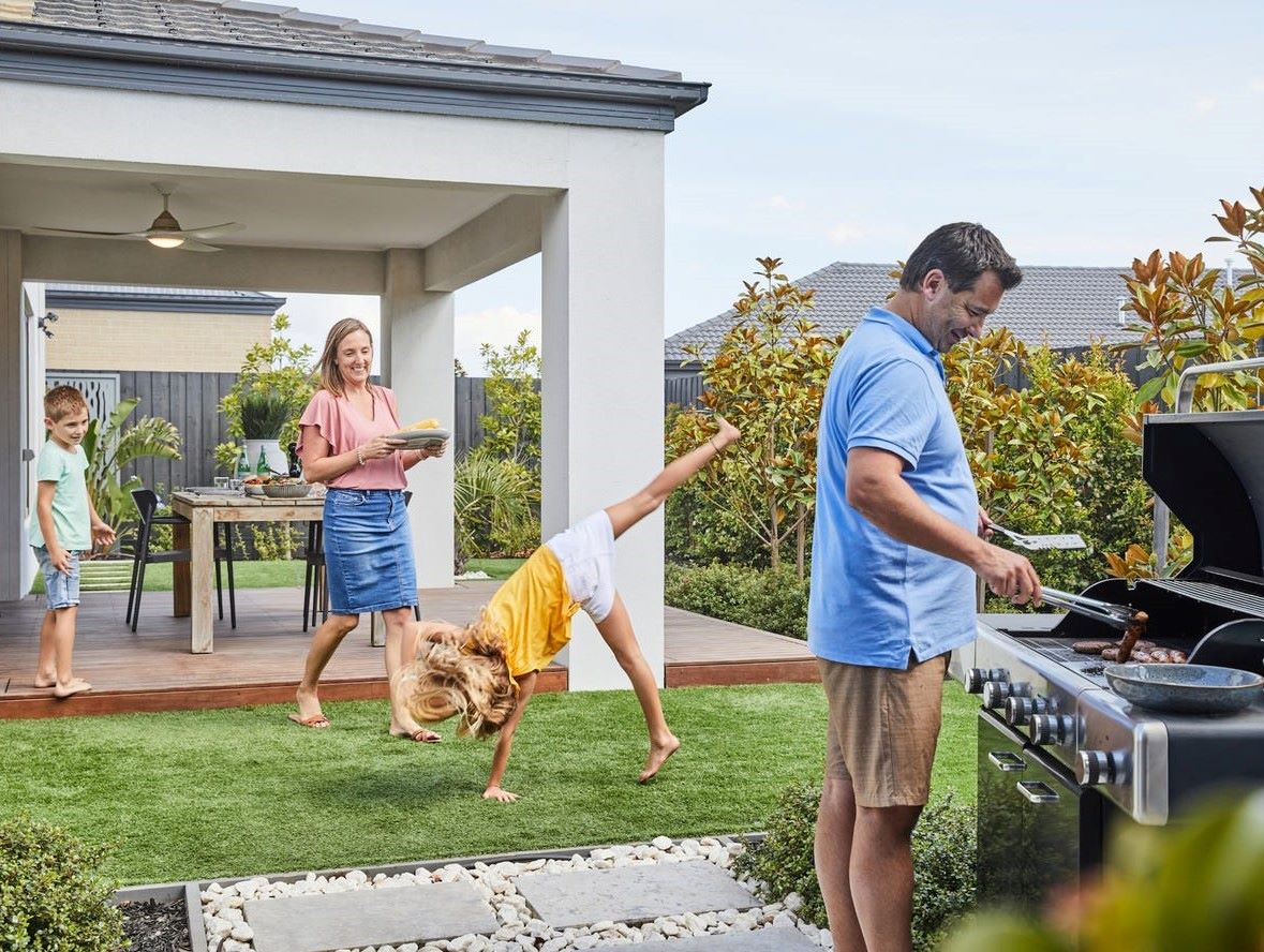

Maple Grove Estate - Pakenham East 30 AVAILABLE
[NEW RELEASE] New Lots in Stage 5 and 6 Now Selling!
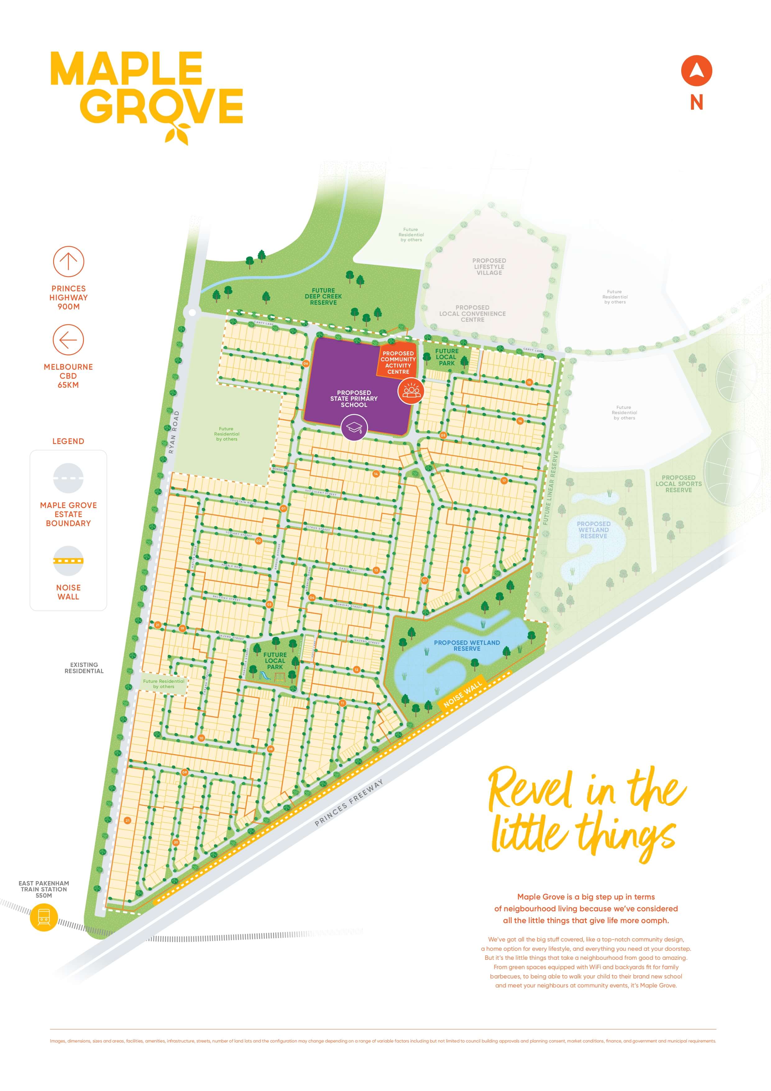
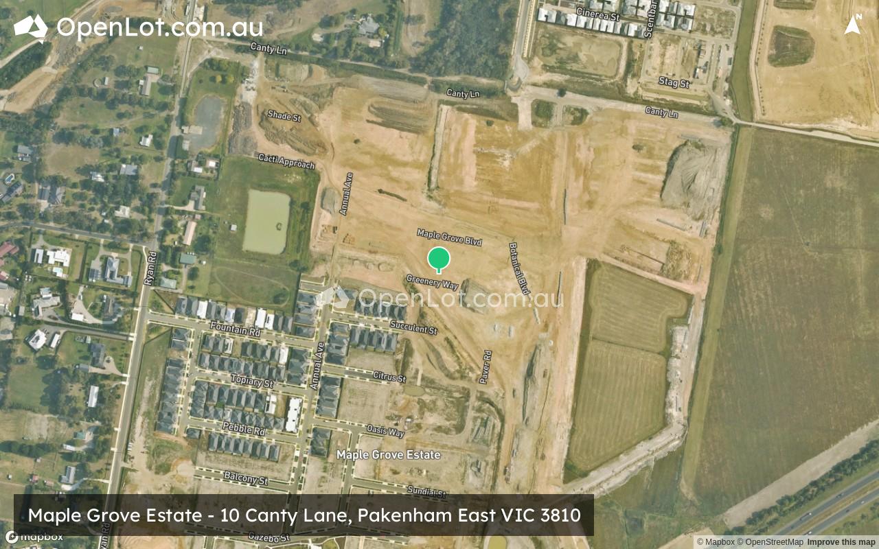
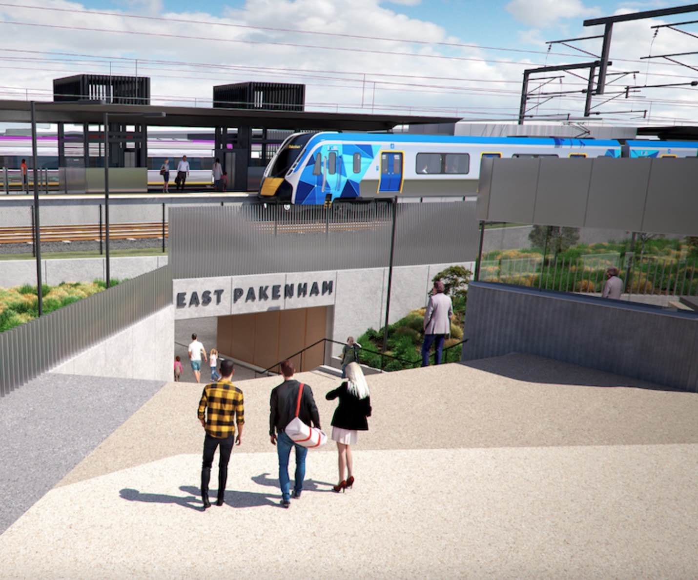
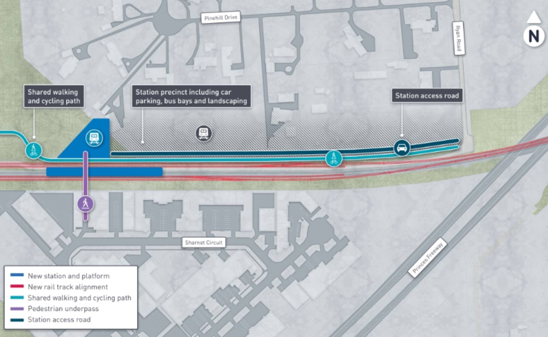
- New East Pakenham Train Station now open – situated only 550 metres from Maple Grove
- Located off Ryan Road and offers easy access to Princes Freeway, within Melbourne’s newest precinct, Pakenham East.
- There are two established primary schools close by: Pakenham Primary School and Pakenham Hills Primary School. Sought-after public and private secondary schools, such as Pakenham Secondary College and ECG College are also nearby.
- If childcare is what you need, there are plenty of choices conveniently located throughout Pakenham, as well as the Ryan Road Childcare, which is just 900m from our community.
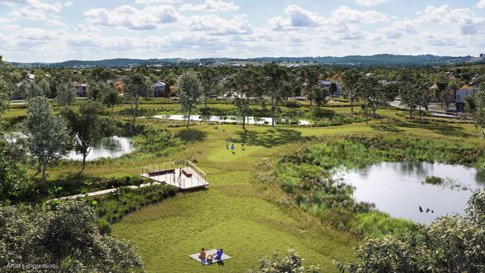
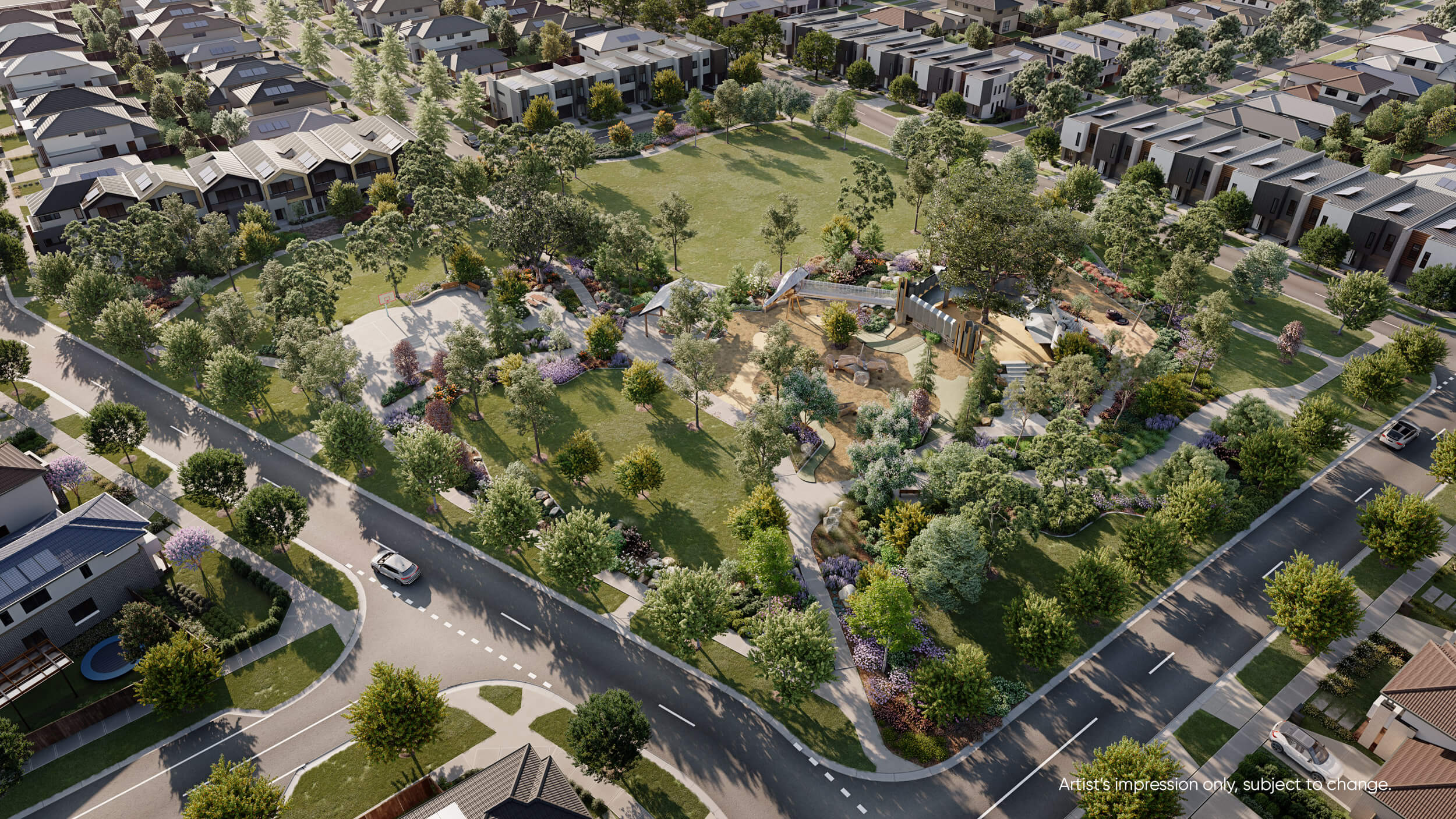
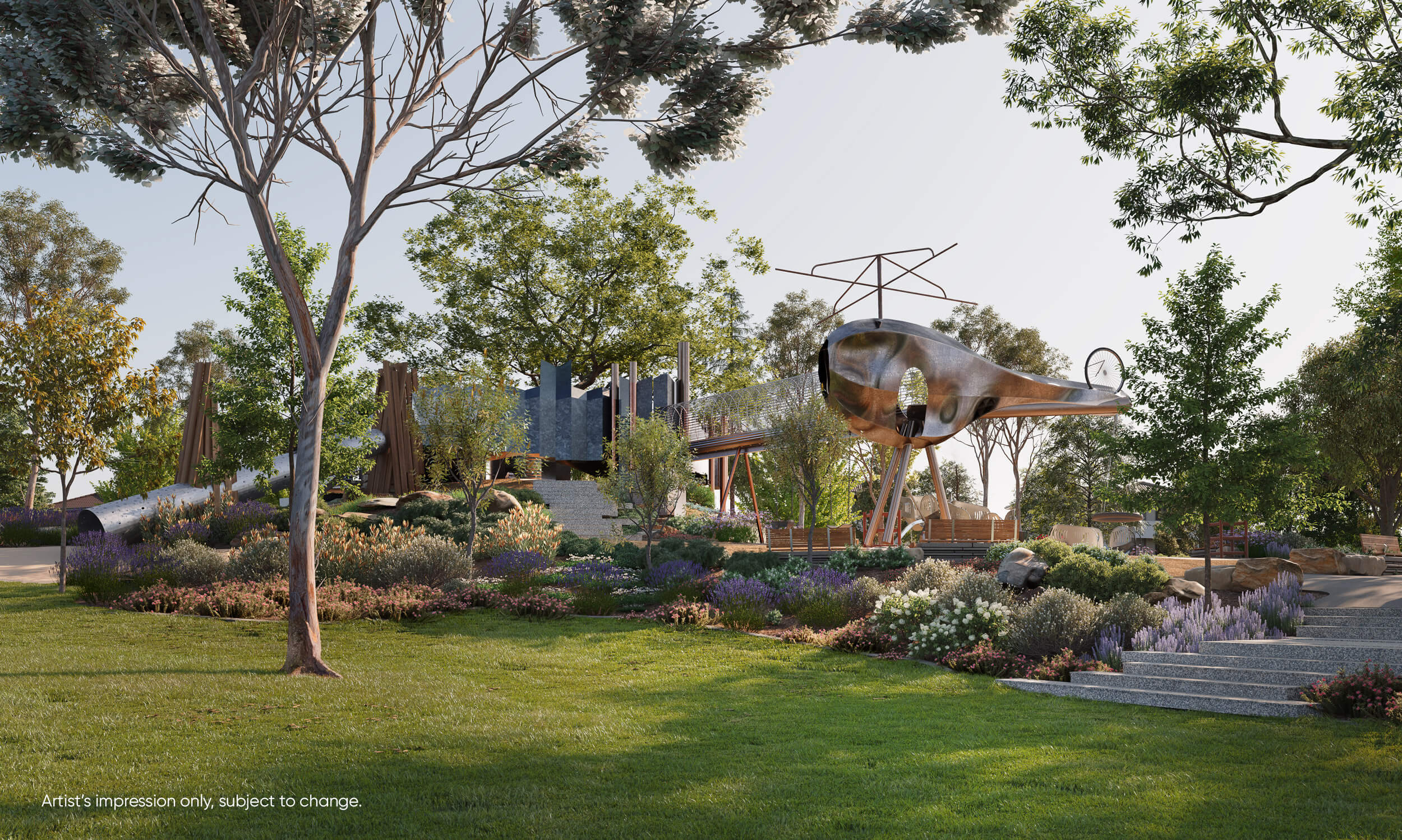
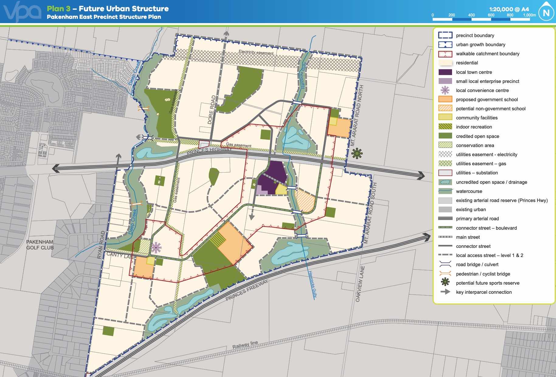
- Include over 7.5 hectares of public open space, including a six-hectare wetlands and two local parks.
- More than one fifth of the precinct will be dedicated to open space, including 43 hectares for parks and sports reserves.
- There are multiple shopping centres nearby for you to choose from, including Cardinia Lakes Shopping Centre and Pakenham Place Shopping Centre, as well as the Village Lakeside Shopping Centre also located nearby
- 4.8kms from Pakenham Main Street, offering an abundance of convenience stores and eateries
- 5kms from existing Pakenham Train Station
This information is estimated by the OpenLot research team. Let us know here to provide up-to-date information about this development.
| Total new homes | 1,160 |
| Area size | 29.89 hectares |
| Growth Region | Melbourne South East Growth Corridor |
| City council | Cardinia Shire Council |
| Developer | Satterley Property Group |
| Distance to | Melbourne CBD - 57 km south-east |
Land for Sale, House and Land Packages:
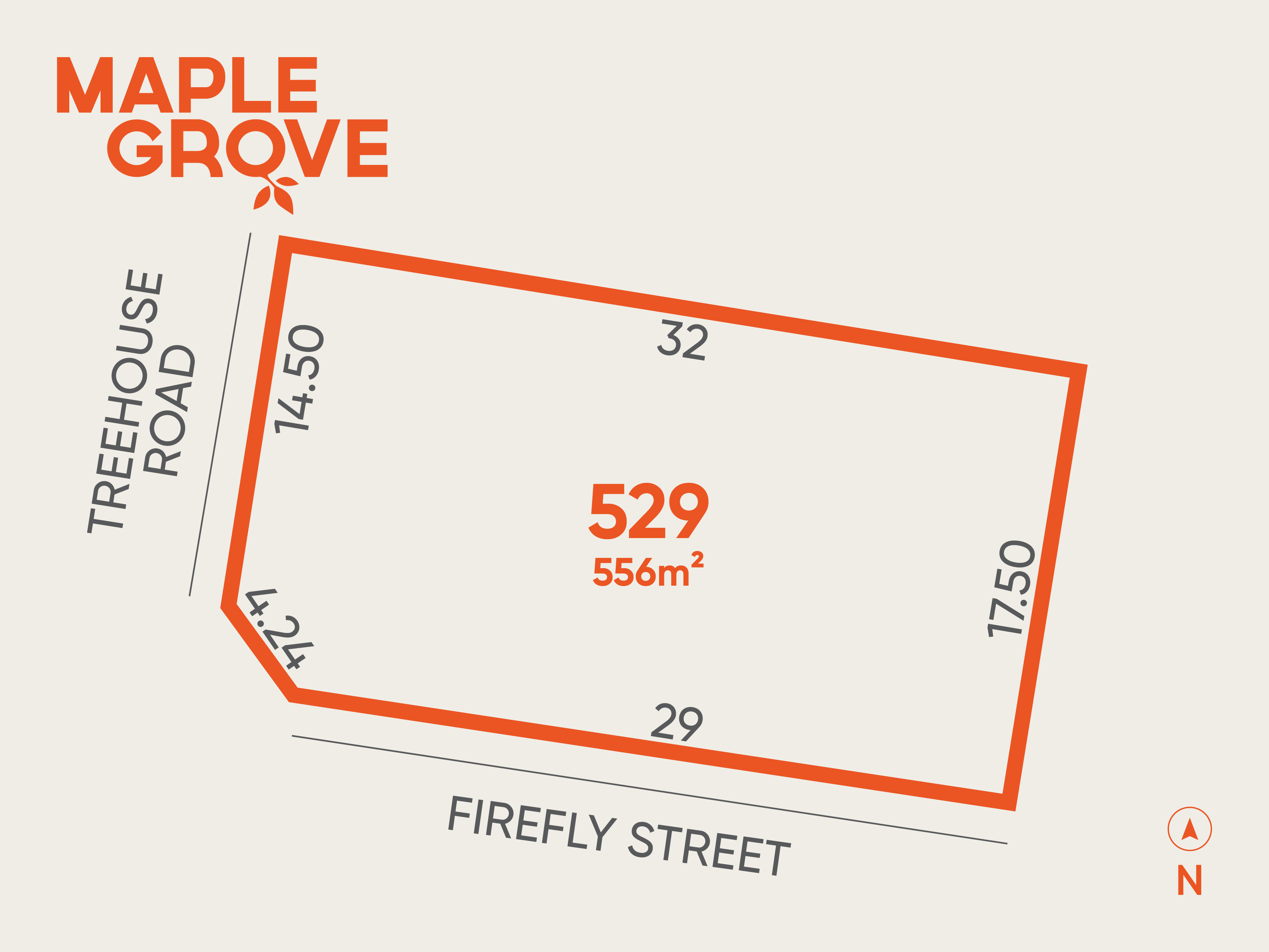
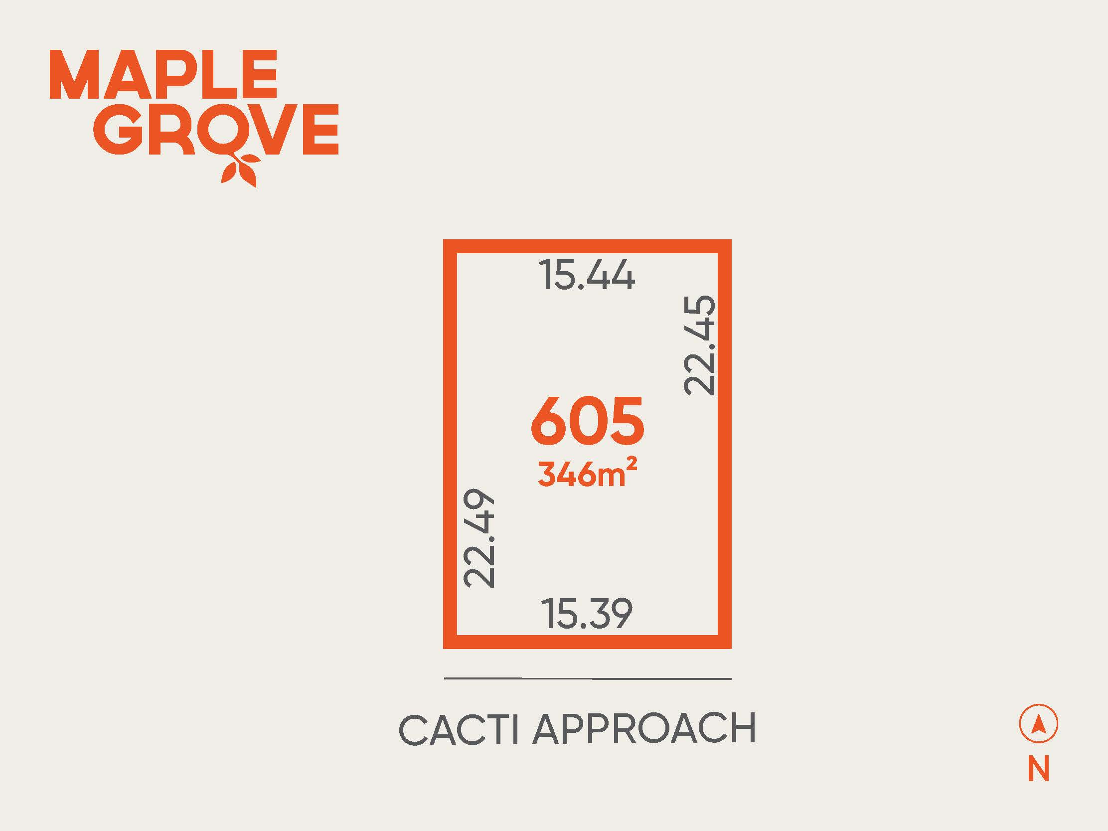
22 Land Lots in Maple Grove Estate - Pakenham East

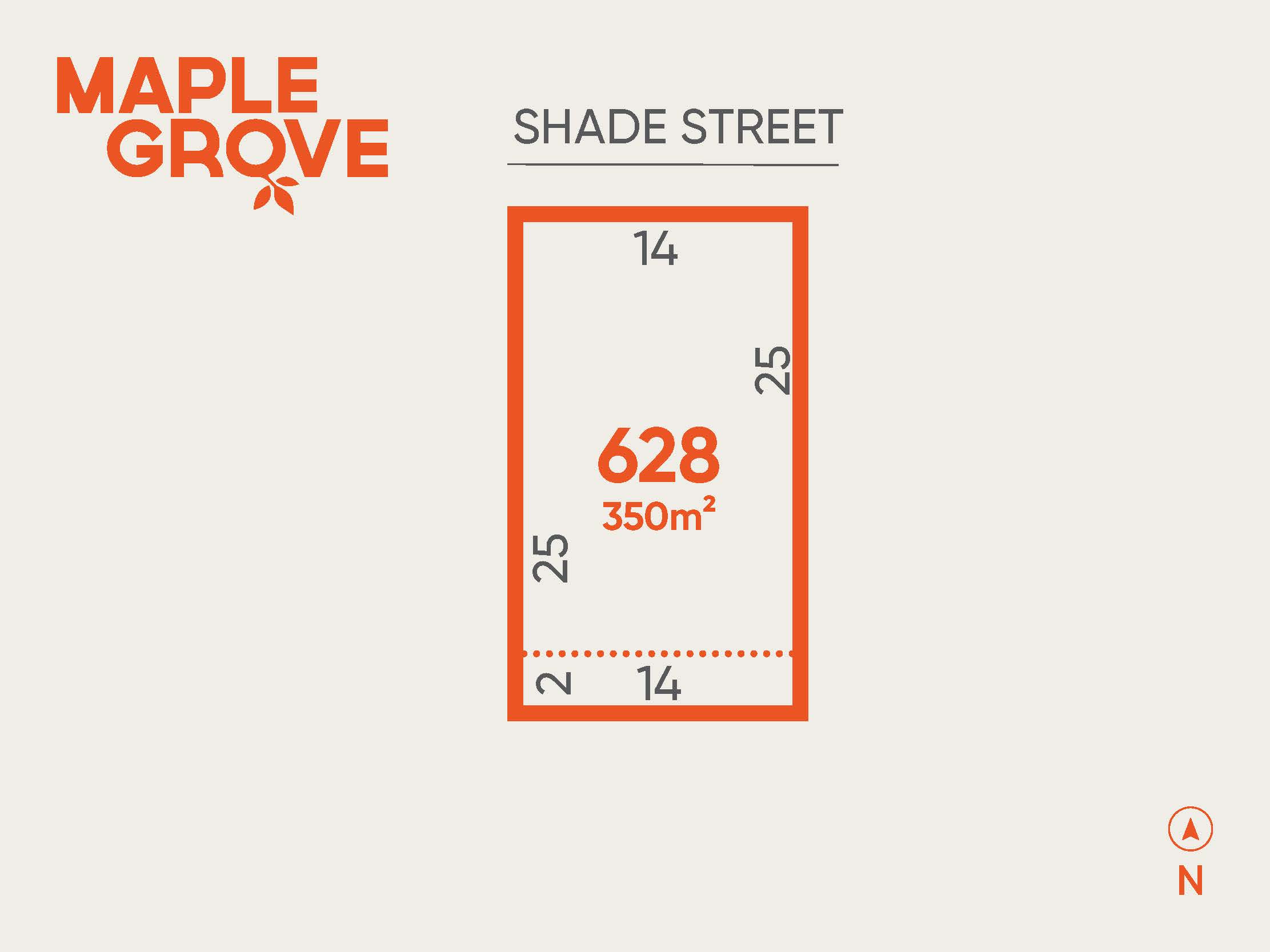
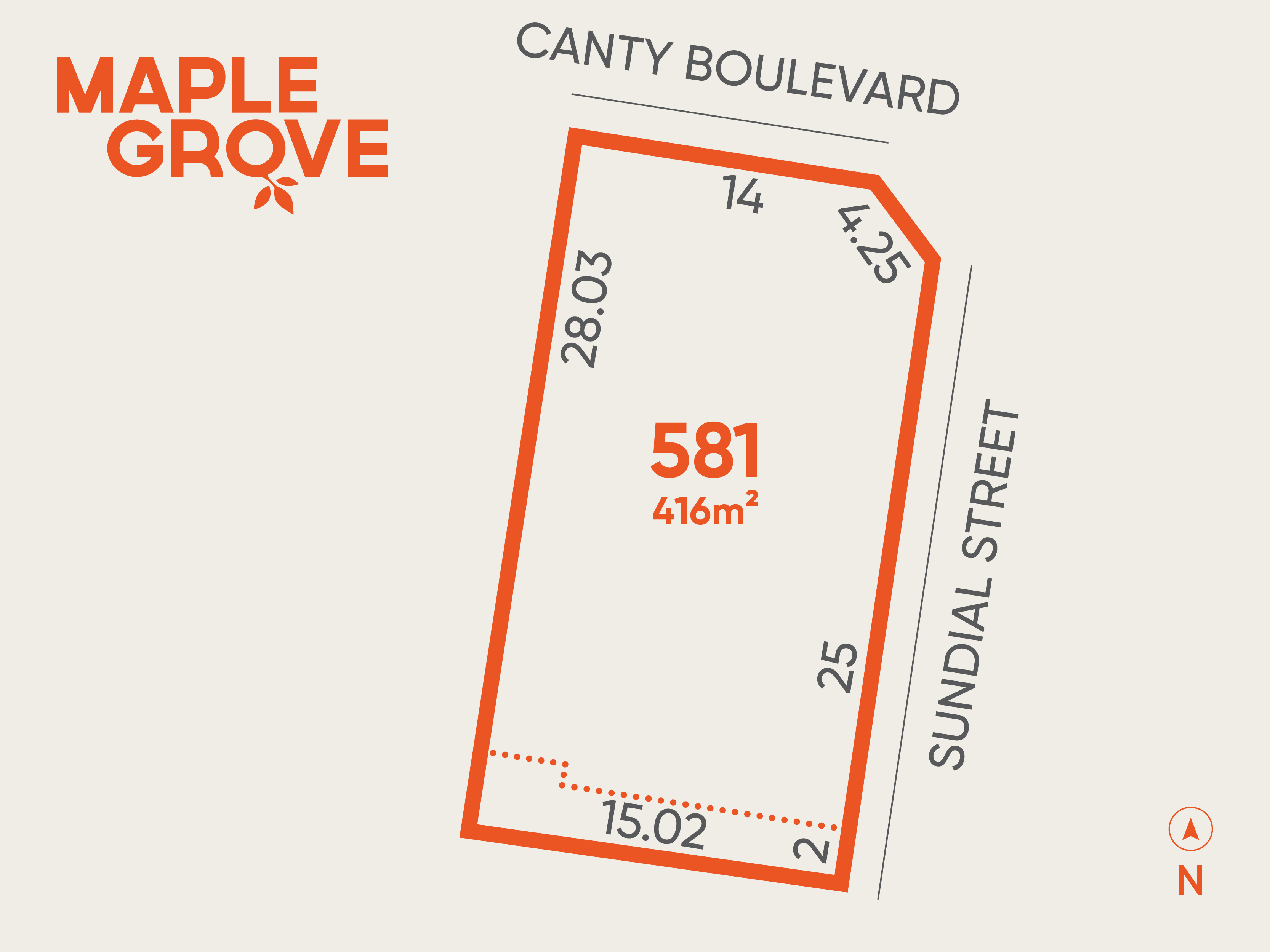
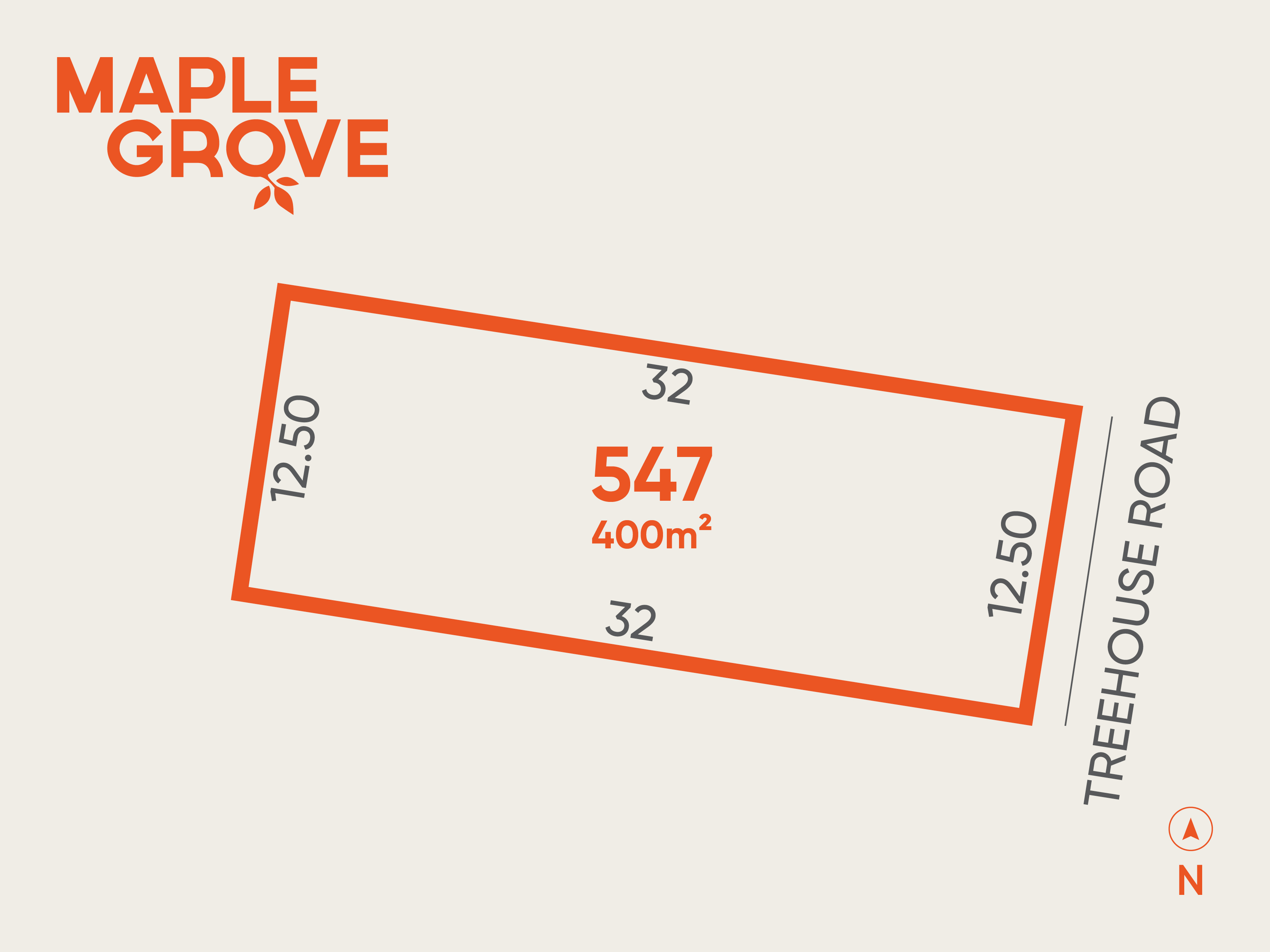
Build your new home at Maple Grove, Pakenham East. Enjoy living close to the proposed state primary school, future community centre, future local park, and a proposed convenience centre. Maple Grove is also the closest residential community to the new East Pakenham Train Station, making everyday travel easier. Contact Lorraine from our sales team to learn how to secure this lot.
Build your new home at Maple Grove, Pakenham East. Enjoy living close to the proposed state primary school, future community centre, future local park, and a proposed convenience centre. Maple Grove is also the closest residential community to the new East Pakenham Train Station, making everyday travel easier. Contact Lorraine from our sales team to learn how to secure this lot.
Build your new home at Maple Grove, Pakenham East. Enjoy living close to the proposed state primary school, future community centre, future local park, and a proposed convenience centre. Maple Grove is also the closest residential community to the new East Pakenham Train Station, making everyday travel easier. Contact Lorraine from our sales team to learn how to secure this lot.
Build your new home at Maple Grove, Pakenham East. Enjoy living close to the proposed state primary school, future community centre, future local park, and a proposed convenience centre. Maple Grove is also the closest residential community to the new East Pakenham Train Station, making everyday travel easier. Contact Lorraine from our sales team to learn how to secure this lot.
34 House and Land Packages in Maple Grove Estate - Pakenham East

 3
3
 2
2
 1
1
Updates for Maple Grove Estate - Pakenham East
Facebook updates:
Related news:
Pakenham East is located in the Shire of Cardinia, the fringe of Melbourne’s Urban Growth Boundary and logical expansion of the existing Pakenham township. The new 630ha suburb area is located on either side of the Princes Highway and is bounded by natural features, existing urban community, infrastructure and farmland.
As Victoria's property market continues to evolve, buyers are keen to secure prime real estate in the state's most sought-after growth corridors. According to data from OpenLot.com.au, the following estates have emerged as the top five in each region based on buyer interest in January 2025.

Missing articles? Send us a link here.
Location & Map for Maple Grove Estate - Pakenham East
Visit Display Homes near Maple Grove Estate - Pakenham East


Vacancy Rate in Pakenham East VIC 3810
View full vacancy rate history in Pakenham East VIC 3810 via SQM Research.
Schools near Maple Grove Estate - Pakenham East
Here are 6 schools near Maple Grove Estate - Pakenham East:
Prep-6 Government Primary School
Prep-6 Government Primary School
Prep-6 Catholic Primary School
7-12 Government Secondary School
Prep-6 Government Primary School
Prep-6 Catholic Primary School
Suburb Planning Review in Pakenham East VIC 3810
Pakenham East is located in the Shire of Cardinia, the fringe of Melbourne’s Urban Growth Boundary and logical expansion of the existing Pakenham township. The new 630ha suburb area is located on either side of the Princes Highway and is bounded by natural features, existing urban community, infrastructure and farmland.
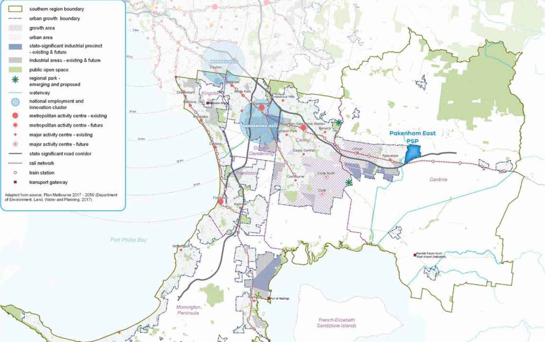
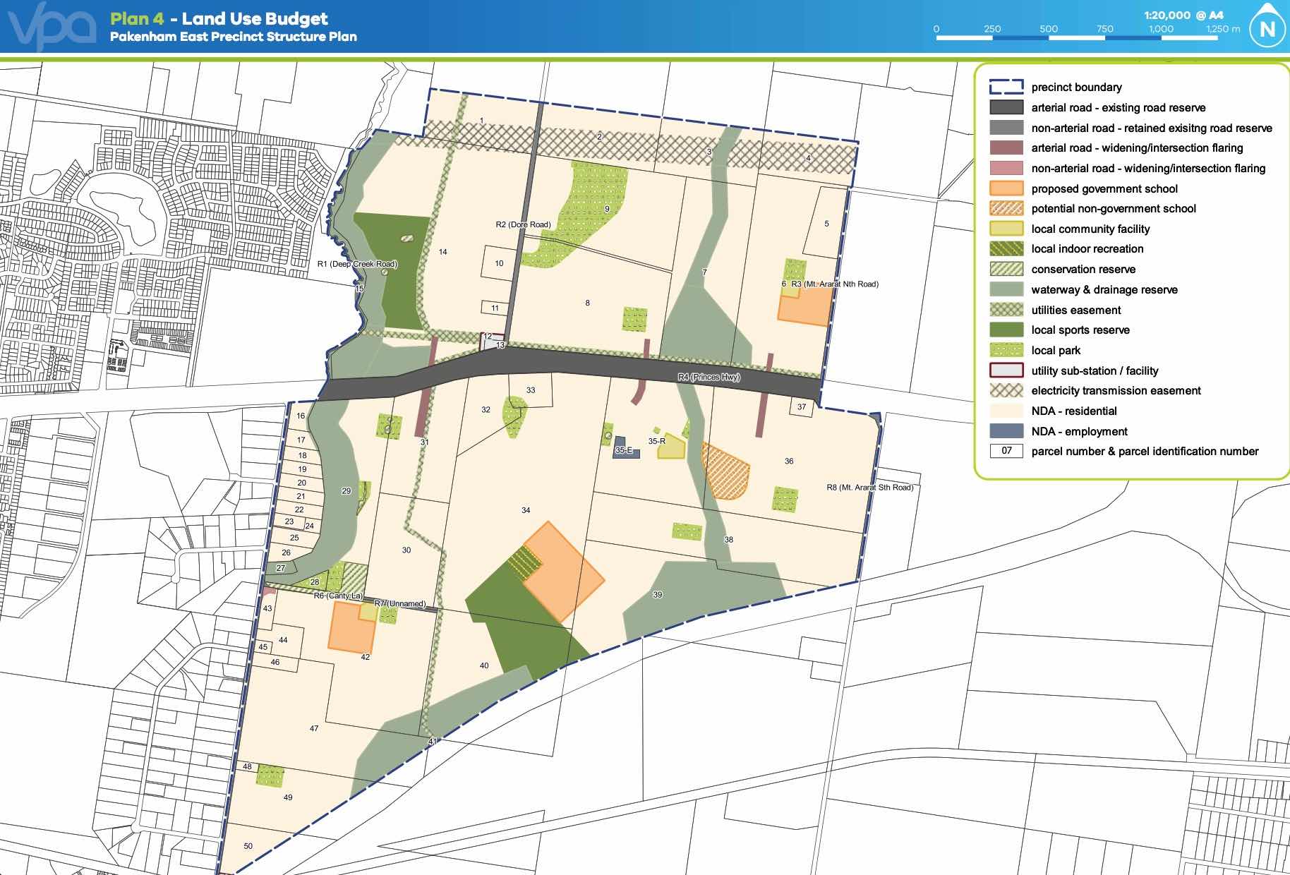
The Pakenham East Precinct Structure Plan (PSP) and Native Vegetation Precinct Plan (NVPP) were prepared to guide the redevelopment of the released land, protection of natural assets and where services are planned to support the suburb growth. This includes local heritage, landscape and environmental values of the area while delivering a variety of housing options and community and recreational facilities as a logical extension of the Pakenham township.
Both the Pakenham East PSP and NVPP were prepared by Victorian Planning Authority (VPA) in consultation with the Cardinia Shire Council and was approved on 2 January 2021 by the Minister for Planning in December 2020. The decision was officially gazetted on 21 January 2021 under Amendment C234 of the Cardinia Planning Scheme.
The Vision of Pakenham East
“for a sustainable and resilient community with plenty of housing choices, open space, well-connected streets, future schools and a local town centre and convenience centre. It will complement Pakenham, with an extensive network of cycling paths, public transport and pedestrian links to central Pakenham”.
Benefits of Pakenham East
The amendments allow the rezoning of Farming and Low Density Residential Zones to Urban Growth Zone. This allows the new greenfield sites to provide for a new residential community, protect natural features and sports and recreation areas. A series of new schools, local community hubs, a town centre and a convenience centre will provide local employment.
Transportation in Pakenham East
Pakenham East is well connected to public passenger transport, with the Pakenham rail line set to be extended to a new station to be built adjacent to Deep Creek Reserve within the Pakenham community fringe and car parking access from Ryan Road. The passenger train service on the Orbost mainline will connect Flinders Street and the new Pakenham East train station.
While located just outside the new suburb boundary the train station will be well connected to a network of shared paths including cycle links and the local road network. The Princes Highway will provide vehicle access to the Princes Freeway and a direct connection to Melbourne CBD or the east coastline of Victoria.
Pakenham East Suburb Summary
References
- Cardinia Shire Council
- Victoria Planning Authority
- Premier of Victoria – New Station
- Premier of Victoria – New Suburb
- Level Crossing Removal Project
Reviews & Comments on Maple Grove Estate - Pakenham East
Estate Brochure, Masterplan, Engineering Plan, Plan of Subdivision (POS), Design Guidelines
FAQs about Maple Grove Estate - Pakenham East
View all estates from Satterley Property Group
- Pakenham Primary School - 1.5km north-west
- Pakenham Hills Primary School - 2.6km north-west
- St Patrick's School - 4.0km west
- Pakenham Secondary College - 4.3km west
- Pakenham Springs Primary School - 4.3km west
- St James School - 4.8km east
Popular Estates near Maple Grove Estate - Pakenham East


Latest New Home Articles for You

16/Mar/2026 | OpenLot.com.au
New South Wales: Top 30 Most Searched Housing Developments (February 2026)
If you’ve been considering a move in New South Wales, February 2026 provi...

09/Mar/2026 | OpenLot.com.au
Victoria: Top 30 Most Searched Housing Developments (February 2026)
If you’ve been exploring housing opportunities in Victoria, February 2026...

20/Feb/2026 | OpenLot.com.au
Display Homes at Drouin Fields Estate: A Thriving Community in Drouin
Welcome to Drouin Fields, a place where beauty, space, and modern luxury ...

19/Feb/2026 | OpenLot.com.au
Display Homes at Manor Lakes Esate: A Thriving Waterside Community in Manor Lakes
A place where you can settle in, rather than just settle down. Named for ...

13/Feb/2026 | OpenLot.com.au
🏠 Victoria: Top 30 Most Searched Townhouse Developments – January 2026

11/Feb/2026 | OpenLot.com.au
🏡 Top 30 Most Searched Estates by State - January 2026

10/Feb/2026 | OpenLot.com.au
Victoria: Top 30 Most Searched Housing Developments (January 2026)
If you’ve been considering making a move in Victoria, January 2026 offere...

10/Feb/2026 | OpenLot.com.au
Queensland: Top 30 Most Searched Housing Developments (January 2026)
If you’ve been considering making a move in Queensland, January 2026 offe...

09/Feb/2026 | OpenLot.com.au
Western Australia: Top 30 Most Searched Housing Developments (January 2026)
If you’ve been considering making a move in Western Australia, January 20...