
Rosewood Green Estate - Rosewood
[NEW RELEASE] Fortrose Release Selling Now!


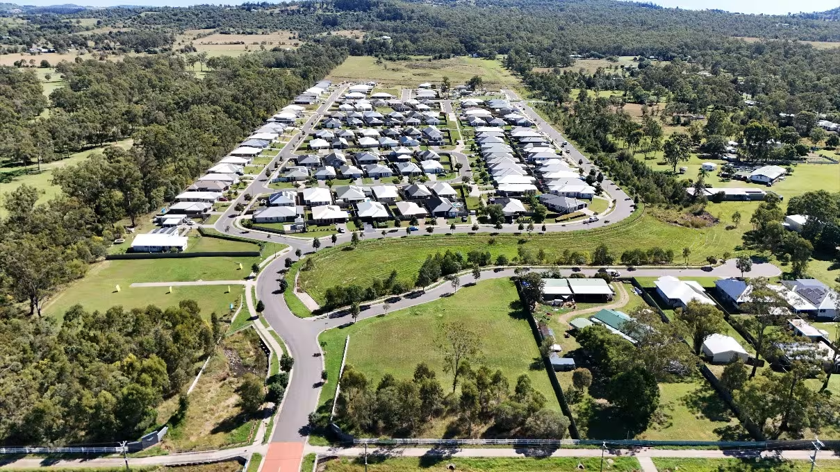
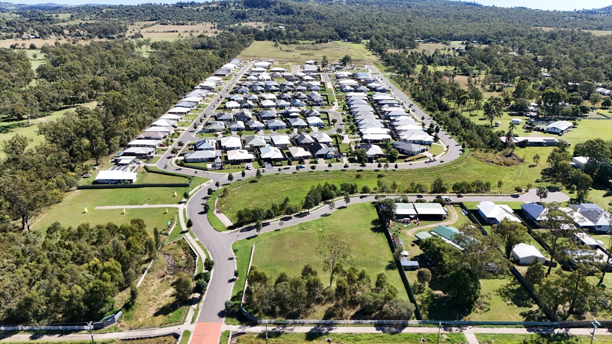
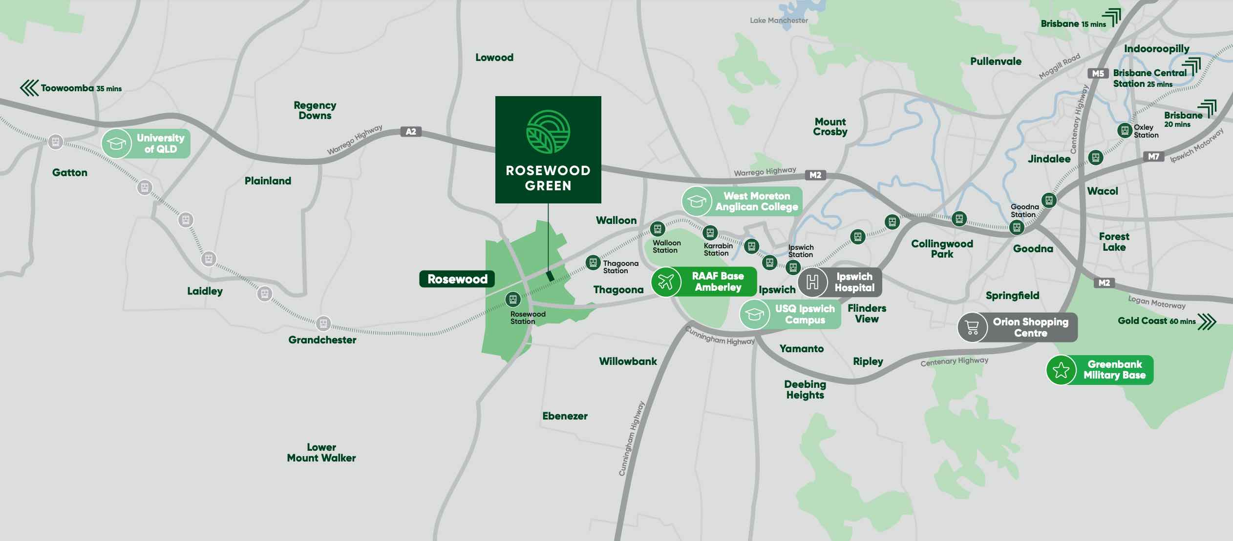
- Nestled next to the Rosewood Golf Club
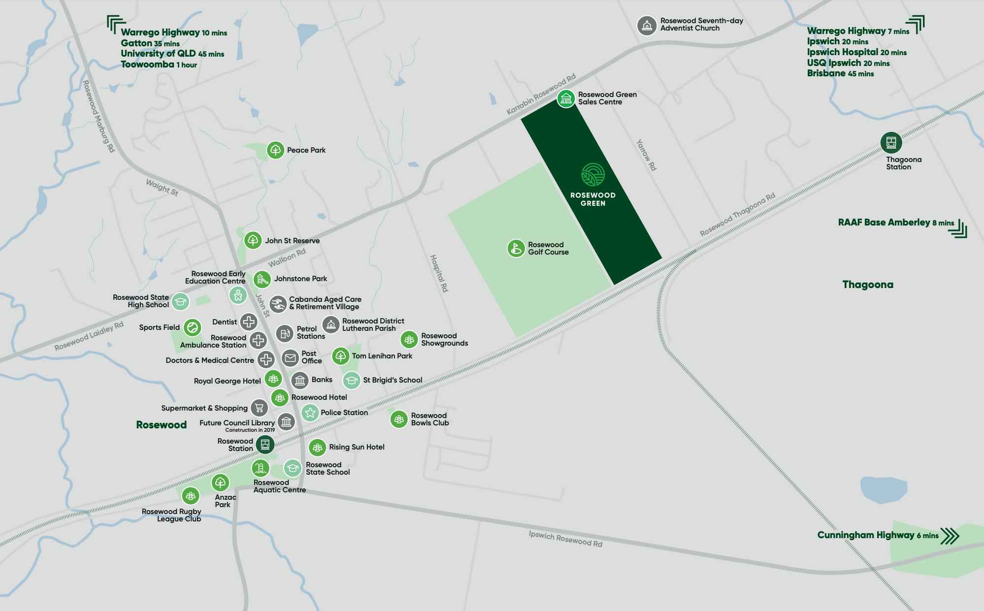
- Just 2 minutes to Rosewood’s supermarket, childcare, schools and medical centre
- 2 train stations within walking distance
- 20 minutes to Ipswich CBD and 45 minutes to Brisbane CBD
- 19km west to Ipswich CBD
What's special about Rosewood Green Estate - Rosewood This snippet was generated with OpenLotAI based on the information available in this listing. It was not provided by the developer and we encourage you to contact the agent directly to request more details.
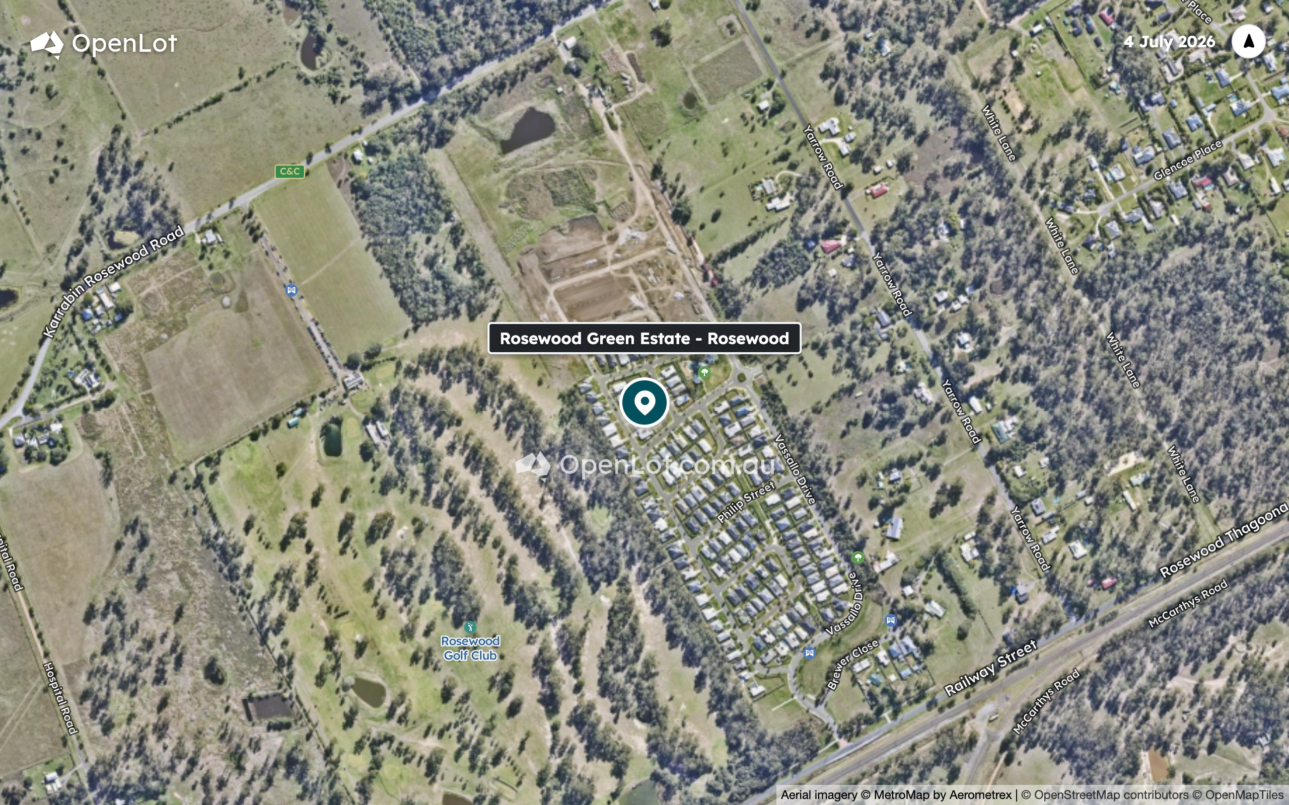
- Rosewood Green Estate is nestled next to the Rosewood Golf Club in Rosewood.
- Rosewood State School, Rosewood State High School and St Brigid's Primary School are among the nearby local schools.
- Freemans Park is 1.5 km away, with Papillon Park 1.6 km away and Tom Lenihan Park 1.7 km away.
- Drakes IGA, Fritzy's Diner, Pizza Hut, The Lockyer Doctors and Rosewood Pharmacy are each 2.1 km away.
- Train stations at Thagoona and Rosewood are 2.0 km and 2.2 km away respectively.
What's within 5 km of Rosewood Green Estate - Rosewood
-
-
 Distance
- 2.0km
-
 Approximate drive time
- 4min
-
 Approximate walk time
- 32min
-
-
-
Distance
- 2.3km
-
Approximate drive time
- 5min
-
Approximate walk time
- 37min
-
-
-
Distance
- 2.5km
-
Approximate drive time
- 6min
-
Approximate walk time
- 41min
-
-
-
Distance
- 3.1km
-
Approximate drive time
- 7min
-
Approximate walk time
- 51min
-
-
-
Distance
- 2.0km
-
Approximate drive time
- 4min
-
Approximate walk time
- 32min
-
-
-
Distance
- 2.1km
-
Approximate drive time
- 5min
-
Approximate walk time
- 34min
-
-
-
Distance
- 2.2km
-
Approximate drive time
- 5min
-
Approximate walk time
- 36min
-
-
-
Distance
- 2.2km
-
Approximate drive time
- 5min
-
Approximate walk time
- 36min
-
-
-
Distance
- 2.3km
-
Approximate drive time
- 5min
-
Approximate walk time
- 37min
-
-
-
Distance
- 2.1km
-
Approximate drive time
- 5min
-
Approximate walk time
- 34min
-
-
-
Distance
- 1.5km
-
Approximate drive time
- 3min
-
Approximate walk time
- 24min
-
-
-
Distance
- 1.6km
-
Approximate drive time
- 4min
-
Approximate walk time
- 27min
-
-
-
Distance
- 1.7km
-
Approximate drive time
- 4min
-
Approximate walk time
- 28min
-
-
-
Distance
- 1.9km
-
Approximate drive time
- 4min
-
Approximate walk time
- 31min
-
-
-
Distance
- 2.0km
-
Approximate drive time
- 4min
-
Approximate walk time
- 32min
-
-
-
Distance
- 2.1km
-
Approximate drive time
- 5min
-
Approximate walk time
- 34min
-
-
-
Distance
- 2.1km
-
Approximate drive time
- 5min
-
Approximate walk time
- 34min
-
-
-
Distance
- 2.1km
-
Approximate drive time
- 5min
-
Approximate walk time
- 34min
-
-
-
Distance
- 2.1km
-
Approximate drive time
- 5min
-
Approximate walk time
- 34min
-
Straight-line distance. Drive and walk times are estimates.
Property types for sale
Videos for Rosewood Green Estate - Rosewood
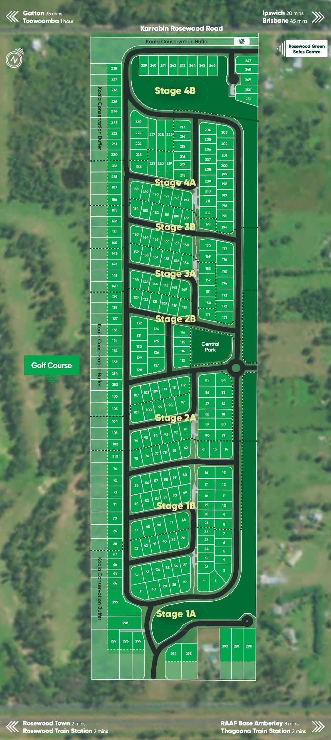
Location & Masterplan for Rosewood Green Estate - Rosewood
6 Land Lots in Rosewood Green Estate - Rosewood


Popular Estates near Rosewood Green Estate - Rosewood


 3
 2
 2


Construction updates for Rosewood Green Estate
Development overview of Rosewood Green Estate - Rosewood
This information is estimated by the OpenLot research team. Let us know here to provide up-to-date information about this development.
Updates for Rosewood Green Estate - Rosewood




Schools near Rosewood Green Estate - Rosewood
Land Price Trend in Rosewood QLD 4340
Below shows the price trend from vacant land sales recorded in Rosewood QLD 4340.
The data and information provided by Terralytics (Aust) Pty Ltd (Terralytics Data) is general in nature and is not intended to constitute professional advice. Read more
It should not be relied upon as a substitute for legal, financial, valuation, or other specialist advice relevant to your specific circumstances.
Terralytics uses commercially reasonable endeavours to ensure the Terralytics Data is current and accurate. However, as the Terralytics Data incorporates information sourced from third parties, Terralytics makes no representation or warranty — express or implied — as to its accuracy, completeness, or currency. To the maximum extent permitted by applicable law, Terralytics excludes all liability for any loss or damage (including consequential loss) arising out of or in connection with reliance on the Terralytics Data, whether arising in contract, tort (including negligence), statute, or otherwise.
Popular Estates near Rosewood Green Estate - Rosewood
Not exactly what you're looking for? Try surrounding suburbs

Walloon QLD 4306
6 estates | Ipswich City Council
7.4km north-east
Hatton Vale QLD 4341
2 estates | Lockyer Valley Regional Council
14.7km north-west
Thagoona QLD 4306
2 estates | Ipswich City Council
4.3km east
Wulkuraka QLD 4305
2 estates | Ipswich City Council
14.3km east
Marburg QLD 4346
3 estates | Ipswich City Council
8.6km north
Mount Marrow QLD 4306
1 estate | Ipswich City Council
6.3km north-east
Latest published articles




FAQs about Rosewood Green Estate - Rosewood
Rosewood Green Estate - Rosewood consists of 376 homes.
The total area for Rosewood Green Estate - Rosewood is 17.75 hectares.
Rosewood Green Estate - Rosewood falls under Ipswich City Council.
Rosewood Green Estate - Rosewood is 45 km south-west of Brisbane CBD.
Nearby schools for Rosewood Green Estate - Rosewood:
- St Brigid's Primary School - 2.0km south-west
- Rosewood State School - 2.3km south-west
- Rosewood State High School - 2.5km west
- Mount Marrow State School - 3.1km north
- Ashwell State School - 5.2km west
- Walloon State School - 5.9km north-east