

$538,000
View Property Price Statement
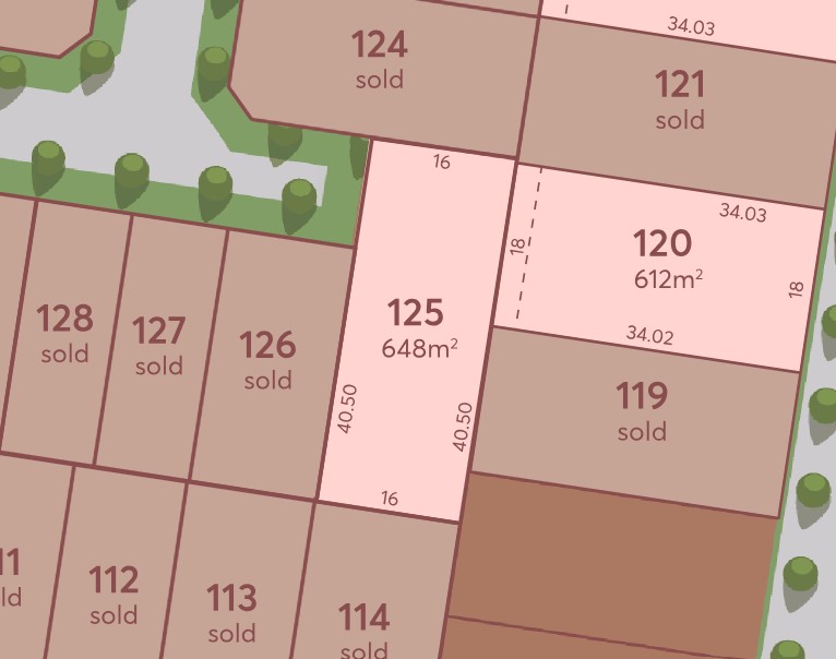
Stage 1 - Fourth Edition Lot 125 @ Kala


One of Kala's Last Stage 1 Lots, Now Titled!
Prices, availability and land details are subject to change without notice.
Images, plans and artist impressions are indicative only and may be subject to change.
Property overview
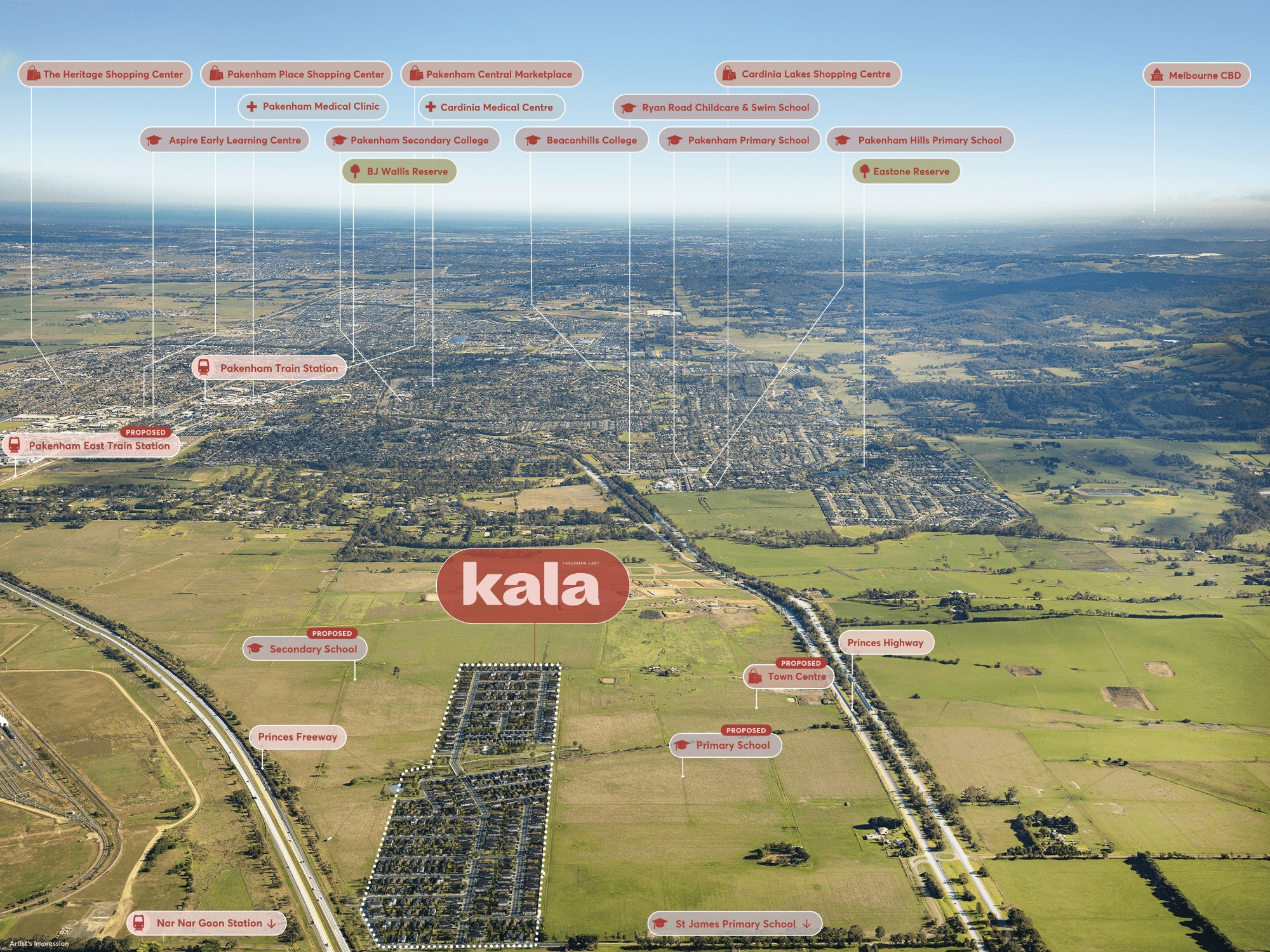
Local Information in Pakenham East VIC 3810
8 Land Lots in Kala - Pakenham East
12 House and Land Packages in Kala - Pakenham East


Videos for Kala - Pakenham East
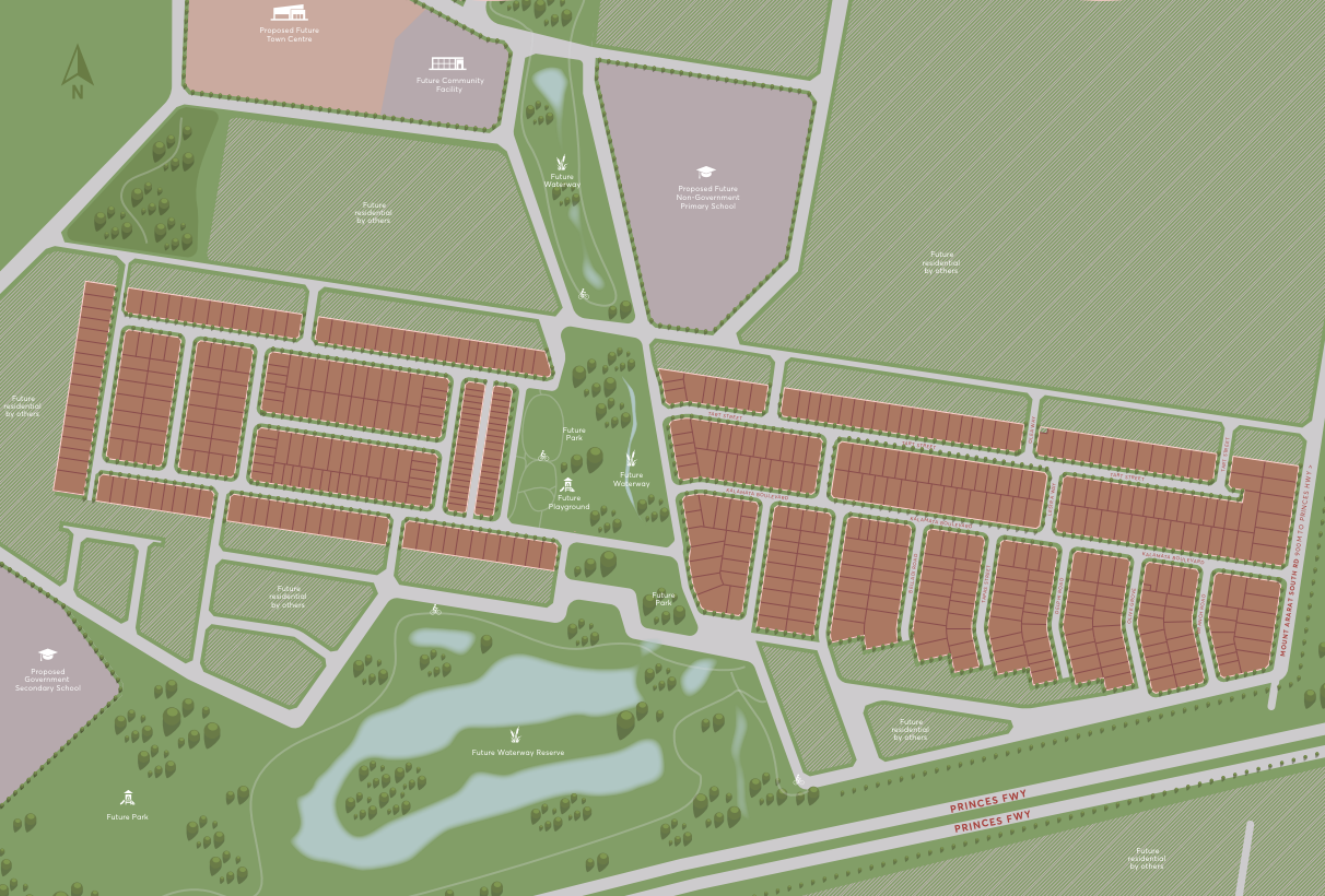
Development overview of Kala - Pakenham East
This information is estimated by the OpenLot research team. Let us know here to provide up-to-date information about this development.
Project team of Kala - Pakenham East


Nearby schools in Kala - Pakenham East
FAQs about Kala - Pakenham East
SIG Group is the developer behind Kala - Pakenham East.
Kala - Pakenham East consists of 525 homes.
The total area for Kala - Pakenham East is 28.53 hectares.
Kala - Pakenham East falls under Cardinia Shire Council.
Kala - Pakenham East is 58 km south-east of Melbourne CBD.
Core Projects is the project marketer for Kala - Pakenham East.
Nearby schools for Kala - Pakenham East:
- Pakenham Primary School - 2.6km west
- St James School - 3.1km east
- Nar Nar Goon Primary School - 3.3km east
- Pakenham Hills Primary School - 3.9km west
- St Patrick's School - 5.6km west
- Pakenham Secondary College - 5.9km west
Vacancy Rate in Pakenham East VIC 3810
View full vacancy rate history in Pakenham East VIC 3810 via SQM Research